Mount Mansfield’s Sunset Ridge Trail offers a challenging hike with rewarding panoramic views that stretch across Vermont’s iconic landscape. Perfect for hikers ready to engage with a trail that demands focus and respect, this route combines rugged terrain and stunning natural beauty, making it a must-visit for outdoor enthusiasts.
Start Early to Avoid Afternoon Storms
Vermont mountains often build afternoon thunderstorms in summer; beginning your hike early ensures safer and cooler conditions on the ridge.
Wear Footwear with Good Traction
The trail’s roots, rocks, and exposed alpine terrain can be slippery, especially in wet conditions—solid hiking boots reduce slip risk.
Pack for Variable Weather
Wind can make the summit feel much colder; bring layered clothing that handles moisture and wind protection.
Carry Adequate Hydration
The climb is strenuous; having at least 2 liters of water and electrolyte replacements keeps energy steady on the ascent.
Sunset Ridge Trail: Your Practical Guide to Hiking Vermont's Mount Mansfield
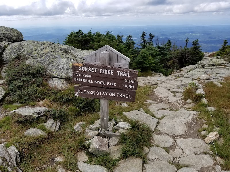
Rising as Vermont’s tallest peak at 4,393 feet, Mount Mansfield stands fiercely itself, demanding respect and readiness from those who chase its summit. The Sunset Ridge Trail offers a direct, invigorating climb that combines forested climbs with expansive ridgeline views, ideal for hikers who want a dose of challenge balanced by accessible navigation. Starting from the parking area at The Nose, the trail carves through sturdy hardwoods where the trees seem to lean inward, guiding your ascent. As the elevation gains, the forest opens abruptly onto a weather-carved ridge where wind plays a constant companion, daring you forward.
This trail measures roughly 3.6 miles one way with an elevation gain close to 2,600 feet. The terrain varies from firm dirt paths littered with roots and occasional rocks to exposed alpine zones near the summit that can be brisk and sharp. Footwear with good grip and ankle support is necessary because sections can be slippery, especially after rain.
The ridge itself unfolds like a rugged spine with panoramic views to the west, where the Champlain Valley stretches out below, and to the east, where the Green Mountains roll into the distance. Time your hike to avoid peak afternoon heat and afternoon thunderstorms common in summer. Starting early not only offers calmer conditions but also lets you experience the soft morning light filtering through the trees. Hydration and frequent breaks on open ledges bring balance to the exertion.
At the summit, the rocks tell the story of relentless weather—chiseled by wind and snow. Here, the exposure demands attention; sudden weather shifts are a force to respect. The descent retraces the route, with the ridge offering a different perspective at twilight as shadows stretch across the slopes.
Preparation tips? Carry layered clothing for swift temperature changes, bring more water than you think, and pack a reliable map or GPS. Cell service can falter across the ridge, so navigation skills remain essential. This hike is not just a trek—it’s a dynamic dialogue between you and a mountain fiercely itself, rewarding those who come ready to listen and respond.
Nearby Trips
All Adventures
Boat Charters
Water Activities
Adventures near Stowe, Vermont
Discover the unique and memorable adventures that make Stowe, Vermont special.
Frequently Asked Questions
How long does it typically take to hike the Sunset Ridge Trail to Mount Mansfield’s summit?
Most average hikers complete the 7.2-mile round trip in 4 to 6 hours, depending on fitness level, breaks, and weather conditions.
Is the Sunset Ridge Trail suitable for beginners?
While accessible, the trail is steep and physically demanding with exposed sections near the summit, so it’s best for hikers with moderate experience and proper preparation.
Are dogs allowed on the trail?
Yes, dogs are permitted but must be kept on leash due to wildlife and steep terrain caution.
What is the best time of day for photography along the Sunset Ridge Trail?
Early morning light captures the forest’s texture, while late afternoon provides golden hues across the ridgeline and valley below.
Are there any water sources on the trail?
No reliable water sources exist along the route; hikers should carry all necessary water before starting.
What wildlife might I encounter on this trail?
Expect to see white-tailed deer, various songbirds, and if lucky, the occasional black bear or moose in the surrounding forest areas.
Recommended Gear
Sturdy Hiking Boots
Firm ankle support and traction handle the rocky, root-laced path and slippery ledges near the summit.
Layered Clothing
Variable temperatures and winds on the ridge require layering for insulation and protection.
Hydration System
Bring at least 2 liters of water and electrolyte options to maintain energy throughout the ascent.
Map and Compass or GPS
Cell coverage drops on the ridge; reliable navigation tools ensure you stay on track.
Local Insights
Hidden Gems
- "The outlook known as 'The Nose' provides dramatic views without summiting, perfect for a shorter adventure."
- "On a clear day, the summit’s West Ridge ledges offer quieter spots often missed by crowds."
Wildlife
- "Listen for the elusive Hermit Thrush’s call in spring and early summer along the lower forested sections."
- "Black bears traverse the Appalachian corridor; keep food secured and be aware during early morning or late evening."
History
"Mount Mansfield’s name is said to come from the profile of its ridgeline resembling a man's face. The area was logged heavily in the 19th century before preservation efforts took hold."