Hiking the Maah Daah Hey Trail: North Dakota’s Ultimate Backcountry Adventure
The Maah Daah Hey Trail cuts through North Dakota’s Badlands with raw, unfiltered wilderness on every mile. From rugged ridges to quiet forest pockets, this 144-mile trek challenges adventurers to engage deeply with the land while testing planning and endurance.
Hydrate Strategically
Water sources are scarce and far between; carry at least 3 liters per day and bring a filtration system for natural water.
Choose Durable Footwear
The mix of rocky terrain and soft prairie demands boots with strong ankle support and reliable traction to prevent injury.
Plan for Weather Swings
Badlands weather changes quickly; layered clothing protects against hot sun, sudden winds, and cooler nights.
Respect Wildlife Distance
Maintain distance from animals like pronghorn and deer; sudden movements can startle them and create unsafe situations.
Hiking the Maah Daah Hey Trail: North Dakota’s Ultimate Backcountry Adventure
The Maah Daah Hey Trail stretches 144 miles through North Dakota’s rugged Badlands, inviting adventurers to engage with a landscape fiercely itself — raw, wide-open, and unapologetically wild. Known as the state’s premier backcountry route, this trail offers a challenging blend of rolling hills, rocky ridges, and forested hollows that compel both respect and exploration. It’s a journey where the land dares you to move forward, its rivers telling stories as they curve and rush beneath weathered bridges.
Starting near the town of Medora and ending around Watford City, the trail traverses Burning Coal Vein State Trail, Theodore Roosevelt National Park, and several public lands. Elevation changes are moderate but frequent, with total gains around 7,400 feet — enough to keep your heart working but manageable with steady pacing. Terrain varies from soft prairie grass and chert rock to pine-shaded corridors, lending a refreshing rhythm to your step.
The Maah Daah Hey is no casual Sunday stroll; it demands preparation. Water sources are limited, so carrying sufficient hydration or treatment supplies is critical. Footwear should be rugged yet broken-in; rocky sections reward boots with solid ankle support. Summer temperatures soar, turning the plains into a dry furnace, while spring and fall offer cooler weather and breathtaking color changes. Winter, rarely attempted, tests both endurance and gear against biting winds.
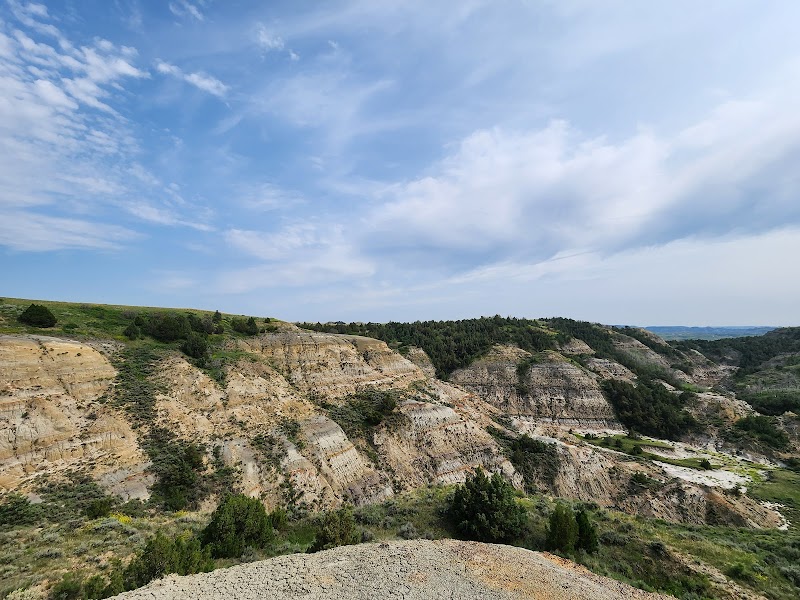
Along the way, the trail reveals quiet overlooks where the horizon suddenly flares with golden Badlands cliffs shaped by eons of wind and water. Wildlife is intermittent yet vivid — pronghorn antelope fleet across open views, while red-tailed hawks circle overhead. When night falls, the sky commands attention, the sweep of stars unimpeded by city glow.
Successful hikers face the Badlands on their terms by pacing daily distances realistically, often between 10 to 15 miles, to savor moments without exhausting their reserves. Planning campsites at established spots or dispersed locations requires knowledge of regulations and terrain. The trail itself respects no shortcuts; persistence pays off, and every mile hiked is earned.
In sum, the Maah Daah Hey Trail invites both practical preparation and an adventurous spirit. It’s a hike of contrasts — gentle and harsh, quiet and striking — demanding you adapt, respect, and ultimately, earn your passage through North Dakota’s signature backcountry route.
Nearby Trips
All Adventures
Boat Charters
Water Activities
Adventures near Medora, North Dakota
Discover the unique and memorable adventures that make Medora, North Dakota special.
Frequently Asked Questions
How long does it typically take to hike the entire Maah Daah Hey Trail?
Most hikers complete the 144-mile trail in about 10 to 15 days, averaging 10 to 15 miles per day depending on weather, fitness, and pack weight.
Are there designated campsites, or can I camp anywhere along the trail?
There are both established campgrounds and dispersed camping areas. You need to follow local regulations and practice Leave No Trace principles, especially in protected areas like Theodore Roosevelt National Park.
Is the trail suitable for beginners or casual hikers?
While parts of the trail are accessible to skilled beginners, the full route requires physical endurance, navigation skills, and preparation. Casual hikers often opt for sections rather than the entire trail.
What wildlife might I encounter on the Maah Daah Hey Trail?
Expect to see pronghorn antelope, mule deer, coyotes, various bird species including red-tailed hawks and wild turkeys. Encounters with rattlesnakes are possible, so stay alert.
When is the best time to hike the trail to avoid extreme weather?
Late spring (May-June) and early fall (September-October) generally provide the best balance of mild temperatures and fewer insects, but weather can still be unpredictable.
Are there opportunities for resupply or water refill along the route?
Limited resupply points exist in towns like Medora and Watford City, but water sources along the trail are scarce and not all are reliable year-round. Carry sufficient water and filtration equipment.
Recommended Gear
Hydration pack or large water bottles
Ample water capacity is vital in dry conditions; allow for refills from natural sources.
Sturdy hiking boots with ankle support
Protect feet and ankles across rocky and uneven ground to avoid injuries.
Weather-resistant layered clothing
Adjusts for temperature shifts and wind, making it easier to manage changing conditions.
Portable water filtration system
Ensures safe drinking water when relying on streams and ponds along the route.
Local Insights
Hidden Gems
- "Turtle Rock Overlook – an unexpected sandstone formation offering close-up views."
- "Burning Coal Vein historic coal seam visible in unique rock layers."
- "Little Missouri River crossings where the current quietly tests your footing."
Wildlife
- "Look for swift pronghorn herds in open areas early morning or dusk."
- "Red foxes and badgers are nocturnal but sometimes spotted at twilight."
- "Rattlesnake sightings increase in warmer months, mostly sunning on rocks."
History
"The trail runs through regions rich in Native American history and early settler mining activity, notably the 'burning coal vein' that inspired much local lore."