Ride the Greenbrier River Trail: A Rail-Trail With History and Heart
The Greenbrier River Trail offers a 77-mile journey through West Virginia's rugged beauty and compelling history. Perfect for cyclists and hikers alike, this rail-trail balances manageable terrain with rich natural and cultural sights, inviting an adventure rooted in both endurance and discovery.
Bring ample water and snacks
Water sources are limited along segments, so pack enough hydration and energy-rich snacks to stay fueled and alert.
Wear shoes with solid traction
The crushed limestone surface can be loose in parts; footwear with grip helps maintain stability on uneven edges.
Start early to avoid midday heat
Temperatures soar midday in summer; mornings provide cooler air and softer light for a safer, more enjoyable ride.
Respect trail etiquette
Yield to hikers and horses, communicate when passing, and pack out all trash to protect this fragile environment.
Ride the Greenbrier River Trail: A Rail-Trail With History and Heart
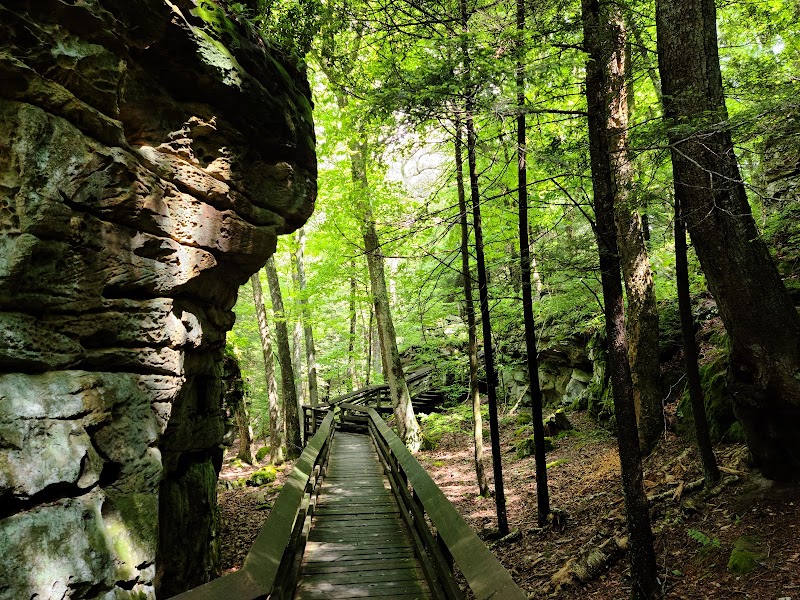
Stretching 77 miles through West Virginia’s Appalachian foothills, the Greenbrier River Trail invites riders and hikers to engage with a landscape fiercely itself. Formerly a railroad line, this trail now hums with a gentler rhythm, where the river dares you to follow its winding course beneath broad-leafed canopies and past remnants of industrial history. The terrain is mostly flat, making it accessible for casual riders while the steady glide of crushed limestone surfaces challenges your focus on maintaining momentum. Expect long stretches flanked by dense forests where the air carries the musk of earth and pine, splitting occasionally to reveal sweeping views where the river pushes and curls, a restless companion.
Begin near the town of Alderson, where parking and trail access are convenient. The complete length requires planning, but many choose manageable day rides of 10 to 20 miles, timing their outing to avoid summer’s midday heat and the trail’s occasional muddy patches after rain. The gentle elevation changes max out around 1,000 feet but happen gradually, keeping the focus on endurance rather than climbing skill.
Hydration is crucial here: streams and springs near the trail offer refreshment, but carrying water is a must if you plan to go deep. Footwear with good grip will handle the occasional gravelly edges where the crushed limestone loosens. Weather can shift quickly, so lightweight layers help you adapt, along with a rain jacket if forecasts predict storms.
History whispers along the trail in abandoned train tunnels, old trestles, and decaying stations—key markers of the route’s original purpose that invite reflection on the labor and commerce that once fueled this region. Wildlife calls from the shadows—white-tailed deer, songbirds, and if you’re patient, the fleeting glimpse of a fox or wild turkey.
Ride with respect for this fiercely natural place. The Greenbrier River Trail does not bend to your will but offers steady companionship for those ready to move through its unfolding chapters. It’s both an escape and an introduction: a chance to trace the stories of land, water, and human hands over time, all while moving under your own power.
Nearby Trips
All Adventures
Boat Charters
Water Activities
Adventures near Lewisburg, West Virginia
Discover the unique and memorable adventures that make Lewisburg, West Virginia special.
Frequently Asked Questions
How accessible is the Greenbrier River Trail for beginners?
The trail’s flat terrain and smooth crushed limestone surface make it approachable for beginners, especially for shorter stretches. However, covering longer distances requires reasonable stamina and planning.
Are there rest stops or facilities along the trail?
Several trailheads have parking and restrooms, but amenities are limited along the route itself. Plan to bring supplies and use facilities at major access points.
Is the trail open for horseback riding or only biking and hiking?
The trail welcomes hikers, bikers, and horseback riders. Shared use requires extra caution and communication among trail users.
What wildlife might I encounter?
Expect to see white-tailed deer, wild turkeys, various songbirds, and occasionally foxes or small mammals. Pack binoculars for birdwatching.
Are there guided tours or bike rentals nearby?
Local outfitters in Lewisburg offer bike rentals and occasional guided rides, making it easy to plan a trip without personal gear.
Can I camp along the trail?
Designated camping areas are sparse, but several nearby state parks and campgrounds offer overnight options if you want to extend your visit.
Recommended Gear
Sturdy hybrid or mountain bike
Designed to handle crushed limestone and occasional rough patches comfortably.
Hydration pack or water bottles
Keeps you hydrated over long, sun-exposed stretches where water sources are scarce.
Layered clothing
Allows quick adjustment for temperature swings, wind, and unexpected rain.
Trail map or GPS device
Helpful for planning segments and locating trailheads and water stops.
Local Insights
Hidden Gems
- "The Alderson Tunnel – a quiet, historic passage enveloped in moss and shadow"
- "Hidden river bends east of Cass where old railroad ties peek through the foliage"
Wildlife
- "Listen for the rattle of woodpeckers striking tree trunks"
- "Spot the flicker of a red fox darting between thickets at dawn or dusk"
History
"Once a critical rail link for coal and timber, the trail corridor preserves railroad artifacts, including steel trestles and stations that speak to early Appalachian industry."