Discover the many ways to move efficiently around Las Vegas, from convenient public transit to flexible car rentals perfect for both city exploration and desert adventures. This guide delivers practical tips and insider advice to help you navigate the city’s dynamic transportation system with ease.
Plan Around Traffic Peaks
Avoid driving during rush hours (morning 7-9 AM, evening 4-7 PM) and large event dates to save time and frustration.
Use the RTC Bus for Budget Travel
Public buses cover key tourist areas and connect to the monorail, offering affordable and convenient transit without parking hassles.
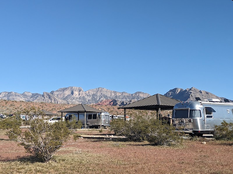
Rent a Car for Outdoor Trips
If exploring parks like Red Rock Canyon or Valley of Fire, a rental car offers the freedom to venture beyond city limits on your schedule.
Stay Hydrated in Desert Weather
Even during transit waits, carry water to stay hydrated—the dry desert air pulls moisture quickly.
Navigating Transportation Near Las Vegas: Your Ultimate Guide
Las Vegas pulses with energy, not just on the Strip but through every avenue of its transportation network. Whether arriving by air, hopping on a bus, or renting a car, the city’s diverse transit options set the stage for adventure in the Mojave Desert. McCarran International Airport, just minutes from downtown, handles millions of travelers annually, making air travel the most common gateway to the neon-lit cityscape.
For ground travel, the RTC bus system offers reliable, cost-effective routes throughout Vegas and the surrounding valley, linking visitors to major hotels, downtown hotspots, and suburban neighborhoods. Expect buses every 15 to 30 minutes on principal lines, with convenient passes available for extended stays. For those craving flexibility and speed, rideshare services like Uber and Lyft are widely available, providing door-to-door convenience at any hour.
Car rentals dominate for visitors planning excursions beyond the city limits. Rental agencies abound near the airport and along the Strip, offering everything from economy cars to rugged SUVs built for the desert landscapes around Red Rock Canyon or Valley of Fire. Navigating highways such as I-15 and US-95 is straightforward, though peak tourism seasons and weekend events merit double-checking traffic conditions to avoid delays.
For practical transit: Opt for traffic monitoring apps and plan early morning or late evening drives when the roads breathe easier. Use public transit for budget-conscious tourists; it’s efficient and connects to the Las Vegas Monorail, which swiftly transports riders along the heart of the Strip. If your itinerary includes outdoor adventure, securing a rental car is essential. It unlocks remote trails, state parks, and must-see natural wonders beyond city lights.
The city’s transportation ecosystem blends convenience with rugged accessibility: a necessary balance for exploring urban excitement and desert escapes. Knowing how to get around efficiently ensures you spend less time waiting and more time chasing new experiences. Wherever your route leads, Las Vegas taxis, buses, rental cars, and ride-hailing services will get you there, ready for the next adventure.
Nearby Trips
All Adventures
Boat Charters
Water Activities
Adventures near Las Vegas, Nevada
Discover the unique and memorable adventures that make Las Vegas, Nevada special.
Frequently Asked Questions
What is the easiest way to get from McCarran Airport to the Strip?
The Las Vegas Monorail and RTC buses provide direct routes to major Strip locations. Alternatively, taxis and ride-sharing services offer quick door-to-door rides without the need for parking.
Are public buses safe and accessible in Las Vegas?
Yes. The RTC bus system is widely used by locals and tourists alike, with accessible vehicles and comprehensive route coverage throughout the city.
How do I plan a day trip from Vegas to nearby natural parks?
Renting a car is the most practical option. Popular destinations like Red Rock Canyon and Valley of Fire lie 20-60 minutes from the city, with clearly marked highways and visitor centers.
Can I rely on ride-sharing during late-night hours?
Ride-sharing apps operate 24/7 in Las Vegas, making them a safe and convenient choice to avoid the cost and hassle of parking, especially during busy nighttime events.
What should I know about parking around the Strip?
Many hotels offer free or paid parking options; however, during peak events, finding spots can get tricky. Using public transit or ride-hailing may save time and stress.
Are bike rentals a good way to get around Vegas?
Yes, particularly in the downtown and Fremont areas. Several bike-share programs and dedicated bike lanes make cycling a viable and scenic option for short trips.
Recommended Gear
Reusable Water Bottle
Stay hydrated while waiting for buses or waiting in traffic, especially in the dry summer heat.
Comfortable Walking Shoes
Las Vegas involves a lot of walking whether transferring between transit or exploring downtown on foot.
Sun Protection (hat, sunscreen, sunglasses)
Shield your skin and eyes from intense desert sun during any outdoor transit or exploration.
Smartphone with GPS and Transit Apps
Real-time traffic updates, route planners, and ride-hailing apps are essential tools for seamless navigation.
Local Insights
Hidden Gems
- "The unexplored trails at Sunrise Mountain that provide panoramic views away from the crowds."
- "Historic Boulder City, just outside Vegas, offers a glimpse into the region’s early rail and dam construction days."
Wildlife
- "Desert tortoises wandering near Red Rock Canyon."
- "Various bird species, including hummingbirds and roadrunners, commonly spotted along transit routes to natural parks."
History
"Las Vegas transformed from a railroad stop into an entertainment metropolis, with transportation playing a pivotal role—railroads first, then highways, shaping its growth and tourism."