best hiking near Fort Davis, Texas
Discover the best hiking near Fort Davis, Texas, where rugged mountains meet desert plains. This guide highlights trails with practical tips to prepare, explore, and enjoy varied terrain and breathtaking views in the Davis Mountains.
Prioritize Hydration
Carry ample water and drink regularly—dry desert air and elevation demand more hydration than you might expect.
Wear Sturdy Footwear
Rocky, uneven trails make supportive boots necessary to protect against sprains and slips.
Start Early or Late
Avoid midday heat by hiking in the cooler early morning hours or late afternoon for comfort and best lighting.
Prepare for Elevation Changes
Many trails here climb steadily; pace yourself to avoid overexertion and reduce altitude sickness risk.
best hiking near Fort Davis, Texas
Explore the Best Hiking Near Fort Davis, Texas
Fort Davis, Texas, sits at the gateway to some of the most compelling hiking adventures in the Southwest. The landscape dares you to step out onto trails where rugged mountains, wide desert plains, and whispering pine forests forge an experience that’s both grounding and invigorating. Here, the Chihuahuan Desert challenges your pace with dry heat and rocky terrain, while the nearby Davis Mountains offer cooler, shaded paths and sit above the desert’s relentless sun.
When searching for the best hiking near Fort Davis, Texas, the hallmark is variety combined with accessibility. Trails range from moderate day hikes to longer, more demanding routes that test endurance and reward with sweeping views over the vast desert basin. Expect elevations from about 4,800 to 8,000 feet, terrain that alternates between shale and rocky footing, and trail surfaces that hold the stories of centuries.
Among the most notable hikes around Fort Davis is the Skyline Drive Trail, carving through elevation and vegetation changes with clear, panoramic vantage points. This trail challenges with its steady ascent but rewards with lookout spots that make the climb feel worthwhile. Another favorite is the Trail to Mount Livermore - the highest peak in the Davis Mountains. It demands stamina but offers serene pine groves and vast horizons pushing past the eye.
Planning your hike here means preparing for variable weather – mornings can be crisp and afternoons blistering. Hydration is critical as desert air pushes dryness against the skin. Footwear should be sturdy, supporting ankle stability on the rocky and uneven ground. Early morning or late afternoon hikes maximize comfort and lighting.
For those tracking the best hiking near Fort Davis, Texas, our site showcases all top options including routes best for families, solo adventurers, and more expert trekkers. Dive into details about each hike’s distance, elevation, and unique features so you can plan the best route for your skills and interests.
If you want to uncover more outdoor adventures, our page lists the best experiences Fort Davis has to offer, from star gazing at the observatory after your hike to bird watching along wooded creeks. Get ready to meet nature fiercely itself, with respect and readiness as your companions on the trail.
Nearby Trips
All Adventures
Boat Charters
Water Activities
Adventures near Fort Davis, Texas
Discover the unique and memorable adventures that make Fort Davis, Texas special.
Frequently Asked Questions
What is the best time of day for hiking near Fort Davis?
Early mornings and late afternoons offer the coolest temperatures and the best lighting for views. Midday can get very hot, especially in summer.
Are there guided hikes available near Fort Davis?
Yes, local outfitters offer guided hikes covering popular trails, providing insights into the natural history and safety support.
What wildlife might I encounter on these trails?
Expect to see mule deer, birds like roadrunners and hummingbirds, and possibly javelinas. Snakes are present but usually avoid hikers if given space.
Is there cell phone reception on these trails?
Reception can be spotty or nonexistent in remote areas, so plan accordingly and carry a map and compass or GPS device.
Are dogs allowed on hiking trails near Fort Davis?
Many trails allow dogs on leashes, but be mindful of heat and wildlife to ensure safety for pets and native animals.
What permits or fees are required for hiking here?
Most trails near Fort Davis are on public lands with no fees, but some specific areas or guided tours may require permits or charges.
Recommended Gear
Hiking Boots
Strong ankle support and rugged soles protect on rocky, uneven terrain.
Water Bottle or Hydration Pack
Adequate hydration is critical, especially in warmer months and at higher elevations.
Weather-Appropriate Layers
Dress in moisture-wicking, insulating layers to stay warm during chilly mornings and evenings.
Sun Protection
Sunscreen, a hat, and UV-blocking sunglasses are necessary to guard against strong desert sun.
Local Insights
Hidden Gems
- "Hidden viewpoint along Skyline Drive with western sunset views"
- "Secluded pine groves on the hike to Mount Livermore"
Wildlife
- "Rare sightings of the Montezuma quail"
- "Coyotes are active at dusk and dawn, adding life’s soundtrack to trails"
History
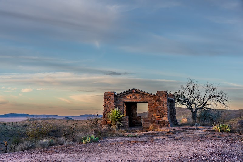
"Fort Davis was originally a military post to protect emigrants and settlers, and some trails pass near preserved historic sites from that era."