Navigating Denver: Your Guide to Transportation Near Denver, Colorado
Discover the best transportation options near Denver, Colorado, to maximize your urban and outdoor adventures. From Denver International Airport to the RTD light rail and flexible rideshares, learn how to navigate the city and surrounding nature with ease.
Plan for Peak Traffic Hours
Avoid delays by traveling outside morning and evening rush hours, especially on Fridays and Sundays when outbound traffic to mountain areas increases.
Use RTD Light Rail for Cost-Effective Travel
The RTD system connects downtown Denver to key neighborhoods and park-and-ride lots, providing a reliable alternative to driving.
Consider Multi-Modal Transportation
Combine a light rail ride with a scooter or bike rental for convenient, quick last-mile travel in busy urban districts.
Keep Weather in Mind
Snow and ice can impact road conditions in winter months; check weather before driving to mountain trailheads outside the metro area.
Navigating Denver: Your Guide to Transportation Near Denver, Colorado
Denver’s transportation network connects the city’s urban energy to the sprawling trails and peaks that invite adventure seekers year-round. Whether arriving by air, navigating downtown streets, or venturing beyond city limits, Denver offers practical and varied transport modes designed to keep pace with your plans. From the convenience of Denver International Airport’s global gateway to the RTD light rail system threading through neighborhoods and park-and-ride lots, getting around is straightforward and efficient.
Public transit options include the extensive RTD bus and rail services, linking key districts like Union Station—a lively hub buzzing with food, culture, and rail lines—to popular outdoor portals like the foothills to the west. For renters and locals, car-sharing services such as Lyft, Uber, and rentable scooters offer flexible last-mile solutions, especially for trips where timing or terrain demands agility.
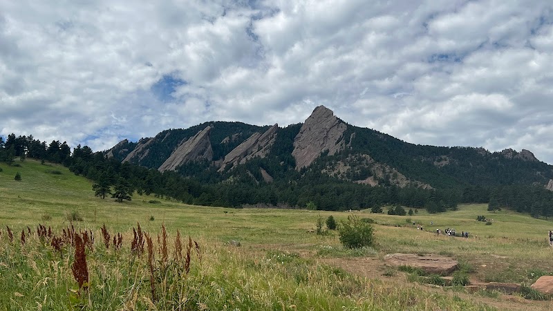
Denver’s well-maintained roadways provide easy highway access to major nearby destinations, including Red Rocks Amphitheatre and mountain trailheads. Driving yourself unlocks the freedom to explore off-the-beaten-path spots where public transit doesn’t reach. For the urban explorer, bike lanes and rental programs offer environmentally friendly ways to move while soaking up city vibes, especially around the Cherry Creek Trail or downtown’s cultural corridors.
Understanding peak travel times and surge periods can save time and stress, especially on weekends when nature beckons and traffic swells towards mountain passes. Planning rides ahead, combining transit with ride-shares, or opting for early departures streamlines your journey.
From the airport to scenic day trips, the blend of public transit, rideshare, bikes, and private vehicles equips travelers to tackle Denver’s cityscape and wild edges alike. With clear routes and diverse options, your gateway to Colorado’s front range adventures begins in motion before you even step onto a trail.
Nearby Trips
All Adventures
Boat Charters
Water Activities
Adventures near Denver, Colorado
Discover the unique and memorable adventures that make Denver, Colorado special.
Frequently Asked Questions
What is the best way to get from Denver International Airport to downtown?
The RTD A Line light rail offers a direct, cost-effective connection between Denver International Airport and Union Station downtown, running frequent service with a 37-minute travel time.
Are there public transportation options to popular trailheads near Denver?
While some bus routes reach foothill communities like Golden or Evergreen, most mountain trailheads require a car or rideshare, as public transit coverage is limited in those areas.
Is it practical to use bike-sharing programs in Denver year-round?
Bike-sharing thrives in Denver spring through fall; winter use drops due to snow and icy conditions, but many core routes remain serviceable when weather permits.
When is traffic typically heaviest for trips from Denver to outdoor destinations?
Traffic peaks on weekend mornings and afternoons, especially in summer and fall, with congestion common on highways toward the mountains as visitors chase hiking, biking, or sightseeing.
Are scooters a safe transportation option in Denver’s city center?
Electric scooters are widely used downtown and along bike paths but require caution in traffic-heavy areas and adherence to local regulations.
Can I rent a car at Denver International Airport for access to remote outdoor sites?
Yes, multiple rental agencies operate at Denver International Airport, providing flexibility for off-grid exploration where transit options end.
Recommended Gear
Transit Card or App
A reloadable transit card or smartphone app ensures smooth access to RTD light rail and bus systems.
Comfortable Walking Shoes
Whether walking from a transit stop or exploring urban trails, durable shoes improve comfort and mobility.
Layered Clothing
Seasons shift quickly in Denver; layers keep you comfortable especially when transferring between indoor transit and outdoor stops.
Portable Phone Charger
Keep devices powered for navigating transit schedules, ride-share apps, and maps during day trips.
Local Insights
Hidden Gems
- "Roxborough State Park viewpoints accessible via Golden's transit and short rideshare"
- "Cherry Creek State Park’s multi-use trails near transit stops"
- "Platte River Greenway – a scenic, often overlooked urban trail"
Wildlife
- "Pikas and marmots in foothill areas"
- "Migratory birds along the South Platte River corridor"
- "Urban foxes and hawks adapting to city life"
History
"Denver’s transportation roots run deep with Union Station as a historic rail hub since the late 1800s, fueling growth from mining camps to modern metro. The evolution of RTD light rail echoes Denver’s shift to sustainable urban mobility."