Suck Creek to Signal Mountain: A Ride Through Chattanooga’s Backcountry Roads
Experience a ride that challenges both your legs and senses on the Suck Creek to Signal Mountain route near Chattanooga. This paved but rugged road climb offers sweeping river views, forested climbs, and a practical route for intermediate cyclists aiming for an invigorating day on the pedals.
Hydrate Before and During the Ride
Carry at least 2 liters of water, especially in warm months, as there are no reliable water stops along the route.
Wear Sturdy Cycling Shoes
The road is paved but includes steep grades and narrow sections where firm grip and steady footing are key for safe control.
Start Early to Avoid Heat
Temperatures climb quickly, so begin before 9 AM in summer to avoid the midday sun and thinning energy levels.
Check Weather Forecasts
Sudden showers or high winds can make sections of the ride slippery or uncomfortable, so be prepared with appropriate gear.
Suck Creek to Signal Mountain: A Ride Through Chattanooga’s Backcountry Roads
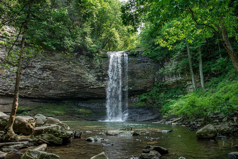
The Suck Creek to Signal Mountain ride is more than just a journey; it’s an engagement with a landscape fiercely itself. Stretching over approximately 16 miles, this route carves a path from the banks of the Tennessee River up the rolling ascent of Signal Mountain. As you cycle along Suck Creek Road and merge onto Signal Mountain Road, the terrain shifts from river valley to forested slopes, with each pedal stroke revealing wider views and the silent watch of ancient hardwoods.
The route’s elevation gain hovers around 1,200 feet — a moderate challenge that rewards with sweeping panoramas of the Tennessee River daring you forward. The road surface is paved but narrow in sections, demanding steady control and caution where curves tighten and shadows deepen beneath the canopy.
Starting near the river’s edge, the lush greenery presses close, ferns brushing the roadside and birds punctuating the quiet with sharp wingbeats. As you climb, the environment leans into pine and oak, their branches shifting like steady sentinels. The occasional pull-off lets you pause and drink in Chattanooga’s distant cityscape framed by the rising ridges. Signal Mountain Road isn’t just a pathway; it’s an experience of shifting elements — the breeze toughening as elevation increases, the sunlight dipping behind cloud banks, the road responding to your persistent effort.
For riders, timing your departure is crucial. Early mornings or late afternoons soften the sun’s push, while mid-day heats can turn the climb into a test of endurance. Hydration is non-negotiable, especially in summer months when humidity can surprise. Robust footwear or cycling shoes with firm grip offer security along the steeper grades and occasional gravel patches.
This ride is practical enough for committed cyclists with some experience tackling elevation but rewarding enough for those who enjoy the interplay between physical exertion and natural scenery. The challenge here isn’t to conquer; it’s to flow with the land’s rhythm — to respect the steep pitches, the unpredictable weather, and the quiet verdict of the woods and water. By the time you crest Signal Mountain, the river valley below doesn’t just look like a map; it feels alive and ready for your next move.
Plan carefully, ride smart, and let Suck Creek to Signal Mountain be a tangible stretch of your outdoor story, where adventure meets grounded preparation.
Nearby Trips
All Adventures
Boat Charters
Water Activities
Adventures near Chattanooga, Tennessee
Discover the unique and memorable adventures that make Chattanooga, Tennessee special.
Frequently Asked Questions
Is the Suck Creek to Signal Mountain ride suitable for beginners?
The route is moderate with steady climbs and narrow sections on paved roads. Casual riders with some hill experience can manage it, but beginners should prepare for the elevation gain and ensure they are comfortable handling climbs.
Are there restroom facilities or water stops along the ride?
There are no formal restrooms or water stations along the route, so plan accordingly by using facilities before you start and carrying sufficient water.
What’s the best parking area to start the ride?
Parking near the Suck Creek bridge at the base is convenient, with some roadside spots. Arrive early on weekends to secure a space.
Can the ride be done on a mountain bike or hybrid bike?
Yes, although the paved roads suit road or hybrid bikes better, mountain bikes handle steep grades and occasional rough patches well.
Are pets allowed on this route?
Pets can accompany riders if they are trained and controlled, but be mindful of traffic and the physical demands of the climb for dogs.
Is the route rideable year-round?
Generally yes, but winter conditions may include ice, and spring showers can make sections slippery. Check weather before going.
Recommended Gear
Hydration Pack or Water Bottles
Staying hydrated throughout the climb is critical due to limited refill points.
Helmet
Protect your head—this road includes sections where control and safety are vital.
Lightweight Rain Jacket
Spring showers can strike without warning; pack a breathable rain jacket.
Cycling Shoes with Good Grip
Steady footing on pedals and navigating tight turns demands reliable shoes.
Local Insights
Hidden Gems
- "A small overlook just past mile 7 on Signal Mountain Road offers unobstructed river views rarely crowded."
- "The forest adjacent to Suck Creek Road harbors wild rhododendron clusters—best seen in late spring."
Wildlife
- "Watch for white-tailed deer near dusk, and listen for the call of barred owls after sunset."
- "Eastern box turtles occasionally cross quieter parts of the road in warmer months."
History
"The road follows historic routes once used by river traders and settlers, with nearby remnants of old homesteads and railroad grades hidden in forest clearings."