Grafton Notch State Park is a prime destination for waterfall chasers and nature lovers alike. This guide lays out the trails, gear, and seasonal tips you need to safely explore the park’s breathtaking cascades and rugged terrain.
Choose Footwear with Traction
Trails become slippery near waterfalls, especially after rain. Hiking boots with solid grip will keep you steady on wet rocks and uneven ground.
Bring Layered Clothing
Temperatures in the park shift quickly; layering allows you to adjust from cool morning fog to warmer afternoon sun without discomfort.
Start Early in the Day
Early starts help you avoid crowds at popular falls and catch the waterfalls when light is best for photography and visibility is highest.
Stay Hydrated and Energized
Carry sufficient water and snacks; the climbs and terrain demand steady energy and hydration to maintain pace and focus on tricky sections.
Chasing Waterfalls: A Practical Adventure Guide to Grafton Notch State Park
Grafton Notch State Park in Maine is a playground where rugged wilderness flows fiercely, carving waterfalls that dare you to get closer. The park’s network of trails invites hikers of all levels to chase water as it spills over ancient rock faces, drops into clear pools, and threads through dense forests. Each waterfall is a moment where nature shows its power—both wild and inviting.
Start your journey at the Gulf Hagas trailhead, where an 8-mile loop challenges you with steady elevation gains and rocky terrain underfoot. The forest presses in around the trail, with pines and maples leaning toward the stream, their branches whispering encouragement. This path grants access to the stunning Screw Auger Falls and Leightons Gorge, where water carves silent paths through granite walls. On average, expect about 1,200 feet of elevation gain—a test not of speed but steady endurance.
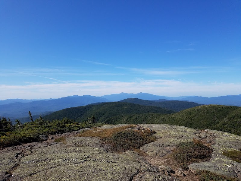
For a shorter excursion, try the Blueberry Mountain Trail. It’s a 2.5-mile hike with a crisp climb that rewards with a sweeping overlook of the park’s waterfalls far below. At this vantage, waterfalls appear as liquid ribbons threading through the green, daring you to follow their course on foot.
Timing is key. Waterfalls swell with spring thaw or after heavy rain, but wet trails become slippery and demands sharper focus. Wear solid footwear with good grip and pack a lightweight water purifier because the streams run clear but currents are relentless. Bring layered clothing as temperatures can shift quickly—morning fog and afternoon sun engage in a quiet duel.
Hydration is a must: the effort of the climb paired with the humid woods tests stamina. Allow for breaks by the rushing waters, listening to the current’s push and the craggy rocks’ steady resistance. The area’s natural temperament insists you respect its pace.
When to go? Late spring through early fall offers the most stable conditions and vibrant foliage, each season painting the forest differently but always boldly. For photographers, early morning light captures mist rising off falls; late afternoon casts long, warm shadows.
In all, chasing waterfalls at Grafton Notch is adventure with a practical balance. It demands preparation but promises reward: a raw, tangible connection with fiercely alive landscapes. Step cautiously, pack wisely, and let the water lead the way.
Nearby Trips
All Adventures
Boat Charters
Water Activities
Adventures near Bethel, Maine
Discover the unique and memorable adventures that make Bethel, Maine special.
Frequently Asked Questions
What is the best trail for waterfall views in Grafton Notch State Park?
The Gulf Hagas loop offers the most comprehensive waterfall experience, showcasing dramatic drops like Screw Auger Falls and Leighton’s Gorge over about 8 miles with moderate elevation. For a shorter hike, Blueberry Mountain Trail grants panoramic views of multiple falls.
Are dogs allowed on the trails near the waterfalls?
Dogs are permitted on most trails but must be kept on a leash to protect both wildlife and other park visitors. Water crossings and rugged terrain can be challenging for some dogs, so evaluate your pet's fitness and comfort.
When is the waterfall flow the most impressive?
Waterfalls hit peak flow in late spring with snowmelt and after heavy rains. This increases both the volume and power of water, making for striking sights but potentially slippery trails.
Is swimming allowed in the pools below the waterfalls?
Swimming is generally discouraged due to strong currents and hidden underwater hazards. Some calm pools might appear inviting, but exercise caution and respect posted signage.
Are there restroom facilities available at trailheads?
Basic restroom facilities are available near major trailheads like Gulf Hagas. However, options can be limited, so plan accordingly and carry appropriate supplies for comfort during your hike.
What wildlife might I encounter around the waterfalls?
Expect to see white-tailed deer, black bears, and a variety of bird species like woodpeckers and warblers. Early morning or dusk increases wildlife sightings but also requires heightened alertness.
Recommended Gear
Hiking Boots with Good Traction
To maintain footing on wet and rocky trails, boots with solid grip protect against slips near waterfalls and rugged paths.
Layered Clothing System
Allows quick adaptation to changing temperature and weather conditions encountered throughout the day.
Water Bottle with Filtration
Stream water appears clear but varies in quality; filtration ensures safe hydration during long hikes.
Trekking Poles
Helpful for balance on slippery or steep terrain, especially near wet falls and rocky sections.
Local Insights
Hidden Gems
- "Moxie Falls viewpoint offers a quieter alternative with impressive views"
- "Old logging roads nearby create less trafficked paths worth exploring for solitude"
Wildlife
- "Look for signs of beaver activity around wetlands adjacent to waterfalls"
- "Listen for the distinctive drumming of pileated woodpeckers echoing in the forest"
History
"Grafton Notch holds historical significance as an old logging route; remnants of early forest industry infrastructure still surface along some trails."