July 14th, 1916: North Carolina’s Catastrophic Flood and the Perfect Storm
On July 14th, 1916, Western North Carolina faced one of its most devastating natural disasters when two hurricanes funneled into the mountains, triggering record-breaking rainfall and catastrophic flooding. This event reshaped the region’s rivers, communities, and history, setting a benchmark for future storms.
Understand Water Behavior
Respect rivers and creeks after heavy rains—they can rise rapidly and become dangerous with little warning.
Monitor Weather Closely
July is historically a high-risk month for flooding due to tropical storms; always check forecasts before exploring river areas.
Prepare for Isolation
Historic flooding cut off towns like Montreat and Asheville; plan your routes and communication accordingly when hiking near waterways.
Protect Historic Sites
Many key flood-affected landmarks from 1916 remain; respect these cultural heritage locations and park only in designated areas.
July 14th, 1916: North Carolina’s Catastrophic Flood and the Perfect Storm
On July 14th, 1916, Western North Carolina faced an unprecedented natural disaster, sculpted by an extraordinary clash of weather forces. Two hurricanes—one pushing up from the Gulf of Mexico and another from the Atlantic Ocean—were funneled directly into the Blue Ridge by high-pressure systems stationed over Tennessee and Norfolk, Virginia. This meteorological bottleneck created an unstoppable deluge unlike any in U.S. history.
The story begins on July 10th, when the Gulf hurricane, steered by the Tennessee high pressure, swept rain over the Blue Ridge’s crest. Torrential downpours saturated the soil and forced rivers downstream—like the Catawba, Yadkin, and French Broad—to swell ominously. By the time the second, massive Atlantic hurricane crossed just north of Charleston on July 13th, the ground was already soaked and rivers primed to rage.
July 14th marked the peak of this flood catastrophe. The Weather Bureau’s gauge at Altapass near Spruce Pine recorded the highest single-day rainfall ever measured in the nation, flooding creeks and rivers with 90% runoff from the soaked earth. In Montreat, a small mountain community north of Black Mountain, rain gauges tallied 22 inches over two days. The normally gentle Flat Creek transformed into a violent surge, filling Montreat Lake (now Lake Susan) rapidly.
Disaster struck early on July 16th when the earthen and wooden dams containing Flat Creek broke. A formidable wall of water rushed down the valley, sweeping away cars, bridges, roads, and threats to safety. Montreat found itself isolated, its connections razed by flooding.
This grim scene repeated throughout the region. Asheville and Hendersonville went dark and cut off. The Catawba River destroyed all but one railroad bridge near Marion, yet even that crossing was unusable after damage to its approaches. Telephone and telegraph lines vanished. Railroad tracks—lifelines in 1916—were nearly wiped out, leaving small towns and cities stranded.
The flood crested around 47 feet above flood stage west of Charlotte. To put that in perspective, the Catawba River would have risen three-quarters of the way up to Interstate 40’s bridge decks—a monumental force of water pushing relentlessly over the landscape. Landslides swallowed homes, industrial plants crumbled, and survivors marveled at how quickly peaceful creeks turned deadly torrents. Over 80 North Carolinians lost their lives.
After the waters receded, the damage to crops and property was staggering. Yet, as the cleanup began, the floodwaters left behind thousands of trapped fish, prompting community fish fries and shared meals, a poignant return to normalcy amid devastation.
While Hurricane Helene and other storms remind us flooding risks remain today, the 1916 flood remains the benchmark. The level of destruction was somewhat tempered by the area’s lesser development at the time—just over 30 years after railroads reached up through Swannanoa Gap. This event stands as a brutal lesson and reminder: when nature gathers all its forces, it demands respect and preparedness.
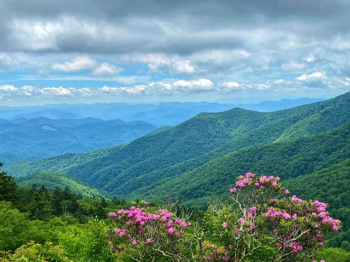
Exploring Western North Carolina today, you witness a landscape scarred and shaped by history but alive with resilience. The waterways that once surged with destructive power now invite adventure and reflection, pushing travelers to appreciate both their beauty and their might.
— Kevin Spencer, Author, North Carolina Expatriates
Nearby Trips
All Adventures
Boat Charters
Water Activities
Adventures near Asheville, North Carolina
Discover the unique and memorable adventures that make Asheville, North Carolina special.
Frequently Asked Questions
Why were the 1916 floods so devastating in Western North Carolina?
The unique combination of two hurricanes funneled between high-pressure systems created extreme rainfall over already saturated ground. This caused rivers like the Catawba and French Broad to rise rapidly, overwhelming dams, bridges, and infrastructure, leading to widespread flooding and destruction.
Can the 1916 flood sites still be visited today?
Many affected areas, such as Montreat and parts of Asheville, still exist and offer historical markers or preserved nature. Visitors should respect property boundaries and local guidelines, as some sites are on private land or protected.
What wildlife might you see near these flood-impacted river valleys?
Look for river otters, great blue herons, and numerous fish species thriving downstream, along with black bears and white-tailed deer in the forested mountains surrounding waterways.
How can hikers safely enjoy river trails in flood-prone seasons?
Always check the weather forecast, avoid crossing rivers during or after heavy rain, carry essentials like waterproof gear and navigation tools, and inform someone of your route and expected return time.
What lesser-known places offer views of the Blue Ridge rivers and flood history?
Try the Montreat Dam overlook trail, which offers panoramic views of Lake Susan and Flat Creek valley, or the Riverside Trail near Asheville that traces parts of the French Broad River.
How have local communities adapted since the floods of 1916?
Communities have improved levees, upgraded bridge designs, and established early warning systems to reduce flood risks while preserving natural habitats. Local festivals and educational events also celebrate the region’s resilience.
Recommended Gear
Waterproof Hiking Boots
Heavy rain and river crossings call for boots that keep feet dry and provide solid traction on slick rocks.
Weather-Resistant Jacket
Be prepared for sudden storms common in July; a lightweight, breathable rain jacket is critical.
Portable Water Filter
Clean drinking water is essential on longer hikes near rivers and streams.
Headlamp or Flashlight
Shorter days and potential trail detours require reliable lighting if you’re out late.
Local Insights
Hidden Gems
- "Montreat Dam Overlook Trail"
- "Hidden waterfall cascades along Flat Creek tributaries"
- "Abandoned railroad trestle sites near Marion"
- "Quiet fishing spots on the French Broad River upstream of Asheville"
Wildlife
- "River Otters"
- "Great Blue Herons"
- "Mountain Laurel blooming in spring"
- "Black Bears"
History
"The 1916 flood was a defining moment in North Carolina’s mountain history, shaping infrastructure decisions and community planning for decades. Montreat’s dam failure is a rare example of early 20th-century earthen dam disasters."