Skip to main content
Hiking the Forest of Nisene Marks in Santa Cruz, California
Santa Cruz
•10.0/10
•Moderate
Hiking the Forest of Nisene Marks in Santa Cruz, California
Category
Natural Landmark
Typical Duration
15 minutes
Difficulty
Moderate
Photo Gallery
Hiking the Forest of Nisene Marks in Santa Cruz, California - Santa Cruz
Hiking the Forest of Nisene Marks in Santa Cruz, California - Santa Cruz
Hiking the Forest of Nisene Marks in Santa Cruz, California - Santa Cruz
About This Landmark
Hiking the Forest of Nisene Marks in Santa Cruz, California
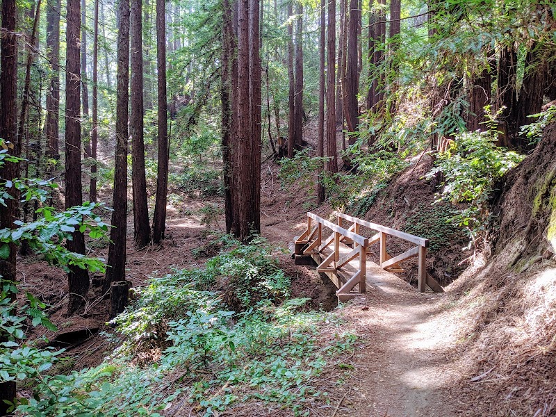
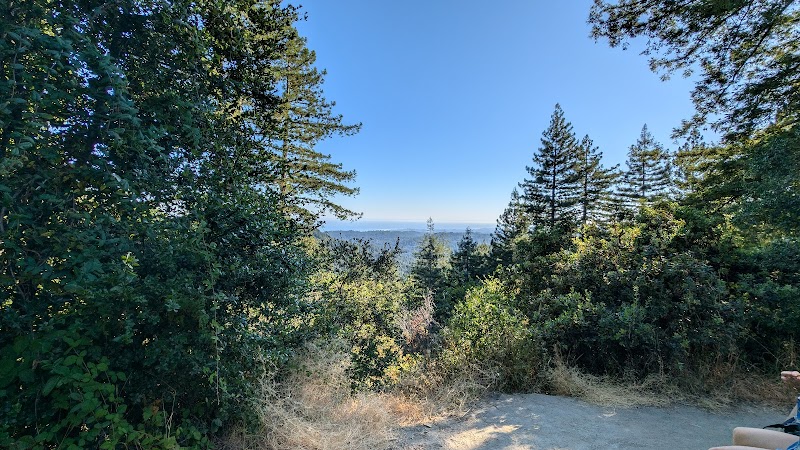
The Forest of Nisene Marks State Park, located just minutes from downtown Santa Cruz, offers hikers a tranquil escape into the heart of California’s redwood wilderness. Spanning over 10,000 acres, this park is celebrated for its peaceful atmosphere, towering second-growth redwoods, and varied trail options that appeal to both casual walkers and seasoned hikers. It holds significant local value, showcasing the regeneration of nature in a former logging region. For Santa Cruz locals and visitors alike, this park provides a perfect setting to reconnect with the area’s natural beauty.
Adventure Guide to Hiking the Forest of Nisene Marks
-
Aptos Creek Trail to the Five Finger Falls
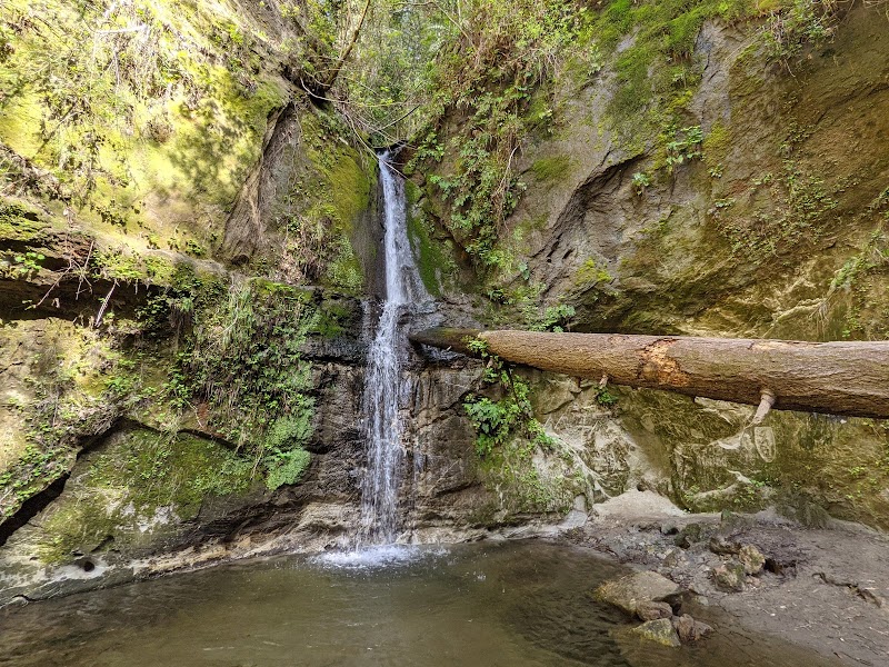
This scenic hike is approximately 10 miles round trip and features shaded redwood groves, lush ferns, and the satisfying endpoint of Five Finger Falls. The falls themselves are a modest yet enchanting series of cascades, perfect for photography or a break before heading back. The trail offers moderate difficulty and is popular among hikers seeking a longer trek. -
The Old Mill Site Trail
Perfect for history buffs or those looking for a short, manageable hike, this 1.2-mile loop leads to the remains of the old logging mill. Along the way, interpretive signs provide a glimpse into the park’s logging history. A picnic area nearby allows visitors to relax post-hike amidst the serene forest. -
Maple Falls via Bridge Creek Trail
Maple Falls is a highlight for many park visitors. This 8.5-mile round-trip hike involves stepping stones across streams and scrambling over tree roots, making it an adventurous yet doable option. The stunning waterfall at the trail’s end is worth the journey, especially in the wetter months when the water flow is strongest.
Local Insights
- The Forest of Nisene Marks was named after Nisene Marks, a matriarch of the Marks family who once owned the land.
- The park’s second-growth redwoods grew after extensive logging in the late 1800s to early 1900s.
Visitor Tips
- Best Times: Spring and fall offer cooler temperatures and vibrant greenery.
- What to Bring: Sturdy shoes, layered clothing, water, and snacks.
- Directions: From Santa Cruz, drive 15 minutes south on Highway 1 to the Aptos Creek Road entrance.
Visitor Tips:
- Best Times: Spring and Fall for cooler temperatures and amazing lighting.
- What to Bring: Water, sunscreen, and a camera!
Ratings
Overall
10.0/10User rating
Experience Level
Moderate
Experience Needed: This natural landmark is recommended for those with some outdoor experience. Good for regular hikers.