
Kintamani UNESCO Global Geopark Adventures
Kintamani UNESCO Global Geopark, located in Bali, offers stunning volcanic landscapes and fascinating geological features for outdoor enthusiasts and nature lovers.
About Kintamani UNESCO Global Geopark
Kintamani UNESCO Global Geopark, situated in the northeastern part of Bali, is renowned for its breathtaking volcanic landscapes dominated by Mount Batur, an active volcano. This geopark showcases a diverse range of geological formations, including the Batur Caldera, lava fields, and Lake Batur, which is the largest lake on the island. Historically and culturally significant, this area is inhabited by the indigenous Bali Aga people, who have lived in harmony with their volcanic surroundings for centuries. Visitors to the park can explore various hiking trails with spectacular views of the volcano and caldera, making it a popular destination for outdoor enthusiasts. Additionally, the park offers opportunities for geological education and cultural experiences, with traditional villages providing insight into local customs and crafts. The combination of dramatic geology, rich biodiversity, and cultural heritage makes Kintamani Geopark a captivating destination for those seeking adventure and knowledge.
Highlights
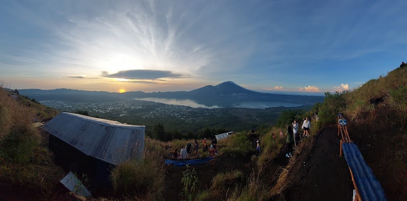
Mount Batur Sunrise Trek
Batur Caldera and Lake Batur
Traditional Bali Aga Villages
Ulun Danu Batur Temple
Notable Natural Features
Mount Batur
An active volcano, offering a popular sunrise trek with panoramic views.
Lake Batur
The largest crater lake in Bali, known for its serene beauty and fishing opportunities.
Bali Aga Villages
Traditional villages that provide cultural insights and handcrafted goods.