Skip to main content
Exploring Devil's Den State Park Trails in West Fork, Arkansas
West Fork, Arkansas
•10.0/10
•Hard
Exploring Devil's Den State Park Trails in West Fork, Arkansas
Category
Natural Landmark
Typical Duration
20 minutes
Difficulty
Hard
Photo Gallery
Exploring Devil's Den State Park Trails in West Fork, Arkansas - West Fork, Arkansas
Exploring Devil's Den State Park Trails in West Fork, Arkansas - West Fork, Arkansas
Exploring Devil's Den State Park Trails in West Fork, Arkansas - West Fork, Arkansas
About This Landmark
Exploring Devil's Den State Park Trails in West Fork, Arkansas
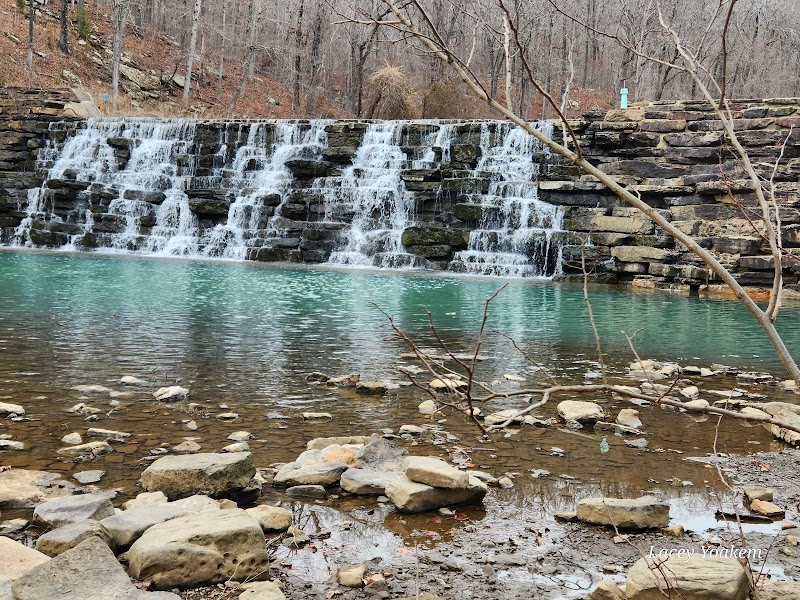
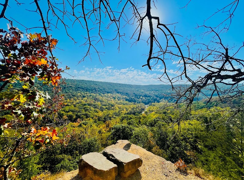
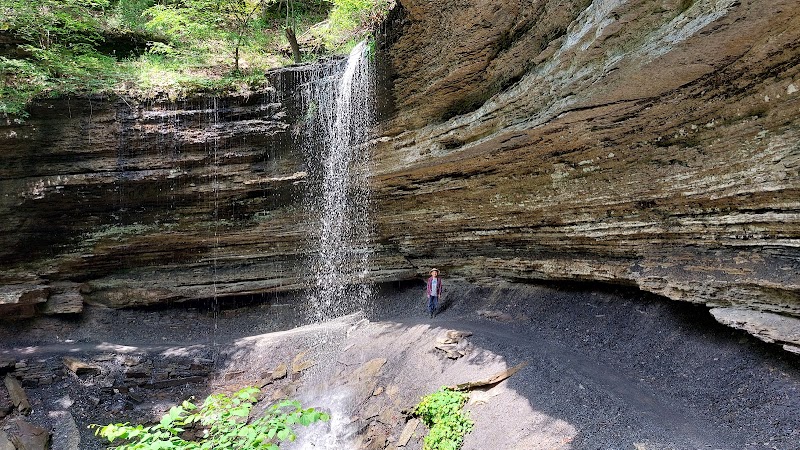
Devil's Den State Park, located a short drive from West Fork in the heart of the Ozark Mountains, is a must-visit destination for trail enthusiasts. This park features some of the most diverse and scenic hiking trails in Arkansas, drawing outdoor lovers with its natural beauty, limestone formations, and rich history. Home to ancient caves, cascading waterfalls, and picturesque overlooks, the area offers a captivating escape for hikers of all experience levels.
Adventure Guide to Devil's Den State Park Trails
Yellow Rock Trail
- Why it’s special: Known for its breathtaking panoramic views, this 3-mile loop leads to the iconic Yellow Rock Overlook, a favorite vantage point for photography and relaxation.
- Key features: The trail has well-marked paths with beautiful bluffs and stunning fall foliage in autumn. Benches along the way make it accessible for families.
- Local insight: Arrive early in the morning for soft lighting at Yellow Rock Overlook to capture the best photos.
Devil’s Den Trail
- Why it’s special: A 1.5-mile loop showcasing the park’s unique limestone crevices, rock formations, and cascading streams. Highlights include the Devil’s Den cave, though access may be limited for public safety or bat conservation efforts.
- Key features: This shorter trail is packed with natural wonders, making it ideal for families or hikers short on time. Interpretive signs add intriguing historical context.
- Local insight: Wear sturdy shoes, as parts of this trail can be rocky or slippery, especially after rain.
Butterfield Hiking Trail
- Why it’s special: A challenging 15-mile loop for experienced hikers, this trail offers a remote, backcountry experience with diverse terrain and serene forested sections.
- Key features: Includes creek crossings, scenic ridges, and access to primitive campsites. A perfect way to unplug and immerse yourself in nature’s tranquility.
- Local insight: Check water levels and weather forecasts before starting; some creek crossings can become difficult after heavy rain.
Visitor Tips
- Best times to visit: Late spring or fall for pleasant weather and vibrant scenery.
- What to bring: Comfortable hiking boots, layered clothing, water, and a camera.
- Driving directions: From West Fork, take I-49 south to exit 45. Follow AR-170 for 12 miles to reach the park (approx. 20 minutes).
Visitor Tips:
- Best Times: Spring and Fall for cooler temperatures and amazing lighting.
- What to Bring: Water, sunscreen, and a camera!
Ratings
Overall
10.0/10User rating
Experience Level
Hard
Experience Needed: This natural landmark is recommended for those with significant outdoor experience. Best for experienced adventurers.