THE ADVENTURE COLLECTIVE® · Independent discovery and booking for outdoor travel

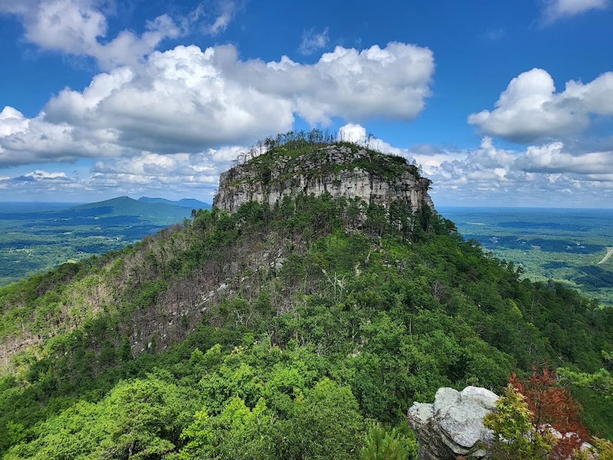
A prominent knob near Pinnacle creates two distinct experiences: drive-up overlooks for short visits and a tight network of rocky, rooty trails—most notably a 7.2-mile Mountain–Grindstone–Grassy Ridge loop and the 6.6-mile Corridor Horse Trail—for disciplined training and longer distance runs.
Running
4-5 hours
Easy
Pilot Mountain State Park - Pilot Mountain State Park
Pilot Mountain State Park - Pilot Mountain State Park
Pilot Mountain State Park - Pilot Mountain State Park
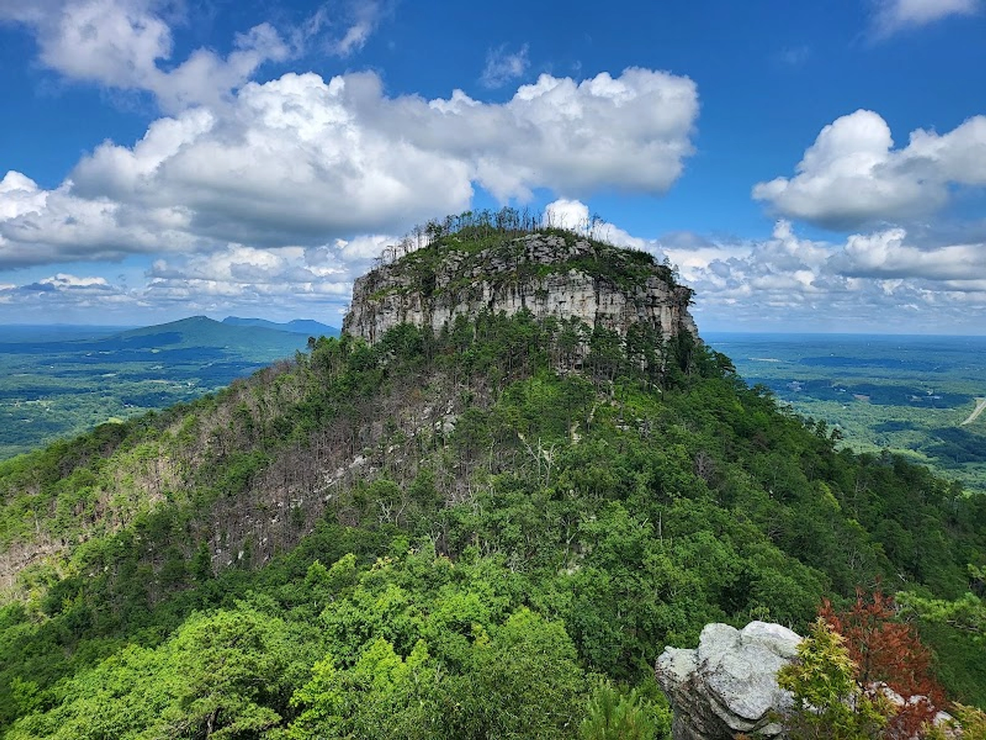
Pilot Mountain State Park sits near Pinnacle in the north-central part of North Carolina, about a short drive from Winston-Salem. The park is anchored by a prominent 2,420-foot knob that rises roughly 1,400 feet above the surrounding countryside; that knob divides two distinct visitor experiences: a compact, vehicular-accessible summit zone popular with casual visitors, and a network of trails around the base that attracts runners and people seeking sustained climbs and technical footing. (sourceRefs withheld in public-facing text.)
For runners and people training on rolling, rocky singletrack, the park can function as a workout venue. The primary running loop described by local guides strings together the Mountain, Grindstone and Grassy Ridge trails into a roughly 7.2-mile circuit that winds around Pilot Mountain’s midsection and base; the park rates those trails "moderate to strenuous." Alternately, the Corridor Horse Trail provides a longer, 6.6-mile option that trends downhill from the base toward the Yadkin River if run one way, or can be extended into an out-and-back for a half-marathon-length training day.
What follows is an editorial guide that treats Pilot Mountain as a purposeful training landscape—how the routes feel underfoot, where crowds concentrate, and which kinds of outings fit the place. The aim is to help a runner, trail athlete, or disciplined day hiker decide whether to plan a full-loop workout, a long corridor run, or a shorter summit visit that relies on the park’s drive-up overlook.
Most drawn to Pilot Mountain arrive with a clear split in mind: the summit overlooks for quick, scenic stops and the trails for sustained effort. The park’s compact footprint means the summit/overlook area receives the majority of casual visitation; many visitors drive to the top and spend time around the viewpoints, while the harder singletrack stays quieter. This arrangement makes the site useful for mixed itineraries—athletes can park, drop a car if needed, and pick up a trailhead near quieter sections of the loop.
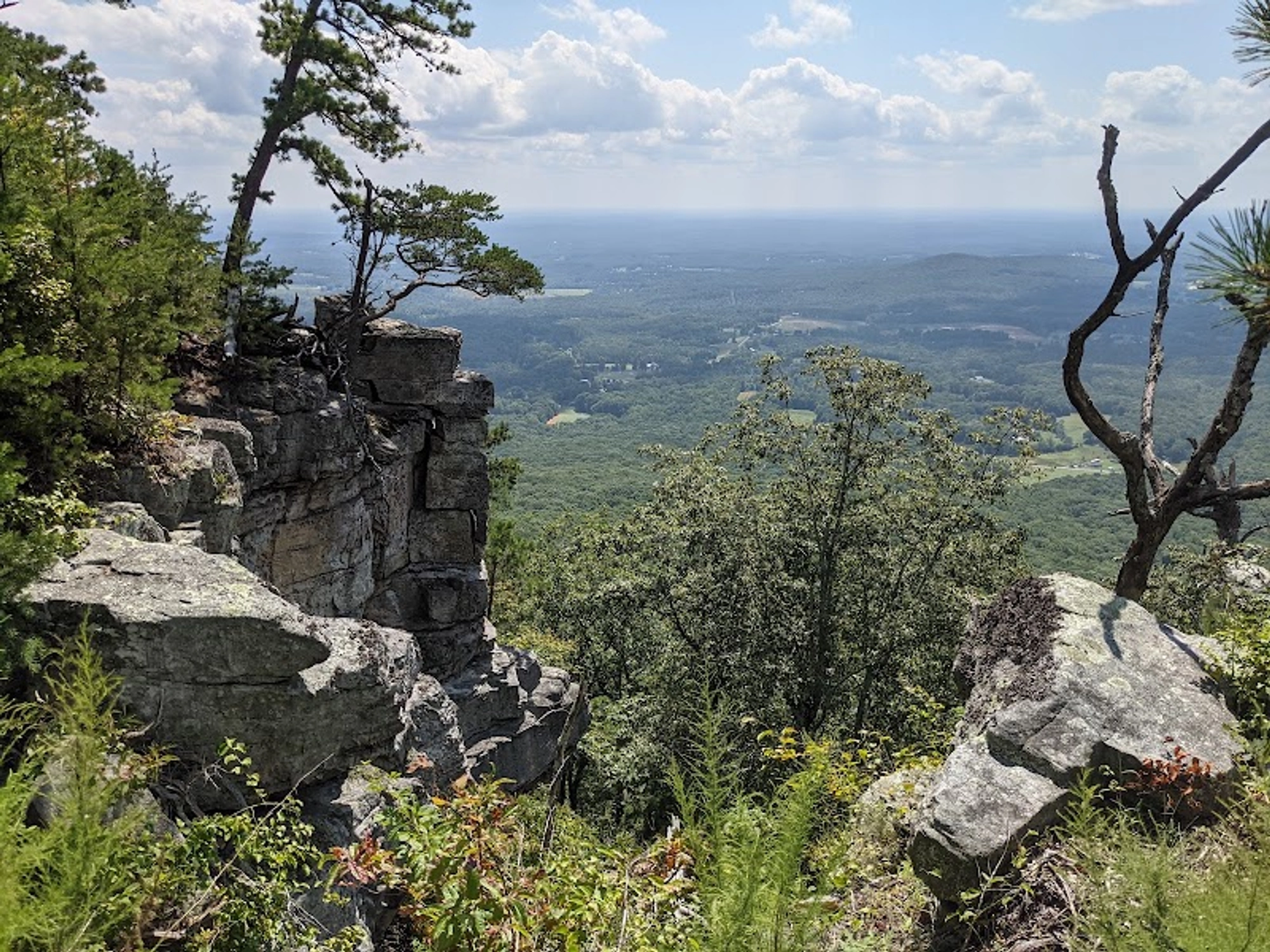
Visitors reporting easy access say the drive-up overlook is straightforward and that parking and the short walks from the lot make summit viewpoints attainable even for those who prefer not to undertake strenuous trail miles. Several supplied visitor accounts emphasize clear, reachable overlooks and accessible walking routes near the summit; those observations align with the park’s visible separation between top-side visitation and lower-elevation trailwork.
The 7.2-mile circuit assembled from the Mountain, Grindstone and Grassy Ridge trails is the destination’s canonical training route. The primary source describes the loop as offering the expected rocky, rooty, rolling challenges—sections that demand technical foot placement and repeated climbs rather than long, steady climbs. Runners and hikers should expect a mix of punchy ascents and shorter descending segments rather than a single continuous climb.
The park’s grading of these trails as "moderate to strenuous" is practical guidance: the route functions as mountain training rather than a flat endurance run. For those specifically seeking climbs and leg strength work, the loop's repeated undulations and technical tread deliver sustained effort close to the knob without requiring large mileage.
The Corridor Horse Trail runs roughly 6.6 miles from the base of Pilot Mountain and heads south toward the Yadkin River corridor in the park’s routing. The primary description characterizes the Corridor trail as generally downward trending on the route from the park toward the river—an orientation that appeals to runners who prefer longer, net-descending miles or who will convert the route into an out-and-back for a half-marathon-length training day.
This trail offers a contrast to the loop: fewer repeated steep climbs, a more sustained mileage profile, and a terrain profile useful for long runs where footing is variable but less punchy. The Corridor can be combined with loop segments for custom workouts—runners focused on distance and pacing often choose it over the tighter, hillier circuits.
Trail descriptions emphasize rocky and rooty tread—the "rolling challenges" and technical footing that define the training quality of the park. That character makes shoe choice and attention to footing meaningful; one supplied visitor note specifically cautions about loose gravel and roots and recommends shoes with good tread. Recent reviews also recall clean restrooms and a helpful visitor center near the summit area, and several emphasize that summit areas are more populated while the hard-work trails are less frequented by casual visitors.
The split between a drive-accessible summit and lower-elevation singletrack has practical consequences for trail users. Runners looking for solitude and sustained effort should plan to start where the singletrack begins rather than at the busiest overlooks. Conversely, groups with mixed abilities can meet expectations by letting less-mobile members use summit walkups while stronger runners or hikers undertake the loop or Corridor Trail.
Pilot Mountain’s trail network and summit access make it particularly well suited to trained trail runners and hikers seeking concentrated climbing work near a nearby city. The park’s proximity to Winston-Salem—reported as roughly a 25-minute drive from downtown in local guidance—makes it a practical option for after-work or weekend training sessions. At the same time, the "moderate to strenuous" rating for the principal loop advises that less experienced trail users should not assume the trails are easy.
Review-sourced observation recommends sturdy footwear and carrying water; one visitor highlighted that many campsites are natural and rocky without electrical hookups, which indicates a need for planning when staying overnight. Recent visitor comments also reinforce that the drive-up overlook, parking, and short summit walks accommodate older visitors or those recovering from injury, but those choices are different from committing to the full loop trails.
Pilot Mountain matters as a compact training landscape with a clear behavioral split: a car-accessible summit that concentrates casual visitation and quieter, more technical trails that deliver the workout. Runners and trail athletes will find the Mountain–Grindstone–Grassy Ridge loop and the Corridor Horse Trail useful for hill repeats, technical footing practice, and longer distance sessions, while visitors seeking quick vistas can still experience notable overlooks without extensive hiking.
For planners, the simple decision is whether the visit’s aim is mileage and leg work or reach-the-viewpoint accessibility; the park supports both but keeps them largely separate. Those who value purposeful trail workouts near an urban center will find Pilot Mountain a repeatable training resource; those seeking a low-effort scenic stop can reach the summit area with minimal trail time.
Three practical options reflect the park’s split personality: a technical loop for focused training, a corridor trail for longer mileage, and a drive-up summit for low-effort viewpoints.
| Option | Best For | Emphasis |
|---|---|---|
| Mountain–Grindstone–Grassy Ridge loop | Trail runners training for hills and technical footing | Moderate-to-strenuous singletrack with repeated ascents and rocky, rooty tread |
| Corridor Horse Trail (out-and-back or one-way) | Long-distance runners wanting sustained mileage or net-descending miles | Approximately 6.6 miles south toward the Yadkin River; useful for longer sessions |
| Drive-up summit and short overlooks | Casual visitors, mixed-ability groups, and those seeking accessible viewpoints | Easy parking and short walks to overlooks; less trail commitment required |
Directions & Logistics: Decide whether your visit is summit-focused or trail-focused; park near the intended start point and be prepared with footwear and water for the moderate-to-strenuous loop or the longer Corridor Horse Trail.
Q: Are there long-run options at Pilot Mountain?
Yes. The Corridor Horse Trail is described as roughly 6.6 miles heading south toward the Yadkin River and is commonly used for longer mileage; it can be run as an out-and-back for extended sessions. The park’s looped singletrack can also be combined with corridor segments for longer outings.
Q: Can you reach summit viewpoints without a long hike?
Yes. Multiple visitor accounts describe an easy drive to summit overlooks and short walks from parking that make summit viewpoints accessible to visitors who prefer minimal trail time.
Q: How hard are the park’s main trails for runners?
The park rates the principal loop connecting the Mountain, Grindstone and Grassy Ridge trails as "moderate to strenuous," with rocky and rooty tread that produces technical sections and repeated climbs rather than a single continuous ascent.
Three practical options reflect the park’s split personality: a technical loop for focused training, a corridor trail for longer mileage, and a drive-up summit for low-effort viewpoints.
| Option | Best For | Emphasis |
|---|---|---|
| Mountain–Grindstone–Grassy Ridge loop | Trail runners training for hills and technical footing | Moderate-to-strenuous singletrack with repeated ascents and rocky, rooty tread |
| Corridor Horse Trail (out-and-back or one-way) | Long-distance runners wanting sustained mileage or net-descending miles | Approximately 6.6 miles south toward the Yadkin River; useful for longer sessions |
| Drive-up summit and short overlooks | Casual visitors, mixed-ability groups, and those seeking accessible viewpoints | Easy parking and short walks to overlooks; less trail commitment required |
Directions & Logistics: Decide whether your visit is summit-focused or trail-focused; park near the intended start point and be prepared with footwear and water for the moderate-to-strenuous loop or the longer Corridor Horse Trail.
Q: Are there long-run options at Pilot Mountain?
Yes. The Corridor Horse Trail is described as roughly 6.6 miles heading south toward the Yadkin River and is commonly used for longer mileage; it can be run as an out-and-back for extended sessions. The park’s looped singletrack can also be combined with corridor segments for longer outings.
Q: Can you reach summit viewpoints without a long hike?
Yes. Multiple visitor accounts describe an easy drive to summit overlooks and short walks from parking that make summit viewpoints accessible to visitors who prefer minimal trail time.
Q: How hard are the park’s main trails for runners?
The park rates the principal loop connecting the Mountain, Grindstone and Grassy Ridge trails as "moderate to strenuous," with rocky and rooty tread that produces technical sections and repeated climbs rather than a single continuous ascent.
Running
Pinnacle, North Carolina
Running
Experience Needed: This natural landmark is recommended for those with minimal outdoor experience. Perfect for families and beginners.