Skip to main content
Conquer the "M": A Missoula Hiking Icon Awaits
Explore the 1.5-mile trail to the 'M' on Mount Sentinel in Missoula, Montana. This moderate hike offers striking views of the valley and is popular for hiking and birdwatching. Best visited in spring and fall, the trail is family-friendly with a steep ascent.
Sentinel Summit Trail
•7.5/10
•Moderate
Conquer the "M": A Missoula Hiking Icon Awaits
Category
Hiking to the "M"
Typical Duration
1-1 hours
Difficulty
Moderate
Photo Gallery
Conquer the "M": A Missoula Hiking Icon Awaits - Sentinel Summit Trail
Conquer the "M": A Missoula Hiking Icon Awaits - Sentinel Summit Trail
Conquer the "M": A Missoula Hiking Icon Awaits - Sentinel Summit Trail
About This Landmark
Conquer the "M": A Missoula Hiking Icon Awaits
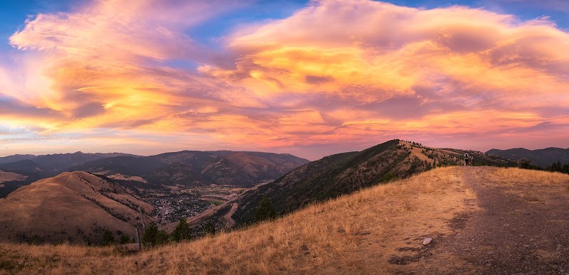
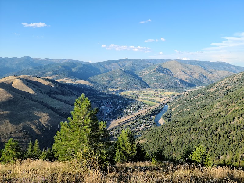
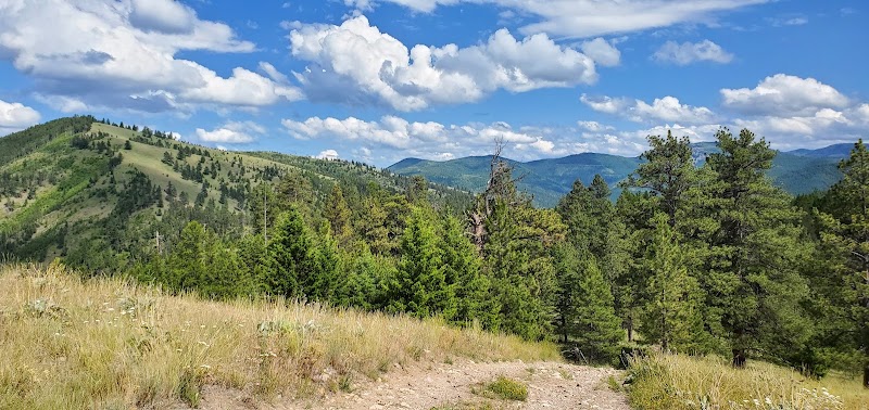
The "M" on Mount Sentinel stands as a defining feature of Missoula, Montana, attracting locals and visitors alike with its striking presence and spectacular views. This iconic destination, marked by a massive concrete letter carved into the hillside, offers not just a hike but a gateway into the heart of Montana’s rugged landscape. The trail to the "M" spans about 1.5 miles and features a steep ascent that rewards hikers with panoramic vistas of the surrounding valley and mountains. Each bend of the trail unfolds a new facet of Missoula's natural beauty, from the vibrant wildflowers in spring to the colorful foliage of autumn, creating a breathtaking backdrop.
Adventure seekers can enjoy a well-maintained path that is accessible year-round, making it an ideal getaway for all levels of hikers. This hike has roots that echo the city’s history, initially being a site for lookout points and military training during World War II. Today, it serves as a popular physical challenge and a gathering place for the community. Whether you are seeking fitness or simply want to experience the refreshing beauty of the outdoors, the "M" awaits.
Adventure Guide to Hiking to the "M"
Key Facts:
- Distance: 1.5 miles one way
- Elevation Gain: Approximately 620 feet
- Trail Difficulty: Moderate
- Best Time to Visit: Late spring through fall
Recommended Suggestions:
- Wear sturdy shoes to navigate the rocky terrain.
- Bring water and snacks for energy, especially if hiking during warmer months.
- Check the weather before heading out to ensure a comfortable hike.
Interesting Facts:
- The "M" has been a part of Missoula since the 1900s, originally created as a tribute to the University of Montana.
- The site also provides fantastic birdwatching opportunities; keep an eye out for local raptors.
History: The hike to the "M" was initially used for military drills and later transformed into a public recreation site, fostering community spirit and offering a place for outdoor enthusiasts of all kinds to gather and appreciate nature. The trail has evolved into an essential part of Missoula’s identity, where locals bring their families, workout groups, and friends to enjoy a slice of Montana's grandeur amid a bustling town.
Visitor Tips:
- Best Times: Spring and Fall for cooler temperatures and amazing lighting.
- What to Bring: Water, sunscreen, and a camera!
Ratings
Overall
7.5/10User rating
Photography
7.0/10Scenic value
Featured Activities
Primary Activity
Hiking to the "M"
Also Great For
Birdwatching
Essential Information
Nearby City
Missoula, Montana
Protected Areas
Mount Sentinel, University of Montana, Lubrecht Experimental Forest
Experience Level
Moderate
Experience Needed: This natural landmark is recommended for those with some outdoor experience. Good for regular hikers.