Hiking the South Boundary Road Trails
Hiking the South Boundary Road Trails
Category
Hiking
Typical Duration
30 minutes
Difficulty
Moderate
Photo Gallery
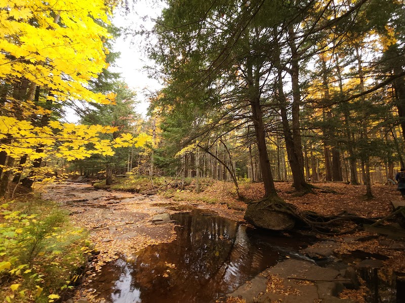
Hiking the South Boundary Road Trails - South Boundary Road
Hiking the South Boundary Road Trails - South Boundary Road

Hiking the South Boundary Road Trails - South Boundary Road
About This Landmark
Hiking the South Boundary Road Trails
Hiking the South Boundary Road Trails in the Porcupine Mountains, Michigan, offers a unique opportunity to experience remote wilderness with a mix of rugged terrain, dense forests, and stunning vistas. Located on the southern edge of the Porcupine Mountains Wilderness State Park, South Boundary Road serves as the backbone of access to several trailheads leading to hidden gems within this pristine natural area. Known for its less-crowded paths and rich biodiversity, these trails are perfect for hikers seeking solitude and an intimate connection with Michigan’s Upper Peninsula landscape.
Adventure Guide To Hiking the South Boundary Road Trails
-
Cloud Peak Trail
Start your journey near the Cloud Peak Trailhead, just off South Boundary Road. This 3.6-mile loop leads you through dynamic forested terrain with views of the Carp River. Its main attraction is the lookout point revealing a stunning panoramic view of the Porcupine Mountains. The trail is moderately challenging and often overlooked by tourists, making it a peaceful experience. Keep an eye out for bald eagles and deer along the way. -
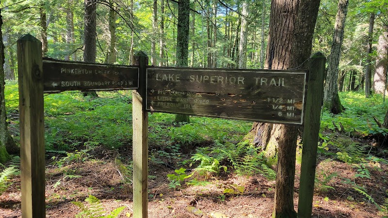
Pinkerton Creek Trail
Just a 15-minute drive west of the park’s entrance on South Boundary Road, Pinkerton Creek Trail offers a 2.3-mile out-and-back hike. Following the creek, the trail features footbridges and calm sections perfect for enjoying the sound of cascading water. Fall, with its vibrant foliage, is the most scenic time to visit. -
Union River Outpost Trail
Located near the eastern end of South Boundary Road, this 2-mile trail winds through old-growth forests and leads to the Union River. Ideal for a short day hike, it provides opportunities to spot wildlife such as black bears or red foxes.
Local Insights
The trails off South Boundary Road are less trafficked than popular routes like Lake of the Clouds. This gives visitors a chance to experience the serene beauty of the Porcupine Mountains. Many of the paths were developed by logging companies in the early 20th century, leaving a legacy of human interaction with the wilderness.
Visitor Tips
- Best Time to Visit: Late spring through early fall for optimal trail conditions.
- What To Bring: Sturdy hiking boots, insect repellent, and a map from the visitor center.
- Directions: From the Porcupine Mountains Wilderness State Park Visitor Center, head south on South Boundary Road (approx. 15–30 minutes to key trailheads).
- Best Times: Late Spring to Early Fall for cooler temperatures and amazing lighting.
- What to Bring: Water, sunscreen, and a camera!
Ratings
Overall
Photography
Featured Activities
Primary Activity
Hiking
Also Great For
Essential Information
Nearby City
Ontonagon, Michigan
Protected Areas
Porcupine Mountains Wilderness State Park
Experience Level
Experience Needed: This natural landmark is recommended for those with some outdoor experience. Good for regular hikers.