THE ADVENTURE COLLECTIVE® · Independent discovery and booking for outdoor travel

Yant Flat — the Candy Cliffs — delivers remote, striped Navajo Sandstone domes and expansive views of Zion without the crowds. This moderate 4-mile outing rewards photographers and hikers with dramatic color and quiet exploration; plan for route-finding and heat management.
Yant Flat — the Candy Cliffs — delivers remote, striped Navajo Sandstone domes and expansive views of Zion without the crowds. This moderate 4-mile outing rewards photographers and hikers with dramatic color and quiet exploration; plan for route-finding and heat management.
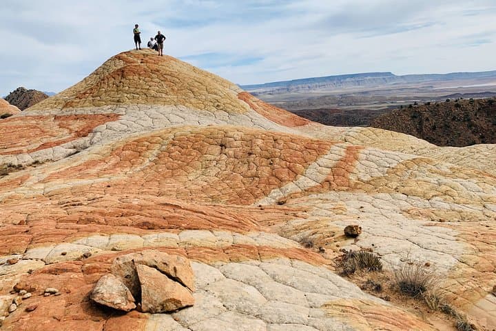
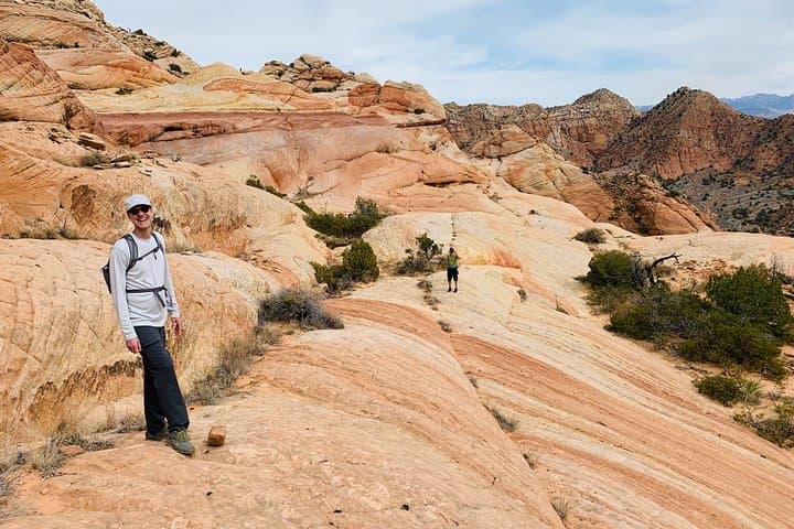
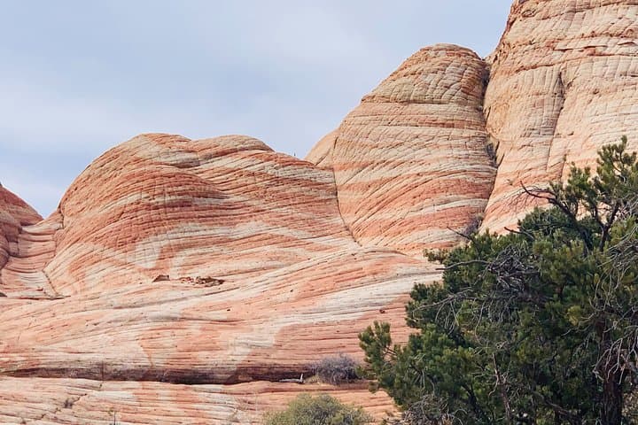
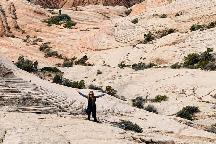
You step off a dusty two-track and the world tilts into color: bands of pink, orange and cream ripple across low domes while the wind pulls grains from the slopes like an impatient artist. At Yant Flat — widely called the Candy Cliffs — the sandstone seems to breathe, each dome and rib revealing layers of ancient dunes turned to stone. Zion’s jagged ridgelines stand at the horizon, a steady counterpoint to the rounded, striped forms at your feet.
Verified experiences and guided adventures in the surrounding area.
Operated by Grand Circle Tours-AZ · Saint George, Utah
You step off a dusty two-track and the world tilts into color: bands of pink, orange and cream ripple across low domes while the wind pulls grains from the slopes like an impatient artist. At Yant Flat — widely called the Candy Cliffs — the sandstone seems to breathe, each dome and rib revealing layers of ancient dunes turned to stone. Zion’s jagged ridgelines stand at the horizon, a steady counterpoint to the rounded, striped forms at your feet.
Geologically this is Navajo Sandstone, lifted and cracked by younger volcanic rocks and sculpted by millennia of wind and rain; locals sometimes call the shapes brain rock or turtleback. The area has a quiet pioneer history tied to nearby towns like St. George and Leeds, with sparse ranching and road-building leaving few traces. For photographers and hikers alike, Yant Flat offers wide-open compositions without the crowds of Antelope Canyon — light and shadow change fast here.
Practically, expect a moderate outing of roughly 4 miles roundtrip over slickrock, loose sand and low-angle scrambling, with a few hundred feet of cumulative elevation gain. Route-finding is needed; use a GPS or waypoint and allow 5–7 hours if you plan to explore and photograph. Bring 2–3 liters of water, sun protection, sturdy footwear, and a map or downloaded route. Start early to avoid midday heat and to catch the low-angle light that makes the cliffs look electric. Leave no trace: the colored layers are fragile — stay on durable surfaces where possible and pack out all trash.
moderate.
5–7 hours.
Suitable for hikers with moderate fitness — able to handle 4+ miles, uneven terrain, and some low-angle scrambling.
Expect a minimum of about 4 miles roundtrip for the main candy-striped domes, with 5–7 hours if you stop to explore and photograph.
The drive is roughly an hour from St. George on paved roads then a maintained dirt spur; a high-clearance vehicle helps but is not always required—confirm current conditions.
There is no formal permit for day hiking at Yant Flat, but check local land-management notices and respect private property; parking may be informal.
No — expect faint user paths and use GPS waypoints or a downloaded map; good daylight and basic navigation skills are recommended.
The exposed Navajo Sandstone records ancient Saharan-like dune fields; local settlement history ties to 19th-century Mormon pioneers and ranching in Washington County.
Stay on durable surfaces when possible and pack out all waste—fragile colored layers erode easily and human impact accelerates change.
Grand Circle Tours-AZ operates guided outdoor trips and adventures with an emphasis on safety, stewardship, and memorable experiences.
You step off a dusty two-track and the world tilts into color: bands of pink, orange and cream ripple across low domes while the wind pulls grains from the slopes like an impatient artist. At Yant Flat — widely called the Candy Cliffs — the sandstone seems to breathe, each dome and rib revealing layers of ancient dunes turned to stone. Zion’s jagged ridgelines stand at the horizon, a steady counterpoint to the rounded, striped forms at your feet.
You step off a dusty two-track and the world tilts into color: bands of pink, orange and cream ripple across low domes while the wind pulls grains from the slopes like an impatient artist. At Yant Flat — widely called the Candy Cliffs — the sandstone seems to breathe, each dome and rib revealing layers of ancient dunes turned to stone. Zion’s jagged ridgelines stand at the horizon, a steady counterpoint to the rounded, striped forms at your feet.
Geologically this is Navajo Sandstone, lifted and cracked by younger volcanic rocks and sculpted by millennia of wind and rain; locals sometimes call the shapes brain rock or turtleback. The area has a quiet pioneer history tied to nearby towns like St. George and Leeds, with sparse ranching and road-building leaving few traces. For photographers and hikers alike, Yant Flat offers wide-open compositions without the crowds of Antelope Canyon — light and shadow change fast here.
Practically, expect a moderate outing of roughly 4 miles roundtrip over slickrock, loose sand and low-angle scrambling, with a few hundred feet of cumulative elevation gain. Route-finding is needed; use a GPS or waypoint and allow 5–7 hours if you plan to explore and photograph. Bring 2–3 liters of water, sun protection, sturdy footwear, and a map or downloaded route. Start early to avoid midday heat and to catch the low-angle light that makes the cliffs look electric. Leave no trace: the colored layers are fragile — stay on durable surfaces where possible and pack out all trash.