THE ADVENTURE COLLECTIVE® · Independent discovery and booking for outdoor travel

Follow a self-guided audio route from Reserva Ecológica Costanera Sur to Puente de la Mujer, learning the stories of Argentine women whose names line Puerto Madero. Expect wetlands, riverside sculptures and modern architecture on a 60–75 minute walk.
Follow a self-guided audio route from Reserva Ecológica Costanera Sur to Puente de la Mujer, learning the stories of Argentine women whose names line Puerto Madero. Expect wetlands, riverside sculptures and modern architecture on a 60–75 minute walk.
The morning river wind pushes along the boardwalks as you leave the quiet trails of Reserva Ecológica Costanera Sur and step into Puerto Madero’s glass-and-steel edge. Wading birds cluster at lagoon margins, daring you to slow down; the city's glass façades catch the light and throw it back like a challenge. The route threads from wetland observation platforms through Micaela Bastidas Park, past the sculpted figures of Fuente de las Nereidas, and finishes at Santiago Calatrava’s angled span, the Puente de la Mujer.
Verified experiences and guided adventures in the surrounding area.
Operated by VoiceMap Audio Tours · Buenos Aires, Buenos Aires
The morning river wind pushes along the boardwalks as you leave the quiet trails of Reserva Ecológica Costanera Sur and step into Puerto Madero’s glass-and-steel edge. Wading birds cluster at lagoon margins, daring you to slow down; the city's glass façades catch the light and throw it back like a challenge. The route threads from wetland observation platforms through Micaela Bastidas Park, past the sculpted figures of Fuente de las Nereidas, and finishes at Santiago Calatrava’s angled span, the Puente de la Mujer.
Puerto Madero is built on a failed late-19th-century port project that left docks and warehouses to be reborn in the 1990s as a modern district. Street names here are an intentional map of Argentine women — revolutionaries, suffragists and cultural figures — and the tour ties those names to the places they now mark. Geologically the area is river plain and reclaimed docks; the soft ground and shifting shoreline created both the harbor’s problems and the reserve’s lagoons.
Practical guidance: the self-guided audio tour runs about 60–75 minutes and covers roughly 2–3 kilometers of mostly flat pavement and boardwalks. Download the VoiceMap file before you arrive and bring headphones; the app provides turn-by-turn cues. Wear comfortable walking shoes and sun protection — riverfront wind can be cool in winter and brutally open in summer. Respect marked trails in the ecological reserve to protect nesting birds and fragile marsh plants. Time your walk for morning or late afternoon to catch bird activity and softer light for the sculptures and bridges.
easy.
60–75 minutes.
Suitable for most fitness levels; mainly flat urban walking with short boardwalk sections
No — it is a self-guided audio tour delivered through the VoiceMap app; you control pace and stops.
Expect about 60–75 minutes and roughly 2–3 kilometers of mostly flat walking between the reserve and Puente de la Mujer.
Most of the route is flat; however some boardwalks and paved paths may have changes in level — mobility needs vary by individual.
Yes — the tour can be downloaded to the VoiceMap app for offline audio, maps and geodata before you start.
Puerto Madero began as a late-19th-century port project that underperformed; extensive 1990s redevelopment transformed old docks and warehouses into the contemporary district you walk today.
Reserva Ecológica Costanera Sur is a protected wetland—staying on paths and avoiding litter helps preserve habitat for migratory and resident birds.
VoiceMap Audio Tours operates guided outdoor trips and adventures with an emphasis on safety, stewardship, and memorable experiences.
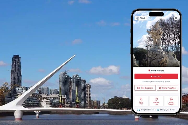


The morning river wind pushes along the boardwalks as you leave the quiet trails of Reserva Ecológica Costanera Sur and step into Puerto Madero’s glass-and-steel edge. Wading birds cluster at lagoon margins, daring you to slow down; the city's glass façades catch the light and throw it back like a challenge. The route threads from wetland observation platforms through Micaela Bastidas Park, past the sculpted figures of Fuente de las Nereidas, and finishes at Santiago Calatrava’s angled span, the Puente de la Mujer.
The morning river wind pushes along the boardwalks as you leave the quiet trails of Reserva Ecológica Costanera Sur and step into Puerto Madero’s glass-and-steel edge. Wading birds cluster at lagoon margins, daring you to slow down; the city's glass façades catch the light and throw it back like a challenge. The route threads from wetland observation platforms through Micaela Bastidas Park, past the sculpted figures of Fuente de las Nereidas, and finishes at Santiago Calatrava’s angled span, the Puente de la Mujer.
Puerto Madero is built on a failed late-19th-century port project that left docks and warehouses to be reborn in the 1990s as a modern district. Street names here are an intentional map of Argentine women — revolutionaries, suffragists and cultural figures — and the tour ties those names to the places they now mark. Geologically the area is river plain and reclaimed docks; the soft ground and shifting shoreline created both the harbor’s problems and the reserve’s lagoons.
Practical guidance: the self-guided audio tour runs about 60–75 minutes and covers roughly 2–3 kilometers of mostly flat pavement and boardwalks. Download the VoiceMap file before you arrive and bring headphones; the app provides turn-by-turn cues. Wear comfortable walking shoes and sun protection — riverfront wind can be cool in winter and brutally open in summer. Respect marked trails in the ecological reserve to protect nesting birds and fragile marsh plants. Time your walk for morning or late afternoon to catch bird activity and softer light for the sculptures and bridges.