THE ADVENTURE COLLECTIVE® · Independent discovery and booking for outdoor travel

Drive the Great Eastern Drive to Freycinet National Park and spend a day between the Wineglass Bay lookout, Mt Amos ridgelines, the Cape Tourville boardwalk, and a swim at Honeymoon Bay. Expect granite cliffs, clear water, and a seafood finale at Freycinet Marine Farm.
Drive the Great Eastern Drive to Freycinet National Park and spend a day between the Wineglass Bay lookout, Mt Amos ridgelines, the Cape Tourville boardwalk, and a swim at Honeymoon Bay. Expect granite cliffs, clear water, and a seafood finale at Freycinet Marine Farm.
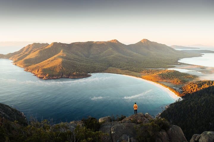
Morning light slices across the Hazards—orange granite cliffs that push into the Tasman Sea—and the minibus eases off the Great Eastern Drive as salt air replaces the highway’s exhaust. By the time the guide shuts off the engine at the Freycinet carpark, the bay’s crescent of white sand and aquamarine water is already pulling at the group. Shoes are tightened, cameras shouldered, and the climb to Wineglass Bay Lookout begins: a steady uphill through eucalypt and silver banksia that opens out onto the curve of beach below.
Verified experiences and guided adventures in the surrounding area.
Operated by Tassie Tours Tasmania · Coles Bay, Tasmania
Morning light slices across the Hazards—orange granite cliffs that push into the Tasman Sea—and the minibus eases off the Great Eastern Drive as salt air replaces the highway’s exhaust. By the time the guide shuts off the engine at the Freycinet carpark, the bay’s crescent of white sand and aquamarine water is already pulling at the group. Shoes are tightened, cameras shouldered, and the climb to Wineglass Bay Lookout begins: a steady uphill through eucalypt and silver banksia that opens out onto the curve of beach below.
Wineglass Bay is more than a postcard; it's a product of geology and time. The Hazards are granite formed some 400 million years ago, their exposed faces shaped by glacial and marine forces. European sealing and whaling crews visited these shores in the 19th century, and today small communities like Coles Bay live off a mix of tourism, fishing, and oysters from the sheltered waters of Great Oyster Bay.
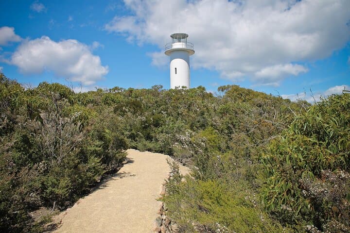
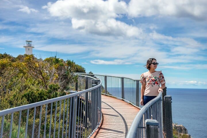
Hikers have choices: the short, well-graded Wineglass Bay Lookout hike (about 3.2 km return, ~200 m elevation gain, 40–60 minutes) offers sweeping views without committing a whole day. For those chasing a steeper line, the Mt Amos ascent demands route-finding across rock and scrub—expect 6–8 km round-trip, 400–500 m of climbing and 3–4 hours of exertion rewarded by panoramic coastal ridgelines. After peaks and viewpoints, Cape Tourville’s wheelchair-accessible boardwalk provides a contrasting, low-sweat way to read the coast; the lighthouse punctuates the walk and delivers wide-angle sea views.
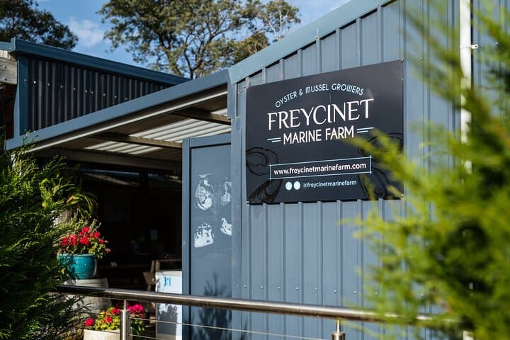
Water is an invitation here: Honeymoon Bay’s clear shallows and orange-capped boulders make for a bracing swim and a good recovery after the climb. End the day at Freycinet Marine Farm on the foreshore—oysters straight from the racks, locally caught crayfish, and Tasmanian pinot to close the loop between land and sea.
Practical guidance: bring sun protection and layered clothing—the weather swings quickly on exposed tracks. Hydrate and carry snacks if you plan the Mt Amos route; the park’s facilities are minimal. Ask your guide about tide times and the best order for viewpoints to avoid crowds; starting early or late afternoon light improves photographs and cools the ascent. Lastly, treat the marine life and oyster farms with respect: stick to marked tracks, pack out rubbish, and leave shells and sea stars untouched.
Whether the day is a brisk hike to a classic lookout, a challenging scramble up Mt Amos, or a relaxed swim and seafood finish, this Launceston-to-Hobart stop delivers a tidy cross-section of Tasmania’s coastal character—rock, surf, and clear, honest air.
moderate.
10–11 hours.
Moderate fitness — able to hike uphill for 1–4 hours and stand on uneven terrain; comfortable with sustained walking.
The lookout route is roughly 3.2 km round-trip with about 200 m of elevation gain; plan 40–60 minutes depending on pace and stops.
Mt Amos is challenging—expect steep sections, rock scrambling and 3–4 hours round-trip. It’s best for experienced hikers with good footwear and a head for heights.
You can swim year-round but the water is cold outside summer; check conditions and avoid entering the water on rough or windy days.
The tour includes a National Parks Pass as part of its inclusions; confirm with the operator at booking.
Facilities are limited—Freycinet Marine Farm and local Coles Bay eateries serve seafood and snacks, but bring your own provisions for longer hikes.
You can tailor the day: a short lookout walk and boardwalk is low-effort, while adding Mt Amos converts the day into a full moderate-to-hard hiking day.
European sealers and later oyster farmers shaped the coastal economy; Indigenous Tasmanian people have long cultural ties to these waters and headlands.
Freycinet faces pressure from visitor numbers and marine farming—stay on tracks, respect farm boundaries, and carry out all waste to minimize impact.
Tassie Tours Tasmania operates guided outdoor trips and adventures with an emphasis on safety, stewardship, and memorable experiences.
Morning light slices across the Hazards—orange granite cliffs that push into the Tasman Sea—and the minibus eases off the Great Eastern Drive as salt air replaces the highway’s exhaust. By the time the guide shuts off the engine at the Freycinet carpark, the bay’s crescent of white sand and aquamarine water is already pulling at the group. Shoes are tightened, cameras shouldered, and the climb to Wineglass Bay Lookout begins: a steady uphill through eucalypt and silver banksia that opens out onto the curve of beach below.
Morning light slices across the Hazards—orange granite cliffs that push into the Tasman Sea—and the minibus eases off the Great Eastern Drive as salt air replaces the highway’s exhaust. By the time the guide shuts off the engine at the Freycinet carpark, the bay’s crescent of white sand and aquamarine water is already pulling at the group. Shoes are tightened, cameras shouldered, and the climb to Wineglass Bay Lookout begins: a steady uphill through eucalypt and silver banksia that opens out onto the curve of beach below.
Wineglass Bay is more than a postcard; it's a product of geology and time. The Hazards are granite formed some 400 million years ago, their exposed faces shaped by glacial and marine forces. European sealing and whaling crews visited these shores in the 19th century, and today small communities like Coles Bay live off a mix of tourism, fishing, and oysters from the sheltered waters of Great Oyster Bay.
Hikers have choices: the short, well-graded Wineglass Bay Lookout hike (about 3.2 km return, ~200 m elevation gain, 40–60 minutes) offers sweeping views without committing a whole day. For those chasing a steeper line, the Mt Amos ascent demands route-finding across rock and scrub—expect 6–8 km round-trip, 400–500 m of climbing and 3–4 hours of exertion rewarded by panoramic coastal ridgelines. After peaks and viewpoints, Cape Tourville’s wheelchair-accessible boardwalk provides a contrasting, low-sweat way to read the coast; the lighthouse punctuates the walk and delivers wide-angle sea views.
Water is an invitation here: Honeymoon Bay’s clear shallows and orange-capped boulders make for a bracing swim and a good recovery after the climb. End the day at Freycinet Marine Farm on the foreshore—oysters straight from the racks, locally caught crayfish, and Tasmanian pinot to close the loop between land and sea.
Practical guidance: bring sun protection and layered clothing—the weather swings quickly on exposed tracks. Hydrate and carry snacks if you plan the Mt Amos route; the park’s facilities are minimal. Ask your guide about tide times and the best order for viewpoints to avoid crowds; starting early or late afternoon light improves photographs and cools the ascent. Lastly, treat the marine life and oyster farms with respect: stick to marked tracks, pack out rubbish, and leave shells and sea stars untouched.
Whether the day is a brisk hike to a classic lookout, a challenging scramble up Mt Amos, or a relaxed swim and seafood finish, this Launceston-to-Hobart stop delivers a tidy cross-section of Tasmania’s coastal character—rock, surf, and clear, honest air.