THE ADVENTURE COLLECTIVE® · Independent discovery and booking for outdoor travel

A high-alpine day hike that opens onto sweeping views of the Columbia Icefield, Snow Dome and Mount Athabasca. Learn about glacial geology and fragile tundra while traversing a well-defined but exposed mountain pass.
A high-alpine day hike that opens onto sweeping views of the Columbia Icefield, Snow Dome and Mount Athabasca. Learn about glacial geology and fragile tundra while traversing a well-defined but exposed mountain pass.
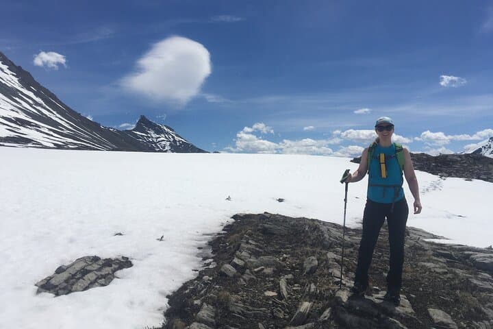
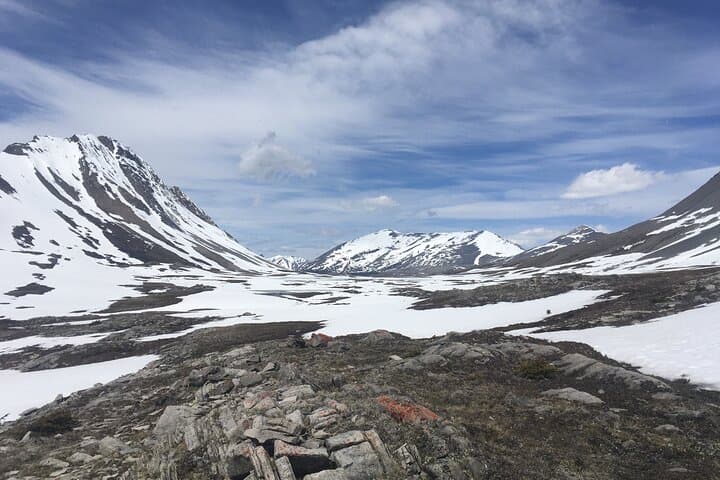
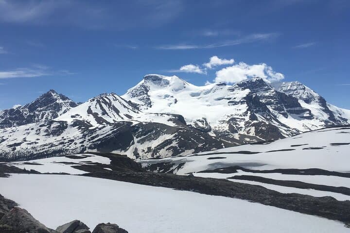
You push through the last stand of subalpine firs and the valley opens — a hard, bright Arctic sky over a wide ribbon of ice. The trail climbs into tundra; wind threads across sedge and dwarf willow while the Columbia Icefield and the jagged shoulders of Mount Athabasca come into view like a carved horizon.
Verified experiences and guided adventures in the surrounding area.
Operated by Freeheelin' Adventures · Jasper, Alberta
You push through the last stand of subalpine firs and the valley opens — a hard, bright Arctic sky over a wide ribbon of ice. The trail climbs into tundra; wind threads across sedge and dwarf willow while the Columbia Icefield and the jagged shoulders of Mount Athabasca come into view like a carved horizon.
Wilcox Pass sits on the eastern edge of Jasper National Park, where Pleistocene glaciers sculpted high bowls and left the Icefield that feeds Alberta’s great rivers. For millennia the area has been part of travel and seasonal routes for Indigenous peoples; today the pass gives a clear window into glacial geology, ongoing recession, and alpine plant communities adapted to a short growing season. Birds and marmots claim the rocks; bighorn occasionally pick their way along the ridgelines.
Expect an exposed ascent across tundra and scree with long sightlines — this is a day hike that feels alpine. The route is well-worn but can be windy and cold; sunlight can be intense at elevation. Learn basic glacier history from interpretive signs or a local guide, and use binoculars to study crevasses and distant peaks.
Practical notes: plan on roughly 11 km round-trip with about 400 m of elevation gain — allow 5–6 hours including stops. Start early for calmer weather and stronger light on the Icefield, pack layered clothing, wind protection, water, and high-energy snacks, and stay on the trail to protect fragile tundra vegetation. Cell service is sporadic; let someone know your plan before you go.
moderate.
5–6 hours.
Suitable for hikers with basic aerobic fitness who can handle steady uphill sections at altitude and uneven terrain.
The route is roughly 11 km round-trip with about 400 m (1,300 ft) of elevation gain; most groups take 5–6 hours including breaks.
Yes — the trail is well-defined but becomes exposed above treeline; follow cairns and stay on the route to protect vegetation.
Yes — Wilcox Pass offers panoramic views of the Columbia Icefield, Mount Athabasca, and Snow Dome on clear days.
Dogs are generally not permitted on many trails inside Jasper National Park; check park regulations and seasonal closures before bringing pets.
Glacial activity from the Columbia Icefield carved the high pass and feed rivers that shaped human travel routes; the landscape remains a key example of Pleistocene glaciation in the Rockies.
This is fragile alpine tundra — stick to durable surfaces, pack out all waste, and follow park guidelines to limit erosion and protect plant communities.
Freeheelin' Adventures operates guided outdoor trips and adventures with an emphasis on safety, stewardship, and memorable experiences.

You push through the last stand of subalpine firs and the valley opens — a hard, bright Arctic sky over a wide ribbon of ice. The trail climbs into tundra; wind threads across sedge and dwarf willow while the Columbia Icefield and the jagged shoulders of Mount Athabasca come into view like a carved horizon.
You push through the last stand of subalpine firs and the valley opens — a hard, bright Arctic sky over a wide ribbon of ice. The trail climbs into tundra; wind threads across sedge and dwarf willow while the Columbia Icefield and the jagged shoulders of Mount Athabasca come into view like a carved horizon.
Wilcox Pass sits on the eastern edge of Jasper National Park, where Pleistocene glaciers sculpted high bowls and left the Icefield that feeds Alberta’s great rivers. For millennia the area has been part of travel and seasonal routes for Indigenous peoples; today the pass gives a clear window into glacial geology, ongoing recession, and alpine plant communities adapted to a short growing season. Birds and marmots claim the rocks; bighorn occasionally pick their way along the ridgelines.
Expect an exposed ascent across tundra and scree with long sightlines — this is a day hike that feels alpine. The route is well-worn but can be windy and cold; sunlight can be intense at elevation. Learn basic glacier history from interpretive signs or a local guide, and use binoculars to study crevasses and distant peaks.
Practical notes: plan on roughly 11 km round-trip with about 400 m of elevation gain — allow 5–6 hours including stops. Start early for calmer weather and stronger light on the Icefield, pack layered clothing, wind protection, water, and high-energy snacks, and stay on the trail to protect fragile tundra vegetation. Cell service is sporadic; let someone know your plan before you go.