THE ADVENTURE COLLECTIVE® · Independent discovery and booking for outdoor travel

Take the quieter western approach into Bucegi Natural Park from Moeciu de Sus: a 15 km guided circuit with roughly 950 m of climbing, open ridgelines and pastoral high meadows. This day hike trades crowds for authentic mountain life and sustained, scenic climbing.
Take the quieter western approach into Bucegi Natural Park from Moeciu de Sus: a 15 km guided circuit with roughly 950 m of climbing, open ridgelines and pastoral high meadows. This day hike trades crowds for authentic mountain life and sustained, scenic climbing.
A wind-cut ridge opens ahead as you leave the stone houses of Moeciu de Sus, the west face of the Bucegi daring you up through fir stands and into broad alpine meadows. The trail climbs steadily—poiana (meadow) after poiana—until forests give way to rocky saddles that frame long views of the Southern Carpathians and the villages tucked below.
Verified experiences and guided adventures in the surrounding area.
Operated by Hola Transylvania / Guia Español Transilvania · Moeciu de Sus, Brașov County
A wind-cut ridge opens ahead as you leave the stone houses of Moeciu de Sus, the west face of the Bucegi daring you up through fir stands and into broad alpine meadows. The trail climbs steadily—poiana (meadow) after poiana—until forests give way to rocky saddles that frame long views of the Southern Carpathians and the villages tucked below.
Bucegi Natural Park sits on the southern edge of the Carpathian chain, carved from limestone and conglomerate into plateaus, steep escarpments, and high pastures. This western approach keeps to quieter pastoral ground: shepherds, hay meadows and seasonal huts remain common, and historic mountain routes once used for transhumance thread the slopes. The massif’s geology produces abrupt cliffs on some aspects and gentler, grassy ascents on others, so terrain shifts are frequent.
Expect a circular route of about 15 km with roughly +950 m ascent and a similar descent, moving through Gutanu, Poiana Gutanu, Şaua Strunga, Şaua Strunguliţa and up to Vârful Bucşa. The walking is physically demanding—rocky sections and short steeper pitches require steady footing—but route-finding is straightforward with a local guide (this trip includes a native Spanish-speaking guide).
Practical guidance: start early to avoid afternoon weather shifts, bring layered, waterproof clothing, sturdy mountain boots and sufficient water/food for a full day (6–8 hours). Mobile signal can be intermittent; follow your guide, respect grazing areas and leave no trace. This is a strong day in real mountain country—rewarded with open ridgelines, quiet meadows and authentic pastoral life.
challenging.
6–8 hours.
Suitable for hikers with a high level of aerobic fitness and good downhill confidence; regular mountain walking experience is recommended.
It’s a challenging day hike: ~15 km with about +950 m ascent; expect 6–8 hours on mixed terrain, including rocky saddles and steep pitches.
Yes — the trip includes a native Spanish-speaking guide who handles route-finding and local interpretation.
Beginners in good shape with prior day-hike experience might manage, but high fitness and comfortable footing on uneven terrain are important.
No permanent facilities—there are seasonal shepherd huts but no guaranteed water or services; bring supplies and a small first-aid kit.
This western approach follows historic pastoral routes used for transhumance; the Bucegi massif also sits near traditional Transylvanian villages like Moeciu and Bran.
Bucegi is a protected park—stay on marked trails, respect grazing regimes and pack out waste to limit impact on fragile alpine meadows.
Hola Transylvania / Guia Español Transilvania operates guided outdoor trips and adventures with an emphasis on safety, stewardship, and memorable experiences.


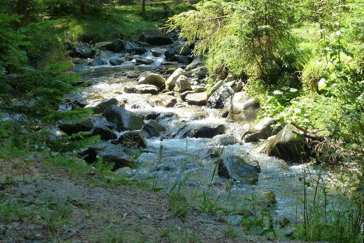
A wind-cut ridge opens ahead as you leave the stone houses of Moeciu de Sus, the west face of the Bucegi daring you up through fir stands and into broad alpine meadows. The trail climbs steadily—poiana (meadow) after poiana—until forests give way to rocky saddles that frame long views of the Southern Carpathians and the villages tucked below.
A wind-cut ridge opens ahead as you leave the stone houses of Moeciu de Sus, the west face of the Bucegi daring you up through fir stands and into broad alpine meadows. The trail climbs steadily—poiana (meadow) after poiana—until forests give way to rocky saddles that frame long views of the Southern Carpathians and the villages tucked below.
Bucegi Natural Park sits on the southern edge of the Carpathian chain, carved from limestone and conglomerate into plateaus, steep escarpments, and high pastures. This western approach keeps to quieter pastoral ground: shepherds, hay meadows and seasonal huts remain common, and historic mountain routes once used for transhumance thread the slopes. The massif’s geology produces abrupt cliffs on some aspects and gentler, grassy ascents on others, so terrain shifts are frequent.
Expect a circular route of about 15 km with roughly +950 m ascent and a similar descent, moving through Gutanu, Poiana Gutanu, Şaua Strunga, Şaua Strunguliţa and up to Vârful Bucşa. The walking is physically demanding—rocky sections and short steeper pitches require steady footing—but route-finding is straightforward with a local guide (this trip includes a native Spanish-speaking guide).
Practical guidance: start early to avoid afternoon weather shifts, bring layered, waterproof clothing, sturdy mountain boots and sufficient water/food for a full day (6–8 hours). Mobile signal can be intermittent; follow your guide, respect grazing areas and leave no trace. This is a strong day in real mountain country—rewarded with open ridgelines, quiet meadows and authentic pastoral life.