
Wellington South Coast Discovery Helicopter Flight — Scenic Coastal Aerial Tour
A 40-minute aerial tour that traces Wellington’s rugged southern coastline from the city, passing wind farms, cliffs, seal colonies and landmark views of the harbour. Ideal for photographers and visitors seeking a compact, weather-dependent taste of Cook Strait’s dramatic landscape.
An Adventure In Wellington.
A 40-minute aerial tour that traces Wellington’s rugged southern coastline from the city, passing wind farms, cliffs, seal colonies and landmark views of the harbour. Ideal for photographers and visitors seeking a compact, weather-dependent taste of Cook Strait’s dramatic landscape.
Read the full experience
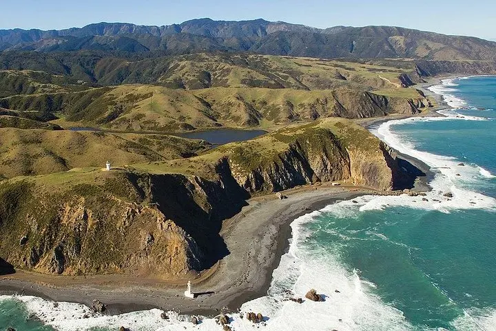
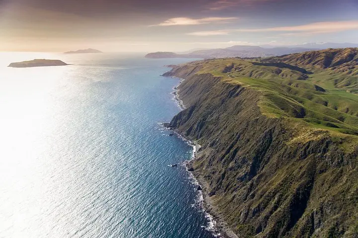
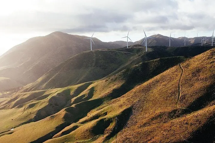
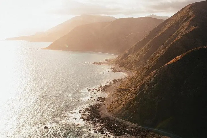
The helicopter lifts off and the city shrinks: rooftops give way to the steel blades of Makara Wind Farm and then to a coastline carved by wind and sea. From above, cliffs drop into raw surf, seal colonies cluster on rocky ledges, and the Cook Strait tightens like a channel daring the ocean to cross it.
The helicopter lifts off and the city shrinks: rooftops give way to the steel blades of Makara Wind Farm and then to a coastline carved by wind and sea. From above, cliffs drop into raw surf, seal colonies cluster on rocky ledges, and the Cook Strait tightens like a channel daring the ocean to cross it.
This short flight threads modern engineering with older stories — Karori Rock Lighthouse has warned ships of these currents for generations, while the Cook Strait itself shaped Māori waka routes and later European shipping lanes. Geologically, the shore is a study in uplifted sedimentary beds and wave-sculpted sandstone; on clear days the South Island’s ragged tips appear across a wide blue gap.
Culturally, the route frames Wellington’s identity: a compact capital defined by wind, water and a working harbour. Pilots and ground crews follow strict conservation practices to avoid disturbing seal and seabird colonies; air tours are one way to view wildlife without landing on sensitive sites.
Practical guidance: flights run about 40 minutes, with headset commentary and no landing on the south coast. Expect brisk winds and quick changes in visibility; bring a layered windproof jacket and secure your camera. Allow extra time for check-in near the waterfront or heliport and check weather-dependent confirmations—operators will reschedule if conditions are unsafe.
For photographers and first-time flyers, sit on the side opposite the sun for cleaner shots. While the trip is accessible for most travelers, anyone with mobility needs should confirm assistance in advance. The reward is a compact, high-altitude primer on Wellington’s wild southern edge—an aerial snapshot that makes the shoreline’s scale unmistakable.
Frequently asked questions
The tour is approximately 40 minutes and is an aerial-only flight; there is no landing on the south coast.
Children are welcome; infants under three may travel on laps but check operator policy and book accordingly.
Flights are weather-dependent—if canceled you’ll be offered an alternative date or full refund per the operator’s policy.
Yes, passenger weights are collected for balance and safety—provide accurate weights when booking and contact the operator with concerns.
About This Experience
Wellington Helicopters operates guided outdoor trips and adventures with an emphasis on safety, stewardship, and memorable experiences.
Adventure tips
Recommended gear
- Camera with strap: A fast shutter and secure strap capture coastal cliffs and wildlife from altitude.
- Windproof jacket: Blocks chill during boarding and on exposed helipad areas.
- Sunglasses: Reduces glare over water and improves visibility for photography.
- Small daypack: Keeps personal items secure and hands free during boarding.
Photos of the experience
Related adventures & guides
Read the full experience
The helicopter lifts off and the city shrinks: rooftops give way to the steel blades of Makara Wind Farm and then to a coastline carved by wind and sea. From above, cliffs drop into raw surf, seal colonies cluster on rocky ledges, and the Cook Strait tightens like a channel daring the ocean to cross it.
The helicopter lifts off and the city shrinks: rooftops give way to the steel blades of Makara Wind Farm and then to a coastline carved by wind and sea. From above, cliffs drop into raw surf, seal colonies cluster on rocky ledges, and the Cook Strait tightens like a channel daring the ocean to cross it.
This short flight threads modern engineering with older stories — Karori Rock Lighthouse has warned ships of these currents for generations, while the Cook Strait itself shaped Māori waka routes and later European shipping lanes. Geologically, the shore is a study in uplifted sedimentary beds and wave-sculpted sandstone; on clear days the South Island’s ragged tips appear across a wide blue gap.
Culturally, the route frames Wellington’s identity: a compact capital defined by wind, water and a working harbour. Pilots and ground crews follow strict conservation practices to avoid disturbing seal and seabird colonies; air tours are one way to view wildlife without landing on sensitive sites.
Practical guidance: flights run about 40 minutes, with headset commentary and no landing on the south coast. Expect brisk winds and quick changes in visibility; bring a layered windproof jacket and secure your camera. Allow extra time for check-in near the waterfront or heliport and check weather-dependent confirmations—operators will reschedule if conditions are unsafe.
For photographers and first-time flyers, sit on the side opposite the sun for cleaner shots. While the trip is accessible for most travelers, anyone with mobility needs should confirm assistance in advance. The reward is a compact, high-altitude primer on Wellington’s wild southern edge—an aerial snapshot that makes the shoreline’s scale unmistakable.
Make a day of it nearby.
Verified experiences and guided adventures in the surrounding area.