THE ADVENTURE COLLECTIVE® · Independent discovery and booking for outdoor travel

Follow a 5 km marked ridge trail to St. Ilija for sweeping views of Tivat and Kotor bays, Austro-Hungarian fort ruins, and karst scenery. This 5–6 hour guided hike combines coastal panoramas, historic fortifications, and varied limestone terrain.
Follow a 5 km marked ridge trail to St. Ilija for sweeping views of Tivat and Kotor bays, Austro-Hungarian fort ruins, and karst scenery. This 5–6 hour guided hike combines coastal panoramas, historic fortifications, and varied limestone terrain.
A low ridge of limestone cuts between two bays, and you start the day with the wind at your back and the Adriatic brimming beneath your feet. On the Vrmac hike you move from shaded oak and pine into open rock where the trail angles up to St. Ilija (785 m). The first viewpoint opens like a window onto Tivat Bay; crest the ridge and Kotor Bay spreads out opposite, islands and ferry channels glittering as the sea dares you to look farther.
Verified experiences and guided adventures in the surrounding area.
Operated by Monte Mare Travel · Kotor, Kotor Municipality
A low ridge of limestone cuts between two bays, and you start the day with the wind at your back and the Adriatic brimming beneath your feet. On the Vrmac hike you move from shaded oak and pine into open rock where the trail angles up to St. Ilija (785 m). The first viewpoint opens like a window onto Tivat Bay; crest the ridge and Kotor Bay spreads out opposite, islands and ferry channels glittering as the sea dares you to look farther.
Geology here is exposed karst—limestone ledges, shallow soil, sudden drops—formed as the Dinaric Alps meet the Adriatic. Vrmac was a strategic spine between empires: Ottoman and Venetian borders left paths, and Austro-Hungarian blockhouses built around 1860 still stand near the summit. On the descent you pass rural architecture and wells that speak to long-standing coastal agriculture, and a WWII-era tunnel bored through the ridge links Kotor with the Adriatic Highway.
Expect roughly 5 km of marked trail with rock steps and short steep pitches, 5–6 hours including transfers. The route suits hikers with a steady aerobic base more than technical climbers; wear grippy footwear, carry 2–3 liters of water, and plan for wind and sudden sun on exposed sections. Local guides point out fort ruins and quiet coves in nearby Donja Lastva—good stops for a post-hike coffee.
Practical: start early in warm months for cooler ascent, check whether the tunnel and access roads are open in winter, and stick to marked routes to limit erosion and protect sensitive karst vegetation. The views reward the effort: bays, battlements, and a ridge that still remembers its strategic past.
moderate.
5–6 hours.
Moderate cardiovascular fitness and sure-footedness; suitable for regular walkers who handle sustained uphill sections.
The guided route covers about 5 km with a maximum altitude of 785 m (St. Ilija); expect steady uphill sections and a total outing of 5–6 hours including transfers.
Fit beginners who are comfortable with sustained uphill walking and rocky terrain can manage this route, but a moderate fitness level is recommended.
Wear sturdy hiking shoes, layered clothing for wind and sun, and carry 2–3 liters of water, snacks, and basic sun protection; trekking poles help on descents.
Service animals are allowed on this tour, but check with the operator ahead of time about any restrictions for pets.
Vrmac formed a contested border corridor; Austro-Hungarian fortifications from the 19th century and older Ottoman-Venetian boundary traces are visible along the ridge.
The karst terrain is ecologically sensitive—stay on marked trails to prevent erosion and avoid collecting plants or disturbing historic structures.
Monte Mare Travel operates guided outdoor trips and adventures with an emphasis on safety, stewardship, and memorable experiences.
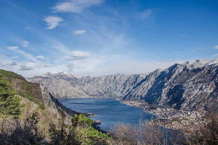
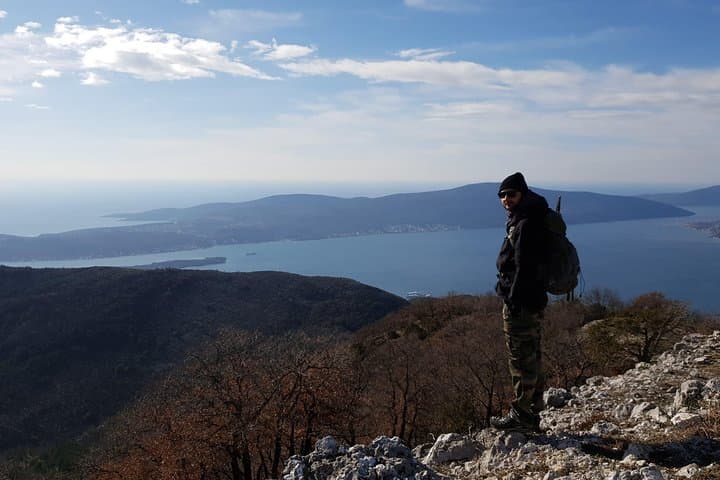
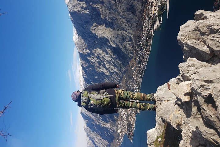
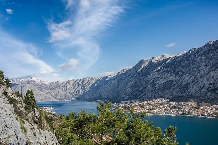
A low ridge of limestone cuts between two bays, and you start the day with the wind at your back and the Adriatic brimming beneath your feet. On the Vrmac hike you move from shaded oak and pine into open rock where the trail angles up to St. Ilija (785 m). The first viewpoint opens like a window onto Tivat Bay; crest the ridge and Kotor Bay spreads out opposite, islands and ferry channels glittering as the sea dares you to look farther.
A low ridge of limestone cuts between two bays, and you start the day with the wind at your back and the Adriatic brimming beneath your feet. On the Vrmac hike you move from shaded oak and pine into open rock where the trail angles up to St. Ilija (785 m). The first viewpoint opens like a window onto Tivat Bay; crest the ridge and Kotor Bay spreads out opposite, islands and ferry channels glittering as the sea dares you to look farther.
Geology here is exposed karst—limestone ledges, shallow soil, sudden drops—formed as the Dinaric Alps meet the Adriatic. Vrmac was a strategic spine between empires: Ottoman and Venetian borders left paths, and Austro-Hungarian blockhouses built around 1860 still stand near the summit. On the descent you pass rural architecture and wells that speak to long-standing coastal agriculture, and a WWII-era tunnel bored through the ridge links Kotor with the Adriatic Highway.
Expect roughly 5 km of marked trail with rock steps and short steep pitches, 5–6 hours including transfers. The route suits hikers with a steady aerobic base more than technical climbers; wear grippy footwear, carry 2–3 liters of water, and plan for wind and sudden sun on exposed sections. Local guides point out fort ruins and quiet coves in nearby Donja Lastva—good stops for a post-hike coffee.
Practical: start early in warm months for cooler ascent, check whether the tunnel and access roads are open in winter, and stick to marked routes to limit erosion and protect sensitive karst vegetation. The views reward the effort: bays, battlements, and a ridge that still remembers its strategic past.