THE ADVENTURE COLLECTIVE® · Independent discovery and booking for outdoor travel

A pre-dawn drive from Cusco leads to a high-Andean climb beneath Ausangate’s snow to the famously striped slopes of Vinicunca. This private full-day hike pairs dramatic geology with cultural landscape and practical high-altitude challenges.
A pre-dawn drive from Cusco leads to a high-Andean climb beneath Ausangate’s snow to the famously striped slopes of Vinicunca. This private full-day hike pairs dramatic geology with cultural landscape and practical high-altitude challenges.
At 4 a.m. your minivan slips out of Cusco into a night that still holds the cold of the high Andes. The road climbs; lights shrink. By first light the hills open and a streaked horizon reveals Ausangate’s permanent snow, a silent, slow-moving presence that frames the day.
Verified experiences and guided adventures in the surrounding area.
Operated by VIPAC Travel · Cusco, Cusco Region
At 4 a.m. your minivan slips out of Cusco into a night that still holds the cold of the high Andes. The road climbs; lights shrink. By first light the hills open and a streaked horizon reveals Ausangate’s permanent snow, a silent, slow-moving presence that frames the day.
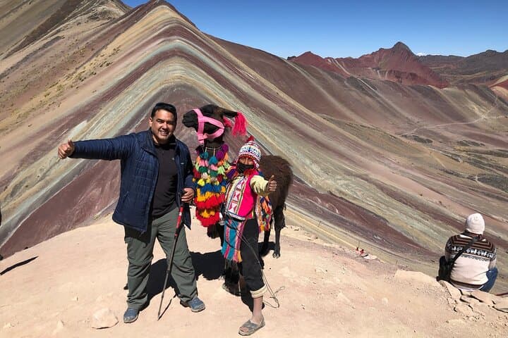
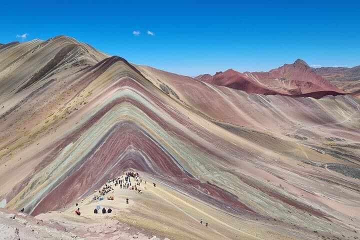
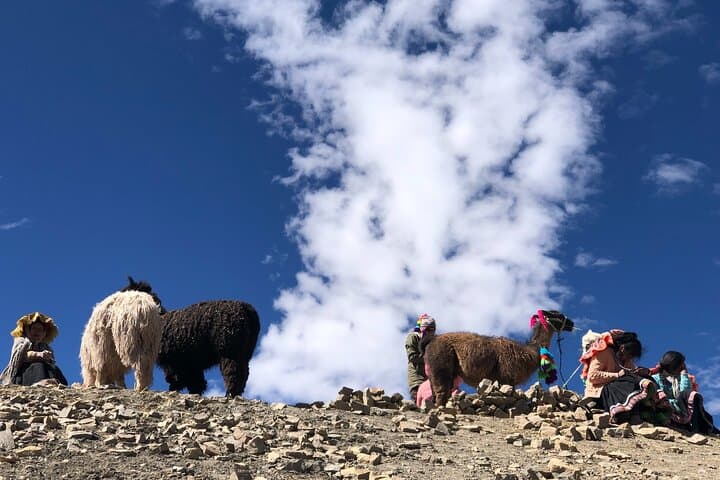
Vinicunca—Rainbow Mountain—owes its stripes to exposed mineral beds: iron, magnesium, copper oxides and quartz that oxidized and layered over millennia. The trail from the Chillihuani parking area pushes up through puna grass and low scrub, trading thin, oxygen-poor air for increasingly wide views. Local Quechua communities have grazed llamas and alpacas here for generations; the landscape is as much cultural as geological.
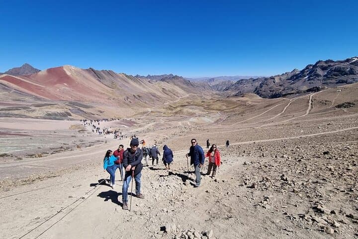
Expect a steep, sustained climb of roughly 1.5–3 km each way (depending on the parking point), with final viewpoints near 5,000–5,200 m (16,400–17,060 ft). The ascent typically takes 1.5–3 hours; weather can shift fast—sun, sharp wind, and snow in a single afternoon are not unusual. A guided private trip includes breakfast, oxygen on hand, and a cooked lunch back in Cusipata.
Practical edge: acclimate in Cusco for 48+ hours, sip water and coca tea, and use trekking poles to reduce knee and breath strain. Wear layered insulation, a wind shell, sun protection, and broken-in boots. Plan the day for early departure to beat clouds and crowds; if altitude symptoms appear, descend immediately. The route is straightforward but demanding at altitude—respect the mountain and go prepared.
challenging.
12–15 hours.
Requires strong cardiovascular fitness and good high-altitude tolerance; regular hikers who acclimatize will fare best.
The viewpoint region sits around 5,000–5,200 meters (16,400–17,060 ft), so altitude effects are common.
Depending on the parking point it’s typically 1.5–3 km each way; uphill time is usually 1.5–3 hours.
The terrain is not technical but is physically demanding at altitude; beginners should acclimatize and consider hiring a guide or using horses where available.
In some areas local riders offer horse transport for the ascent or descent, but availability varies and is not always included.
Vinicunca’s colorful layers were exposed by glacial retreat and erosion in recent decades; nearby communities maintain centuries-old pastoral traditions tied to Ausangate.
High visitor numbers strain fragile puna vegetation and soils; stick to trails, pack out waste, and support local guides and community-run services.
VIPAC Travel operates guided outdoor trips and adventures with an emphasis on safety, stewardship, and memorable experiences.
At 4 a.m. your minivan slips out of Cusco into a night that still holds the cold of the high Andes. The road climbs; lights shrink. By first light the hills open and a streaked horizon reveals Ausangate’s permanent snow, a silent, slow-moving presence that frames the day.
At 4 a.m. your minivan slips out of Cusco into a night that still holds the cold of the high Andes. The road climbs; lights shrink. By first light the hills open and a streaked horizon reveals Ausangate’s permanent snow, a silent, slow-moving presence that frames the day.
Vinicunca—Rainbow Mountain—owes its stripes to exposed mineral beds: iron, magnesium, copper oxides and quartz that oxidized and layered over millennia. The trail from the Chillihuani parking area pushes up through puna grass and low scrub, trading thin, oxygen-poor air for increasingly wide views. Local Quechua communities have grazed llamas and alpacas here for generations; the landscape is as much cultural as geological.
Expect a steep, sustained climb of roughly 1.5–3 km each way (depending on the parking point), with final viewpoints near 5,000–5,200 m (16,400–17,060 ft). The ascent typically takes 1.5–3 hours; weather can shift fast—sun, sharp wind, and snow in a single afternoon are not unusual. A guided private trip includes breakfast, oxygen on hand, and a cooked lunch back in Cusipata.
Practical edge: acclimate in Cusco for 48+ hours, sip water and coca tea, and use trekking poles to reduce knee and breath strain. Wear layered insulation, a wind shell, sun protection, and broken-in boots. Plan the day for early departure to beat clouds and crowds; if altitude symptoms appear, descend immediately. The route is straightforward but demanding at altitude—respect the mountain and go prepared.