THE ADVENTURE COLLECTIVE® · Independent discovery and booking for outdoor travel

Climb the equipped ridge of Cima Capi for sweeping views over upper Lake Garda and the Sarca valley. This guided via ferrata follows WWI walkways and tunnels — physically demanding, historically rich, and intensely panoramic.
Climb the equipped ridge of Cima Capi for sweeping views over upper Lake Garda and the Sarca valley. This guided via ferrata follows WWI walkways and tunnels — physically demanding, historically rich, and intensely panoramic.
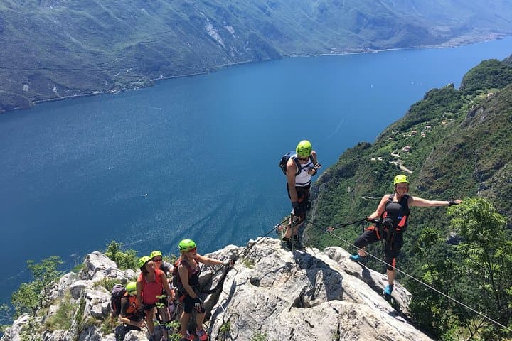
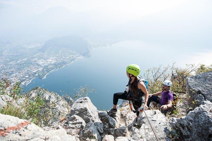
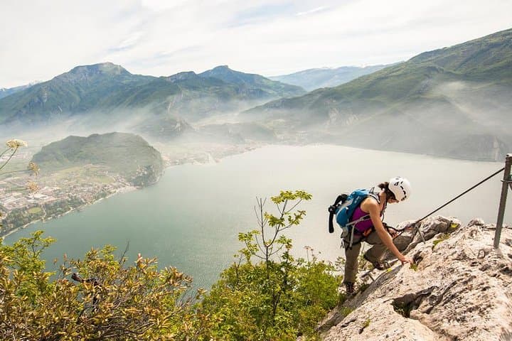
You step off the trail and the lake opens beneath you — a wide sheet of blue held in the palm of a limestone ridge. The path along Cima Capi runs high above the western shore of upper Lake Garda, where terraces of rock and scrub give way to sudden exposures and windows over the Sarca valley.
Verified experiences and guided adventures in the surrounding area.
Operated by Mmove - Into Nature · Riva del Garda, Trentino
You step off the trail and the lake opens beneath you — a wide sheet of blue held in the palm of a limestone ridge. The path along Cima Capi runs high above the western shore of upper Lake Garda, where terraces of rock and scrub give way to sudden exposures and windows over the Sarca valley.
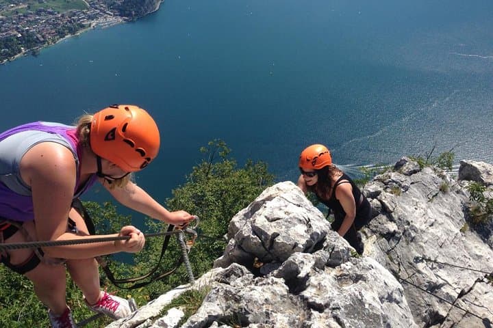
The route follows fixed cables and rungs bolted to the rock, weaving past concrete galleries and rusted anchors left from the First World War. Geologically the ridge is classic dolomite-limestone: steep faces, sharp ledges and pockets that collect wind-scoured vegetation. Local towns like Riva and Arco supply the climbing tradition here; guides keep the route accessible, turning a historic military walkway into a modern ferrata.
Practically, the experience is panoramic and physical rather than technically extreme. The operator supplies harnesses, via-ferrata sets and helmets, and an alpine guide leads groups (shared-group limit ~8). Expect about six hours on the move, several hundred metres of ascent and varied terrain — cabled slabs, short ladders, and WWI tunnels where a torch helps. Not highly exposed throughout, but some airy sections will test those with a fear of heights.
Plan for sun, wind and quick weather shifts: layered clothing, firm boots, a headlamp for the fortifications and at least 1–2 liters of water. The route is best attempted by hikers with solid fitness and sure footing; guides manage safety and ropework, but participants should be prepared for sustained effort and narrow ledges.
challenging.
6 hours.
Recommended for hikers with good aerobic fitness and leg strength; should be able to walk 6–7 hours and manage sustained ascent.
The guided itinerary runs about 6 hours and includes several hundred metres of ascent; it’s physically demanding but not highly technical thanks to fixed cables and guide support.
Yes — harnesses, via-ferrata lanyards and helmets are supplied, and a certified alpine guide leads the group.
Not recommended for those with serious back, heart or leg problems, pregnancy, or inability to walk for 6–7 hours; also avoid if prone to severe vertigo.
Operators typically cancel for bad weather; full refunds are usually available if you cancel at least 24 hours before departure or if the tour is called off due to weather.
Cima Capi’s walkways and tunnels formed part of the Austro-Italian frontline in World War I; many routes reuse the military galleries that once linked fortifications.
Stay clipped to cables and keep to the equipped path to protect fragile limestone flora; guided groups minimize erosion by concentrating foot traffic.
Mmove - Into Nature operates guided outdoor trips and adventures with an emphasis on safety, stewardship, and memorable experiences.
You step off the trail and the lake opens beneath you — a wide sheet of blue held in the palm of a limestone ridge. The path along Cima Capi runs high above the western shore of upper Lake Garda, where terraces of rock and scrub give way to sudden exposures and windows over the Sarca valley.
You step off the trail and the lake opens beneath you — a wide sheet of blue held in the palm of a limestone ridge. The path along Cima Capi runs high above the western shore of upper Lake Garda, where terraces of rock and scrub give way to sudden exposures and windows over the Sarca valley.
The route follows fixed cables and rungs bolted to the rock, weaving past concrete galleries and rusted anchors left from the First World War. Geologically the ridge is classic dolomite-limestone: steep faces, sharp ledges and pockets that collect wind-scoured vegetation. Local towns like Riva and Arco supply the climbing tradition here; guides keep the route accessible, turning a historic military walkway into a modern ferrata.
Practically, the experience is panoramic and physical rather than technically extreme. The operator supplies harnesses, via-ferrata sets and helmets, and an alpine guide leads groups (shared-group limit ~8). Expect about six hours on the move, several hundred metres of ascent and varied terrain — cabled slabs, short ladders, and WWI tunnels where a torch helps. Not highly exposed throughout, but some airy sections will test those with a fear of heights.
Plan for sun, wind and quick weather shifts: layered clothing, firm boots, a headlamp for the fortifications and at least 1–2 liters of water. The route is best attempted by hikers with solid fitness and sure footing; guides manage safety and ropework, but participants should be prepared for sustained effort and narrow ledges.