THE ADVENTURE COLLECTIVE® · Independent discovery and booking for outdoor travel

A brisk half-day hike from Oslo that tops out on Vettakollen for one of the city’s clearest views of the Oslofjord. The 5.4 km route weaves through forest, small lakes and a DNT cabin, returning you to central Oslo via metro.
A brisk half-day hike from Oslo that tops out on Vettakollen for one of the city’s clearest views of the Oslofjord. The 5.4 km route weaves through forest, small lakes and a DNT cabin, returning you to central Oslo via metro.
You step off the Frognerseteren metro and the city exhales behind you — pine scent and a cool, open sky take over. The trail climbs through mixed forest and skirts small, glassy lakes that seem to watch hikers pass; the path opens periodically to reveal the Oslofjord fanning out below, islands like punctuation marks on the water. By the summit of Vettakollen the fjord stretches and the city becomes a low, patterned map.
Verified experiences and guided adventures in the surrounding area.
Operated by When in Norway · Oslo, Oslo
You step off the Frognerseteren metro and the city exhales behind you — pine scent and a cool, open sky take over. The trail climbs through mixed forest and skirts small, glassy lakes that seem to watch hikers pass; the path opens periodically to reveal the Oslofjord fanning out below, islands like punctuation marks on the water. By the summit of Vettakollen the fjord stretches and the city becomes a low, patterned map.
This route follows paths long used by Oslo residents for recreation; the Frognerseteren area has been central to the city’s outdoor culture and the Norwegian Trekking Association maintains many of the cabins and trails here. Geologically, you’re on the ancient Scandinavian Shield — hard bedrock and glacially scoured valleys that shaped the fjord visible from the peak.
You’ll pass DNT Fuglemyrhytta, a small cabin favored for quick breaks, and a handful of small lakes tied to local folklore about the Huldra, a figure of forest tales. The hike is 5.4 km round-trip as offered in organized tours, and the full outing — including the metro ride and return to Jernbanetorget — takes roughly 3.5 hours.
Practical guidance: expect dirt and rock underfoot, some steady climbs and short steeper pitches; bring layered clothing, waterproof shell, and sturdy footwear. Start mid-morning for best light and quieter paths, carry water and snacks, and be prepared for sudden wind on exposed viewpoints. Public transport connections are frequent; many guided tours include transit tickets and an English-speaking guide, making this an efficient half-day adventure from central Oslo.
moderate.
3–3.5 hours.
Suitable for those with a reasonable fitness level who can handle steady climbs and uneven terrain over 5.4 km.
The guided route is moderate: 5.4 km total with steady uphill sections and some short, steeper pitches; suitable for hikers with everyday fitness and proper footwear.
Most tours start near Oslo Central Station and use the Metro to Frognerseteren; public transportation is frequent and the trip is included in many guided options.
Active children and older walkers who are comfortable on uneven ground can do the hike, but pace and rest breaks should be adjusted; the guided group size is often limited to keep a comfortable pace.
The trail is well-marked and popular, so independent hikes are common; a guide adds local insights, folklore, and public transport coordination, and is helpful if you prefer a curated experience.
Frognerseteren and the surrounding uplands have been Oslo’s primary public recreation area since the 19th century, with trails maintained by the Norwegian Trekking Association (DNT).
Stick to marked trails to protect fragile vegetation and avoid disturbing wildlife; littering is rare but carry out what you bring in to protect these urban-adjacent woods.
When in Norway operates guided outdoor trips and adventures with an emphasis on safety, stewardship, and memorable experiences.

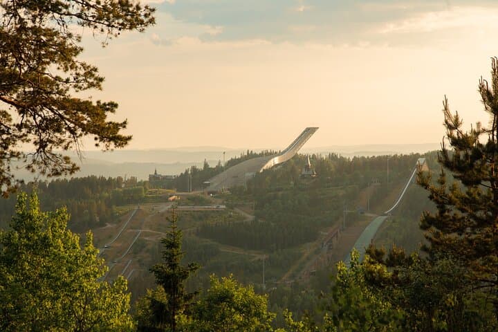
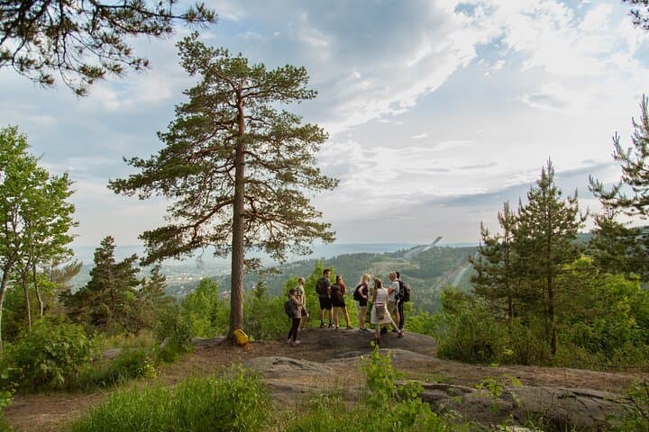

You step off the Frognerseteren metro and the city exhales behind you — pine scent and a cool, open sky take over. The trail climbs through mixed forest and skirts small, glassy lakes that seem to watch hikers pass; the path opens periodically to reveal the Oslofjord fanning out below, islands like punctuation marks on the water. By the summit of Vettakollen the fjord stretches and the city becomes a low, patterned map.
You step off the Frognerseteren metro and the city exhales behind you — pine scent and a cool, open sky take over. The trail climbs through mixed forest and skirts small, glassy lakes that seem to watch hikers pass; the path opens periodically to reveal the Oslofjord fanning out below, islands like punctuation marks on the water. By the summit of Vettakollen the fjord stretches and the city becomes a low, patterned map.
This route follows paths long used by Oslo residents for recreation; the Frognerseteren area has been central to the city’s outdoor culture and the Norwegian Trekking Association maintains many of the cabins and trails here. Geologically, you’re on the ancient Scandinavian Shield — hard bedrock and glacially scoured valleys that shaped the fjord visible from the peak.
You’ll pass DNT Fuglemyrhytta, a small cabin favored for quick breaks, and a handful of small lakes tied to local folklore about the Huldra, a figure of forest tales. The hike is 5.4 km round-trip as offered in organized tours, and the full outing — including the metro ride and return to Jernbanetorget — takes roughly 3.5 hours.
Practical guidance: expect dirt and rock underfoot, some steady climbs and short steeper pitches; bring layered clothing, waterproof shell, and sturdy footwear. Start mid-morning for best light and quieter paths, carry water and snacks, and be prepared for sudden wind on exposed viewpoints. Public transport connections are frequent; many guided tours include transit tickets and an English-speaking guide, making this an efficient half-day adventure from central Oslo.