THE ADVENTURE COLLECTIVE® · Independent discovery and booking for outdoor travel

Drive across Vágar’s mountain roads to a day of coastal cliffs, iconic waterfalls and a lakeside hike to Bøsdalafossur. This six‑hour tour blends short walks, cultural stories and wide Atlantic views — ideal for photographers and hikers with a steady stride.
Drive across Vágar’s mountain roads to a day of coastal cliffs, iconic waterfalls and a lakeside hike to Bøsdalafossur. This six‑hour tour blends short walks, cultural stories and wide Atlantic views — ideal for photographers and hikers with a steady stride.
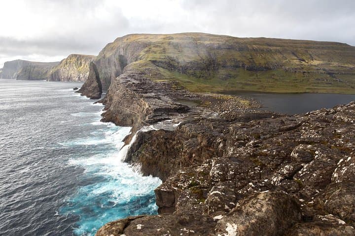
A raw wind from the North Atlantic meets you long before the cliffs do — salt and spray carried across low pastures as the minivan curls up Vágar’s mountain road. You step out at a pull‑off and the landscape snaps into focus: a dark lake perched above the ocean, a sheet of water that seems to hover, and a white ribbon of waterfall pitching itself off the rock and into the sea.
Verified experiences and guided adventures in the surrounding area.
Operated by Experience Faroe Islands · Miðvágur, Vágar
A raw wind from the North Atlantic meets you long before the cliffs do — salt and spray carried across low pastures as the minivan curls up Vágar’s mountain road. You step out at a pull‑off and the landscape snaps into focus: a dark lake perched above the ocean, a sheet of water that seems to hover, and a white ribbon of waterfall pitching itself off the rock and into the sea.
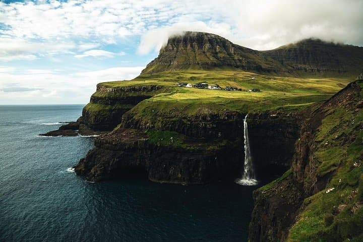
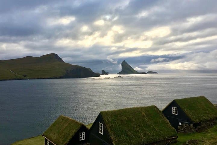
This full‑day circuit takes in Gásadalur’s iconic Múlafossur, the little volcanic beach at Bøur, a viewpoint over Tindhólmur and Drangarnir, and a rewarding hike from Miðvágur to Bøsdalafossur at Leitisvatn. Geology here is young, ocean‑forged basalt scoured by glacial ice; cultural threads run to Viking settlement and local folktales about the “slave cliff” that explain the landscape in human terms. Sheep and seabirds have shaped the turf; a tunnel cut in 2006 opened Gásadalur to cars but the sense of remoteness remains.
Expect roughly a 6‑hour outing with a core hike of about 4–6 km round‑trip and roughly 150–300 m cumulative ascent on uneven, often wet ground. Trails range from grassy peat and sheep tracks to rocky shorelines; exposure to wind is constant. Practicalities: pack a waterproof shell, sturdy boots, water and windproof layers, and allow time for photography and weather checks. Guides will handle logistics and lunch; be prepared for last‑minute route adjustments if wind closes vantage points. Follow marked paths, give nesting birds space, and let the cliffs do the daring — they’ll remind you how small the map feels against real terrain.
moderate.
6 hours.
Moderate — able to hike 4–6 km on uneven ground with short steep sections and sustained exposure to wind
The guided hike portion is about 4–6 km round‑trip with 150–300 m elevation gain; it’s moderate with uneven terrain and exposed sections.
Yes — private transport on Vágar is included to move between villages and trailheads.
Tours may be canceled or routes altered in strong winds or poor conditions; the operator typically cancels for safety and offers refunds per policy.
The itinerary lists a hiking fee and lunch as included, but confirm dietary needs and any additional admissions when booking.
Vágar’s landscape carries Norse history and local folktales; Gásadalur’s tunnel (completed 2006) transformed access to a village long reachable only by foot.
Turf and bird colonies are fragile—stick to marked trails, pack out all waste and avoid drone disturbance near nesting seabirds.
Experience Faroe Islands operates guided outdoor trips and adventures with an emphasis on safety, stewardship, and memorable experiences.
A raw wind from the North Atlantic meets you long before the cliffs do — salt and spray carried across low pastures as the minivan curls up Vágar’s mountain road. You step out at a pull‑off and the landscape snaps into focus: a dark lake perched above the ocean, a sheet of water that seems to hover, and a white ribbon of waterfall pitching itself off the rock and into the sea.
A raw wind from the North Atlantic meets you long before the cliffs do — salt and spray carried across low pastures as the minivan curls up Vágar’s mountain road. You step out at a pull‑off and the landscape snaps into focus: a dark lake perched above the ocean, a sheet of water that seems to hover, and a white ribbon of waterfall pitching itself off the rock and into the sea.
This full‑day circuit takes in Gásadalur’s iconic Múlafossur, the little volcanic beach at Bøur, a viewpoint over Tindhólmur and Drangarnir, and a rewarding hike from Miðvágur to Bøsdalafossur at Leitisvatn. Geology here is young, ocean‑forged basalt scoured by glacial ice; cultural threads run to Viking settlement and local folktales about the “slave cliff” that explain the landscape in human terms. Sheep and seabirds have shaped the turf; a tunnel cut in 2006 opened Gásadalur to cars but the sense of remoteness remains.
Expect roughly a 6‑hour outing with a core hike of about 4–6 km round‑trip and roughly 150–300 m cumulative ascent on uneven, often wet ground. Trails range from grassy peat and sheep tracks to rocky shorelines; exposure to wind is constant. Practicalities: pack a waterproof shell, sturdy boots, water and windproof layers, and allow time for photography and weather checks. Guides will handle logistics and lunch; be prepared for last‑minute route adjustments if wind closes vantage points. Follow marked paths, give nesting birds space, and let the cliffs do the daring — they’ll remind you how small the map feels against real terrain.