THE ADVENTURE COLLECTIVE® · Independent discovery and booking for outdoor travel

Three days of ridge-top hiking, rainforest trails and village homestays around Lushoto. Hike to Irente Viewpoint, explore Magamba Rainforest and sleep in a Shambaa home while traveling by public bus between towns.
Three days of ridge-top hiking, rainforest trails and village homestays around Lushoto. Hike to Irente Viewpoint, explore Magamba Rainforest and sleep in a Shambaa home while traveling by public bus between towns.
A low-slung bus eases out of Tanga at dawn and the Usambara ridgeline rises like a wall ahead—green bands of forest, farmland terraces, and villages clinging to slopes. By midmorning you step off in Lushoto and the trail immediately narrows into damp soil and leaf-litter; the forest breathes around you and the distant plains fall away toward the Maasai lowlands nearly 1,000 metres below.
Verified experiences and guided adventures in the surrounding area.
Operated by Livan Cultural Tourism Enterprise-Tanzania · Lushoto, Tanga Region
A low-slung bus eases out of Tanga at dawn and the Usambara ridgeline rises like a wall ahead—green bands of forest, farmland terraces, and villages clinging to slopes. By midmorning you step off in Lushoto and the trail immediately narrows into damp soil and leaf-litter; the forest breathes around you and the distant plains fall away toward the Maasai lowlands nearly 1,000 metres below.
The Usambara range is part of the Eastern Arc, an ancient block of mountains whose soils and climate support cloud forest pockets and endemic plants. These slopes have long been home to the Shambaa people; villages, terraced fields and coffee plots are integral to the local culture visitors encounter on homestays. Magamba Rainforest and the Irente Viewpoint are signature stops—Magamba for its colobus monkeys and rain-soaked canopy, Irente for wide views and cultivated flower gardens at the reserve.
Expect daily trekking between villages, waterfalls (Mkuzu), viewpoints and a homestay in Mtae. Trails vary from smooth footpaths to steep, rocky stretches; many sections gain a few hundred metres of elevation across 4–12 km. Weather shifts quickly—morning mist can turn to sun or rain by afternoon—so plan for wet, cool conditions at higher elevation.
Practical guidance: travel by public bus or arranged pickup to Lushoto, carry cash for local markets and tips, bring a waterproof layer, sturdy boots and a headlamp for homestays. Start hikes early to avoid mid-afternoon rains and leave time for cultural stops; conservation-minded travelers should stick to trails and minimize single-use plastics.
moderate.
2–3 days.
Suitable for hikers comfortable with consecutive days of 4–12 km walking and several hundred metres of elevation gain; basic stamina and stable footing required.
Public buses run from Tanga and Dar; this tour commonly uses a morning bus to Lushoto—expect 2–5 hours depending on origin and stops.
No national permits are required for the described trails, but small entrance fees may apply at reserves like Irente; carry cash for local fees.
Nights include basic lodges in Lushoto and an overnight in a local Shambaa home for the Mtae visit; facilities are simple and often shared.
The itinerary involves uneven trails and steps; while adaptable, it’s best suited to people without significant mobility restrictions and children used to hiking.
The Usambara Mountains are part of the Eastern Arc, a geologically ancient range that shaped local Shambaa society and attracted German colonial settlement and missionary activity in the 19th century.
Cloud forests here are ecologically fragile; visitors should stay on trails, pack out waste, and support local guides and community-run reserves to aid conservation.
Livan Cultural Tourism Enterprise-Tanzania operates guided outdoor trips and adventures with an emphasis on safety, stewardship, and memorable experiences.
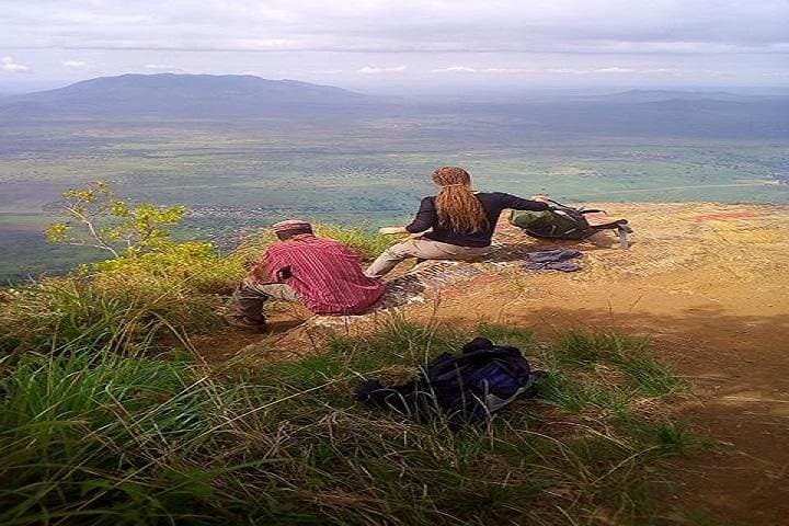

A low-slung bus eases out of Tanga at dawn and the Usambara ridgeline rises like a wall ahead—green bands of forest, farmland terraces, and villages clinging to slopes. By midmorning you step off in Lushoto and the trail immediately narrows into damp soil and leaf-litter; the forest breathes around you and the distant plains fall away toward the Maasai lowlands nearly 1,000 metres below.
A low-slung bus eases out of Tanga at dawn and the Usambara ridgeline rises like a wall ahead—green bands of forest, farmland terraces, and villages clinging to slopes. By midmorning you step off in Lushoto and the trail immediately narrows into damp soil and leaf-litter; the forest breathes around you and the distant plains fall away toward the Maasai lowlands nearly 1,000 metres below.
The Usambara range is part of the Eastern Arc, an ancient block of mountains whose soils and climate support cloud forest pockets and endemic plants. These slopes have long been home to the Shambaa people; villages, terraced fields and coffee plots are integral to the local culture visitors encounter on homestays. Magamba Rainforest and the Irente Viewpoint are signature stops—Magamba for its colobus monkeys and rain-soaked canopy, Irente for wide views and cultivated flower gardens at the reserve.
Expect daily trekking between villages, waterfalls (Mkuzu), viewpoints and a homestay in Mtae. Trails vary from smooth footpaths to steep, rocky stretches; many sections gain a few hundred metres of elevation across 4–12 km. Weather shifts quickly—morning mist can turn to sun or rain by afternoon—so plan for wet, cool conditions at higher elevation.
Practical guidance: travel by public bus or arranged pickup to Lushoto, carry cash for local markets and tips, bring a waterproof layer, sturdy boots and a headlamp for homestays. Start hikes early to avoid mid-afternoon rains and leave time for cultural stops; conservation-minded travelers should stick to trails and minimize single-use plastics.