THE ADVENTURE COLLECTIVE® · Independent discovery and booking for outdoor travel

Cross windswept plateaus and ancient walled towns on the Upper Mustang Trek, a 12–14 day high-altitude route to Lo-Manthang. Expect arid canyons, Tibetan-Buddhist gompas and permit-controlled access through one of Nepal’s best-preserved regions.
Cross windswept plateaus and ancient walled towns on the Upper Mustang Trek, a 12–14 day high-altitude route to Lo-Manthang. Expect arid canyons, Tibetan-Buddhist gompas and permit-controlled access through one of Nepal’s best-preserved regions.
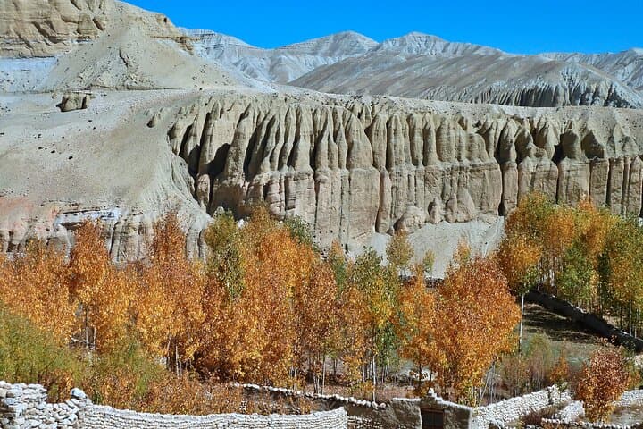
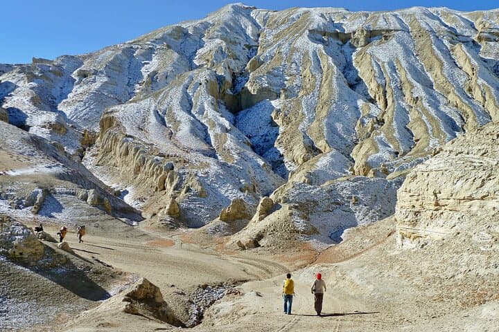
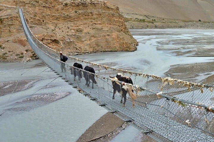
Dusty wind pushes across a wide, wind-carved plateau as trekkers crest a low pass and Lo-Manthang’s white walls come into view — austere, high and quiet against blue Himalayan sky. The landscape switches between razor ridgelines, sandy riverbeds of the Kali Gandaki, and terraced villages where prayer flags flap like weathered promises.
Verified experiences and guided adventures in the surrounding area.
Operated by Asian Heritage Treks and Travels · Lo-Manthang, Gandaki Province
Dusty wind pushes across a wide, wind-carved plateau as trekkers crest a low pass and Lo-Manthang’s white walls come into view — austere, high and quiet against blue Himalayan sky. The landscape switches between razor ridgelines, sandy riverbeds of the Kali Gandaki, and terraced villages where prayer flags flap like weathered promises.
Mustang sits on the edge of the Tibetan Plateau and was closed to outsiders until 1992, which preserved its Tibetan-Buddhist culture, walled towns and fortress gompas. Geologically the region is in a rain shadow: erosion has sculpted red sandstone cliffs and deep canyons, while high passes reveal distant ice of Annapurna and Dhaulagiri. Local villages still speak traditional Tibetan dialects and maintain yak and barley agriculture that shaped daily life for centuries.
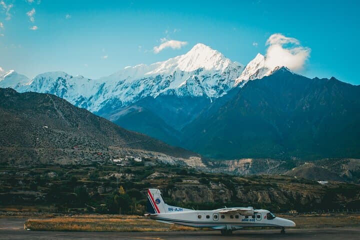
On this 12–14 day route, expect sustained high-altitude walking with passes up to ~3,950 m, long dry stretches, sudden winds and frequent ridge walking. Lodges and teahouses provide simple rooms and hot meals, but services are basic; permits are required for the restricted area and are checked at multiple points. Practical prep focuses on acclimatization, layering for wide temperature swings, sturdy boots for sand and scree, and conserving water in sun-exposed sections. Fly into Jomsom or travel via Pokhara, plan rest days in Lo-Manthang, and carry cash for remote supplies.
The trek rewards with close-up gompas, remote cliffside villages, clear mountain light for photography, and a sense of moving through a place where nature and culture still set the pace.
challenging.
12–14 days.
Good aerobic base with regular hiking or cardio training; ability to hike 4–7 hours a day at altitude.
Yes — a Restricted Area Permit (RAP) and TIMS are required and are checked at checkpoints; your operator usually arranges them.
Spring (Mar–May) and fall (Sep–Nov) offer the most stable weather and clear mountain views; shoulder seasons can work but expect colder nights.
Yes — simple teahouses provide basic meals and lodge rooms in most villages, but amenities are limited compared to lower-altitude treks.
Daily hikes vary 4–7 hours with several passes near 3,600–3,950 m; wind and altitude are the main challenges rather than technical terrain.
Upper Mustang was a restricted kingdom shaped by Tibetan trade routes and was closed to foreigners until 1992, preserving its language and monasteries.
Strict permit systems limit visitor numbers to reduce cultural and environmental impact; stick to trails, avoid single-use plastics and support local lodges.
Asian Heritage Treks and Travels operates guided outdoor trips and adventures with an emphasis on safety, stewardship, and memorable experiences.
Dusty wind pushes across a wide, wind-carved plateau as trekkers crest a low pass and Lo-Manthang’s white walls come into view — austere, high and quiet against blue Himalayan sky. The landscape switches between razor ridgelines, sandy riverbeds of the Kali Gandaki, and terraced villages where prayer flags flap like weathered promises.
Dusty wind pushes across a wide, wind-carved plateau as trekkers crest a low pass and Lo-Manthang’s white walls come into view — austere, high and quiet against blue Himalayan sky. The landscape switches between razor ridgelines, sandy riverbeds of the Kali Gandaki, and terraced villages where prayer flags flap like weathered promises.
Mustang sits on the edge of the Tibetan Plateau and was closed to outsiders until 1992, which preserved its Tibetan-Buddhist culture, walled towns and fortress gompas. Geologically the region is in a rain shadow: erosion has sculpted red sandstone cliffs and deep canyons, while high passes reveal distant ice of Annapurna and Dhaulagiri. Local villages still speak traditional Tibetan dialects and maintain yak and barley agriculture that shaped daily life for centuries.
On this 12–14 day route, expect sustained high-altitude walking with passes up to ~3,950 m, long dry stretches, sudden winds and frequent ridge walking. Lodges and teahouses provide simple rooms and hot meals, but services are basic; permits are required for the restricted area and are checked at multiple points. Practical prep focuses on acclimatization, layering for wide temperature swings, sturdy boots for sand and scree, and conserving water in sun-exposed sections. Fly into Jomsom or travel via Pokhara, plan rest days in Lo-Manthang, and carry cash for remote supplies.
The trek rewards with close-up gompas, remote cliffside villages, clear mountain light for photography, and a sense of moving through a place where nature and culture still set the pace.