THE ADVENTURE COLLECTIVE® · Independent discovery and booking for outdoor travel

A 12-day, permit-protected trek into Upper Mustang leads to Lo Manthang’s walled town, ancient monasteries, and lunar high-desert terrain. Expect long dry trails, high passes, stone villages, and strong cultural encounters with Tibetan-Buddhist communities.
A 12-day, permit-protected trek into Upper Mustang leads to Lo Manthang’s walled town, ancient monasteries, and lunar high-desert terrain. Expect long dry trails, high passes, stone villages, and strong cultural encounters with Tibetan-Buddhist communities.
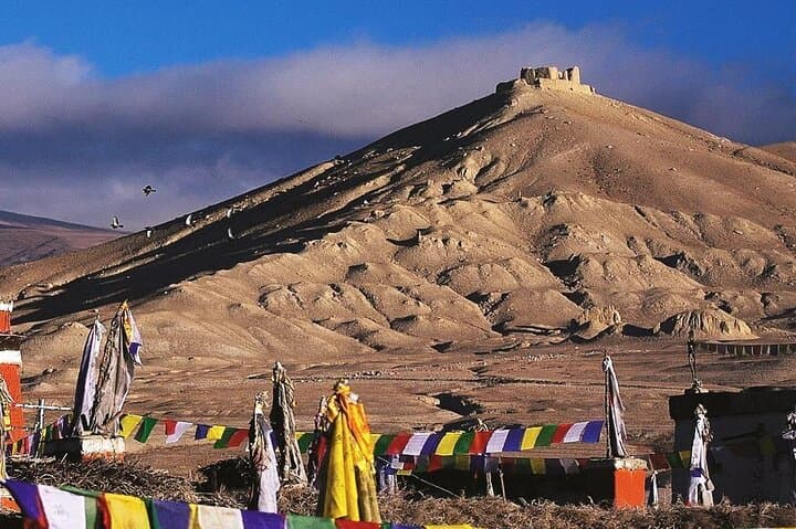
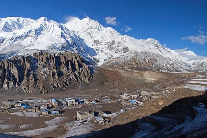
You step out of the dusty jeep into a high, thin air where prayer flags stitch color across a pale sky. The valley opens like an old map—wind-scarred ridgelines, honeycombed cliffs, and the distant white of Himalayan summits. Upper Mustang feels deliberately remote; the light is sharper, the shadows longer, and every village has a single lane of packed earth leading to a square where goats and conversation gather.
Verified experiences and guided adventures in the surrounding area.
Operated by AM Travels and Tours · Lo Manthang, Gandaki Province
You step out of the dusty jeep into a high, thin air where prayer flags stitch color across a pale sky. The valley opens like an old map—wind-scarred ridgelines, honeycombed cliffs, and the distant white of Himalayan summits. Upper Mustang feels deliberately remote; the light is sharper, the shadows longer, and every village has a single lane of packed earth leading to a square where goats and conversation gather.
Historically a corridor between Tibet and Nepal, Mustang preserves Tibetan-Buddhist traditions, fortified towns, and monasteries like Thubchen Gompa. Geologically the region is rain-shadow desert: sandstone and conglomerate carved into caves and towering escarpments by wind and seasonal runoff rather than lush glacial valleys. Local culture is defined by barley fields, chortens watched over by prayer wheels, and household hospitality that still follows centuries-old routines.
On this 12-day route, trekkers move slowly to acclimatize—Pokhara to Kagbeni, then across Lo La and into Lo Manthang at roughly 3,800–3,900 m. Expect high-desert trails, short steep passes, and cold nights in simple guesthouses. Guides handle permits (Restricted Area Permit, ACAP/TIMS) and route logistics; travelers should carry layered clothing, sun protection, and at least one liter of water between refills.
Practical guidance: pace your ascent, drink often, and keep a lightweight wind shell handy for sudden gusts. Walk early when temperatures are calm and use midday to rest or explore village monasteries. Respect local customs—ask before photographing inside gompas—and pack out non-biodegradable waste. The payoff is clear: an intimate cultural landscape under a Himalayan rim, where silence and history feel equally vast.
challenging.
12 days.
Good cardiovascular fitness and experience with multi-day trekking at altitude; able to hike 4–7 hours daily with a daypack.
Yes. A Restricted Area Permit plus ACAP/TIMS are required; operators usually arrange these as part of the trip.
Lo Manthang sits near 3,800–3,900 m; with gradual itineraries and rest days altitude is manageable, but acclimatization and vigilance for symptoms are essential.
Accommodation is in local guesthouses and teahouses—simple rooms with shared bathrooms and basic heating in some places.
Autumn (Sept–Nov) and spring (Mar–May) offer the most stable weather and best visibility; winter is very cold and some services may be limited.
Mustang was an independent kingdom with strong Tibetan ties until the mid-20th century; Lo Manthang remains one of the best-preserved walled towns reflecting that heritage.
Visitor numbers are restricted to protect fragile desert soils, cultural sites, and local water supplies—minimize waste and follow guide instructions to lessen impact.
AM Travels and Tours operates guided outdoor trips and adventures with an emphasis on safety, stewardship, and memorable experiences.


You step out of the dusty jeep into a high, thin air where prayer flags stitch color across a pale sky. The valley opens like an old map—wind-scarred ridgelines, honeycombed cliffs, and the distant white of Himalayan summits. Upper Mustang feels deliberately remote; the light is sharper, the shadows longer, and every village has a single lane of packed earth leading to a square where goats and conversation gather.
You step out of the dusty jeep into a high, thin air where prayer flags stitch color across a pale sky. The valley opens like an old map—wind-scarred ridgelines, honeycombed cliffs, and the distant white of Himalayan summits. Upper Mustang feels deliberately remote; the light is sharper, the shadows longer, and every village has a single lane of packed earth leading to a square where goats and conversation gather.
Historically a corridor between Tibet and Nepal, Mustang preserves Tibetan-Buddhist traditions, fortified towns, and monasteries like Thubchen Gompa. Geologically the region is rain-shadow desert: sandstone and conglomerate carved into caves and towering escarpments by wind and seasonal runoff rather than lush glacial valleys. Local culture is defined by barley fields, chortens watched over by prayer wheels, and household hospitality that still follows centuries-old routines.
On this 12-day route, trekkers move slowly to acclimatize—Pokhara to Kagbeni, then across Lo La and into Lo Manthang at roughly 3,800–3,900 m. Expect high-desert trails, short steep passes, and cold nights in simple guesthouses. Guides handle permits (Restricted Area Permit, ACAP/TIMS) and route logistics; travelers should carry layered clothing, sun protection, and at least one liter of water between refills.
Practical guidance: pace your ascent, drink often, and keep a lightweight wind shell handy for sudden gusts. Walk early when temperatures are calm and use midday to rest or explore village monasteries. Respect local customs—ask before photographing inside gompas—and pack out non-biodegradable waste. The payoff is clear: an intimate cultural landscape under a Himalayan rim, where silence and history feel equally vast.