THE ADVENTURE COLLECTIVE® · Independent discovery and booking for outdoor travel

Climb to the top of Sri Lanka’s second-highest waterfall and swim in natural infinity pools perched above a 220 m drop. This guided hike blends geology, local stories, and a splash of adrenaline for adventurous day-trippers based in Ella.
Climb to the top of Sri Lanka’s second-highest waterfall and swim in natural infinity pools perched above a 220 m drop. This guided hike blends geology, local stories, and a splash of adrenaline for adventurous day-trippers based in Ella.
A thin mist hangs over the ridge as you crest the final switchback and the river below decides to fall in a single, roaring voice. From the lip of Upper Diyaluma the valley opens—cascading rock shelves, distant tea slopes and a sky that seems closer up here. Guides point out natural pools carved into basalt where swimmers can sit with their toes dangling over a 220 m drop.
Verified experiences and guided adventures in the surrounding area.
Operated by Ella Taxi RTS · Koslanda, Uva Province
A thin mist hangs over the ridge as you crest the final switchback and the river below decides to fall in a single, roaring voice. From the lip of Upper Diyaluma the valley opens—cascading rock shelves, distant tea slopes and a sky that seems closer up here. Guides point out natural pools carved into basalt where swimmers can sit with their toes dangling over a 220 m drop.
The falls are fed by Punagala Oya, a tributary of Kuda Oya, and the whole cascade is a product of uplifted Precambrian bedrock sliced by erosion—steep cliffs and stepped ledges that create the waterfall’s tiered character. The local Badulla and Koslanda communities have long used the uplands for tea and rice terraces; stories shared by guides give cultural context to the landscape, from colonial-era plantation shifts to village life along the Colombo–Badulla route.
Practical route: the guided experience typically runs 4–6 hours round-trip with a moderate uphill approach—expect uneven dirt tracks, loose stone, and several short scramble sections. Elevation gain from the Koslanda area is roughly 200–350 m depending on the trailhead chosen; total hiking distance is commonly 6–8 km. Footwear with good traction, layered rain protection and at least 2–3 liters of water are essential. Timing matters: aim for early morning or late afternoon to avoid peak sun and to find the pools at calmer flow levels. Respect local signage: pools at the lip are beautiful but exposed—assess conditions and follow your guide’s instruction before swimming.
moderate.
4–6 hours.
Good aerobic fitness for sustained uphill hiking and short scrambles; able to handle uneven terrain.
Guided outings are typically 4–6 hours round-trip; the walking distance is usually 6–8 km depending on the starting point.
Swimming is allowed but not suitable for weak swimmers—follow your guide’s safety assessment, as currents and pool depth vary by season.
Yes—wet rock and compacted clay can be slick; wear shoes with good grip and consider postponing heavy-rain days.
Ella is the most common base (about 30–60 minutes by car) though Koslanda is the closer village if arranging local pickup.
Upper Diyaluma sits in Badulla District, an upland region shaped by plantation-era routes; local villages have long balanced subsistence farming with tea cultivation introduced during colonial times.
Wear biodegradable sunscreen, pack out all trash, and avoid trampling fragile grasslands—trail erosion is a local issue and guides help minimize impact.
Ella Taxi RTS operates guided outdoor trips and adventures with an emphasis on safety, stewardship, and memorable experiences.
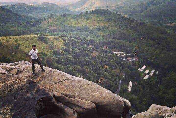
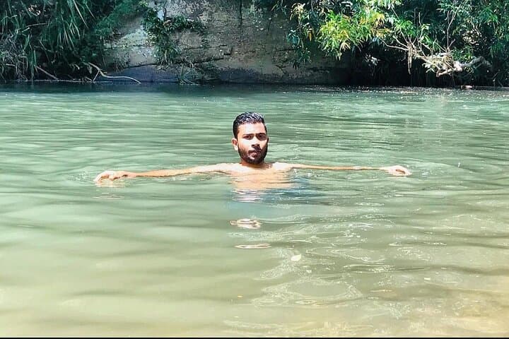
A thin mist hangs over the ridge as you crest the final switchback and the river below decides to fall in a single, roaring voice. From the lip of Upper Diyaluma the valley opens—cascading rock shelves, distant tea slopes and a sky that seems closer up here. Guides point out natural pools carved into basalt where swimmers can sit with their toes dangling over a 220 m drop.
A thin mist hangs over the ridge as you crest the final switchback and the river below decides to fall in a single, roaring voice. From the lip of Upper Diyaluma the valley opens—cascading rock shelves, distant tea slopes and a sky that seems closer up here. Guides point out natural pools carved into basalt where swimmers can sit with their toes dangling over a 220 m drop.
The falls are fed by Punagala Oya, a tributary of Kuda Oya, and the whole cascade is a product of uplifted Precambrian bedrock sliced by erosion—steep cliffs and stepped ledges that create the waterfall’s tiered character. The local Badulla and Koslanda communities have long used the uplands for tea and rice terraces; stories shared by guides give cultural context to the landscape, from colonial-era plantation shifts to village life along the Colombo–Badulla route.
Practical route: the guided experience typically runs 4–6 hours round-trip with a moderate uphill approach—expect uneven dirt tracks, loose stone, and several short scramble sections. Elevation gain from the Koslanda area is roughly 200–350 m depending on the trailhead chosen; total hiking distance is commonly 6–8 km. Footwear with good traction, layered rain protection and at least 2–3 liters of water are essential. Timing matters: aim for early morning or late afternoon to avoid peak sun and to find the pools at calmer flow levels. Respect local signage: pools at the lip are beautiful but exposed—assess conditions and follow your guide’s instruction before swimming.