THE ADVENTURE COLLECTIVE® · Independent discovery and booking for outdoor travel

Reach a live volcano without technical climbing — the half-day Pacaya hike from Antigua gets you close to recent lava flows, steaming vents, and panoramic highland views. Practical tips on gear, safety, and entry fees prepare you to tackle the steep, two‑hour ascent.
Reach a live volcano without technical climbing — the half-day Pacaya hike from Antigua gets you close to recent lava flows, steaming vents, and panoramic highland views. Practical tips on gear, safety, and entry fees prepare you to tackle the steep, two‑hour ascent.
You arrive at the base camp with volcanic steam and wind on your face — the trail begins on black, jagged flank where recent flows still crumble underfoot. The path climbs steadily, a two-hour ascent that compacts volcanic gravel into a rhythm: step, breathe, step. Guides point out heat vents you can warm your hands over and, on active days, the distant orange glow that reminds you this mountain is not dormant.
Verified experiences and guided adventures in the surrounding area.
Operated by Due South Travels · Antigua Guatemala, Sacatepéquez
You arrive at the base camp with volcanic steam and wind on your face — the trail begins on black, jagged flank where recent flows still crumble underfoot. The path climbs steadily, a two-hour ascent that compacts volcanic gravel into a rhythm: step, breathe, step. Guides point out heat vents you can warm your hands over and, on active days, the distant orange glow that reminds you this mountain is not dormant.
Pacaya is one of Guatemala’s most active volcanoes, formed by the subduction of the Cocos Plate beneath the Caribbean Plate; the landscape is raw, young lava and scoria with sparse highland vegetation. The trail skirts old lava flows and crosses fields used by local horse handlers. Culturally, many guides come from nearby communities and weave local stories about the volcano into the climb — a practical mix of geology and oral history that situates the hike within daily life in Sacatepéquez.
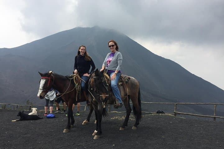
Practical guidance: arrive with closed-toe hiking shoes, water, sun protection and exact local currency for the Q100 park fee. The climb is steep and dusty; poles help but aren’t required. If you’d rather conserve energy, horse rentals are available from locals at the base (negotiate price ahead). Expect wind and big temperature swings — layer for chill at higher elevation and sun lower down.
Safety: Pacaya is active; guides enforce limits and you will not be allowed to go to the summit when activity is high. Stick to marked paths, follow your guide, and don’t linger near fresh lava or unstable edges.
moderate.
4–7 hours.
Moderate cardiovascular fitness and comfort with steep, uneven terrain; ability to walk uphill for ~2 hours.
Expect about 4–7 hours total: roughly 1–1.5 hours each way by vehicle plus a ~2‑hour uphill hike and descent; exact timing varies by departure.
Yes — independent horse handlers at the base rent horses for uphill or downhill rides; negotiate price locally and note the tour operator is not affiliated with horse vendors.
Pacaya is active and can emit ash, rock, and lava; guides enforce park regulations and restrict access when activity increases — follow instructions and accept closures when issued.
No — the Q100 National Park entrance fee for foreigners is paid on arrival in local currency; bring exact change to streamline entry.
Since pre-Columbian times the volcano has shaped local settlement and agricultural patterns; modern tourism around Pacaya grew as road access from Antigua improved in the late 20th century.
Erosion and unmanaged trail traffic can damage fragile volcanic soils; stick to marked trails, pack out trash, and support local guide services that follow park rules.
Due South Travels operates guided outdoor trips and adventures with an emphasis on safety, stewardship, and memorable experiences.
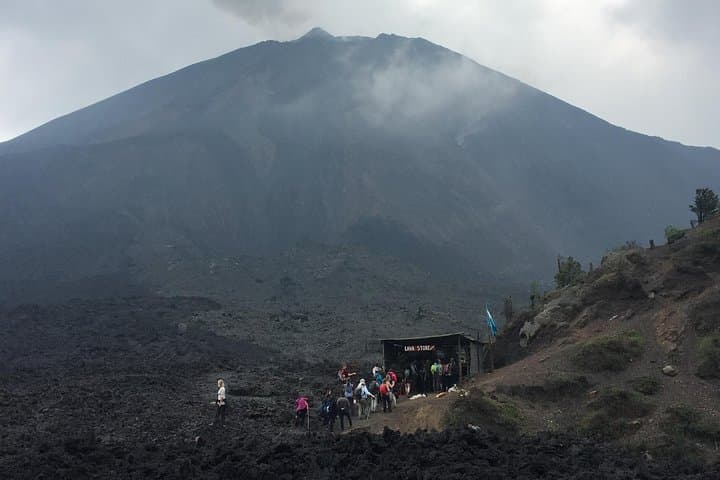

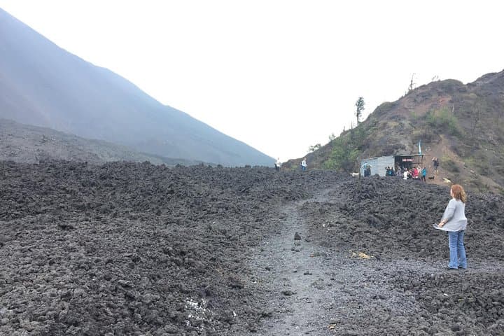
You arrive at the base camp with volcanic steam and wind on your face — the trail begins on black, jagged flank where recent flows still crumble underfoot. The path climbs steadily, a two-hour ascent that compacts volcanic gravel into a rhythm: step, breathe, step. Guides point out heat vents you can warm your hands over and, on active days, the distant orange glow that reminds you this mountain is not dormant.
You arrive at the base camp with volcanic steam and wind on your face — the trail begins on black, jagged flank where recent flows still crumble underfoot. The path climbs steadily, a two-hour ascent that compacts volcanic gravel into a rhythm: step, breathe, step. Guides point out heat vents you can warm your hands over and, on active days, the distant orange glow that reminds you this mountain is not dormant.
Pacaya is one of Guatemala’s most active volcanoes, formed by the subduction of the Cocos Plate beneath the Caribbean Plate; the landscape is raw, young lava and scoria with sparse highland vegetation. The trail skirts old lava flows and crosses fields used by local horse handlers. Culturally, many guides come from nearby communities and weave local stories about the volcano into the climb — a practical mix of geology and oral history that situates the hike within daily life in Sacatepéquez.
Practical guidance: arrive with closed-toe hiking shoes, water, sun protection and exact local currency for the Q100 park fee. The climb is steep and dusty; poles help but aren’t required. If you’d rather conserve energy, horse rentals are available from locals at the base (negotiate price ahead). Expect wind and big temperature swings — layer for chill at higher elevation and sun lower down.
Safety: Pacaya is active; guides enforce limits and you will not be allowed to go to the summit when activity is high. Stick to marked paths, follow your guide, and don’t linger near fresh lava or unstable edges.