THE ADVENTURE COLLECTIVE® · Independent discovery and booking for outdoor travel

A full-day mountain hike from Umoljani to Bosnia’s highest permanent village, Lukomir, via Obalj Peak. Expect 8 km each way across alpine meadows, karst outcrops, medieval Stećci, and sweeping summit views; ideal for hikers with basic endurance.
A full-day mountain hike from Umoljani to Bosnia’s highest permanent village, Lukomir, via Obalj Peak. Expect 8 km each way across alpine meadows, karst outcrops, medieval Stećci, and sweeping summit views; ideal for hikers with basic endurance.
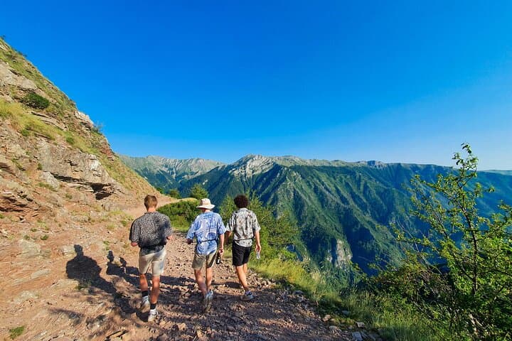
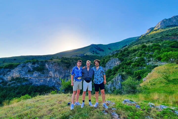
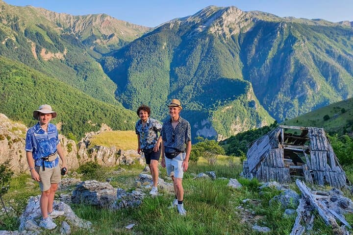
You step out of the van where the road ends and the mountain begins: a ring of stone houses, the wind sharpening the air, and a trail that angles toward the ridgeline. The trail from Umoljani climbs into open pastures and dwarf pines, with the Dinaric Alps stretching like a low, patient ocean to the west. The route leads you through bubbling streams and patterned limestone slabs, the terrain changing every kilometer.
Verified experiences and guided adventures in the surrounding area.
Operated by Torus Tours · Sarajevo, Sarajevo Canton
You step out of the van where the road ends and the mountain begins: a ring of stone houses, the wind sharpening the air, and a trail that angles toward the ridgeline. The trail from Umoljani climbs into open pastures and dwarf pines, with the Dinaric Alps stretching like a low, patient ocean to the west. The route leads you through bubbling streams and patterned limestone slabs, the terrain changing every kilometer.
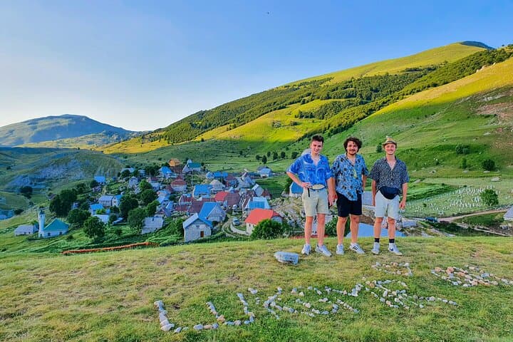
Lukomir sits at about 1,496 meters and is Bosnia and Herzegovina’s highest permanent village — its stone houses and slate roofs speak of a life tuned to snow and sun. Nearby Obalj Peak rises to roughly 1,896 meters; from its shoulders you get a 360° sweep that explains why shepherds worked here for generations. Along the way you'll pass Stećci — medieval tombstones scattered across the landscape — and cross short stretches of karst and alpine meadow shaped by Pleistocene glaciation.
Expect a full-day outing: roughly 8 km each way across mixed trail — dirt, rock, occasional scree — with altitude moving between roughly 1,400–1,900 m. The hike is steady but accessible for fit beginners; you’ll want sturdy boots, layered clothing, and at least 2 liters of water. Plan for strong sun, sudden wind, and a picnic with wide views once you reach Lukomir.
Logistics: pickup in Sarajevo, about a 1.5-hour drive; guided group size is small. Bring a charged phone, cash for small village purchases, and respect local grazing land and cultural sites.
moderate.
7–9 hours.
Suitable for hikers with steady cardio fitness — regular walkers who can sustain 16 km on uneven ground at altitude.
The route is about 8 km each way (roughly 16 km roundtrip) over mixed trail with moderate climbs; expect a 7–9 hour day including transport and lunch.
No technical skills required, but you should be comfortable on uneven ground and able to sustain several hours of steady walking at altitude.
Yes — the tour typically includes pickup/return to Sarajevo and an air-conditioned vehicle for the 1.5-hour drive to the trailhead.
Facilities are limited; bring snacks and expect a picnic lunch. Small village stalls may sell basic items but carry essentials with you.
Lukomir’s stone architecture and nearby Stećci reflect medieval and pastoral traditions; the village remained isolated into the 20th century, preserving older building techniques.
The area is sensitive alpine pasture and karst; staying on trails, packing out waste, and avoiding livestock disturbance help protect fragile soils and archaeological sites.
Torus Tours operates guided outdoor trips and adventures with an emphasis on safety, stewardship, and memorable experiences.
You step out of the van where the road ends and the mountain begins: a ring of stone houses, the wind sharpening the air, and a trail that angles toward the ridgeline. The trail from Umoljani climbs into open pastures and dwarf pines, with the Dinaric Alps stretching like a low, patient ocean to the west. The route leads you through bubbling streams and patterned limestone slabs, the terrain changing every kilometer.
You step out of the van where the road ends and the mountain begins: a ring of stone houses, the wind sharpening the air, and a trail that angles toward the ridgeline. The trail from Umoljani climbs into open pastures and dwarf pines, with the Dinaric Alps stretching like a low, patient ocean to the west. The route leads you through bubbling streams and patterned limestone slabs, the terrain changing every kilometer.
Lukomir sits at about 1,496 meters and is Bosnia and Herzegovina’s highest permanent village — its stone houses and slate roofs speak of a life tuned to snow and sun. Nearby Obalj Peak rises to roughly 1,896 meters; from its shoulders you get a 360° sweep that explains why shepherds worked here for generations. Along the way you'll pass Stećci — medieval tombstones scattered across the landscape — and cross short stretches of karst and alpine meadow shaped by Pleistocene glaciation.
Expect a full-day outing: roughly 8 km each way across mixed trail — dirt, rock, occasional scree — with altitude moving between roughly 1,400–1,900 m. The hike is steady but accessible for fit beginners; you’ll want sturdy boots, layered clothing, and at least 2 liters of water. Plan for strong sun, sudden wind, and a picnic with wide views once you reach Lukomir.
Logistics: pickup in Sarajevo, about a 1.5-hour drive; guided group size is small. Bring a charged phone, cash for small village purchases, and respect local grazing land and cultural sites.