THE ADVENTURE COLLECTIVE® · Independent discovery and booking for outdoor travel

See Badlands National Park from a small plane: jagged ridges, fossil-rich buttes and roaming bison revealed in a single, 70‑minute aerial sweep. Perfect for photographers and first-time visitors who want the whole landscape at once.
See Badlands National Park from a small plane: jagged ridges, fossil-rich buttes and roaming bison revealed in a single, 70‑minute aerial sweep. Perfect for photographers and first-time visitors who want the whole landscape at once.
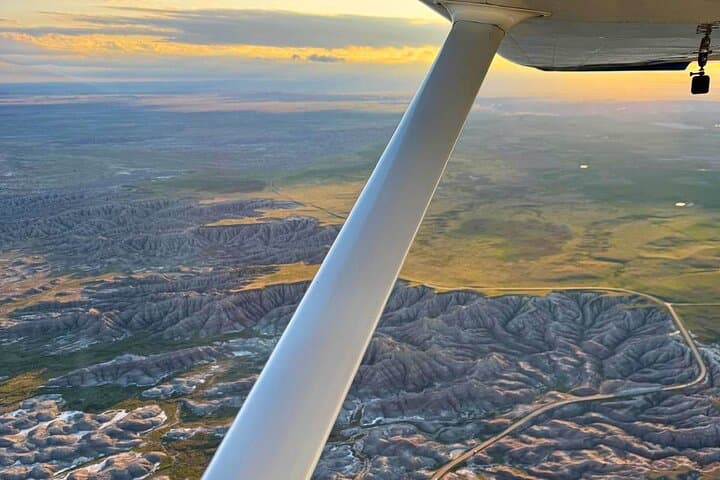
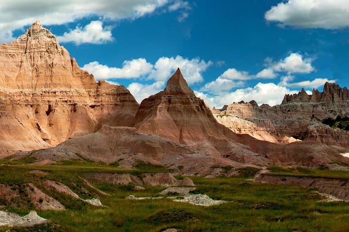
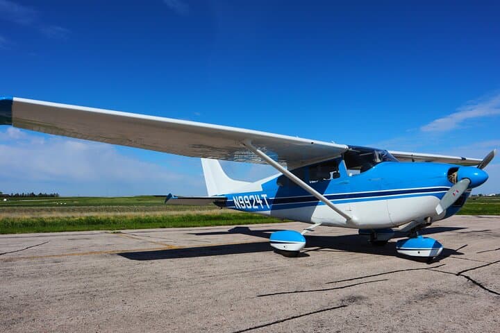
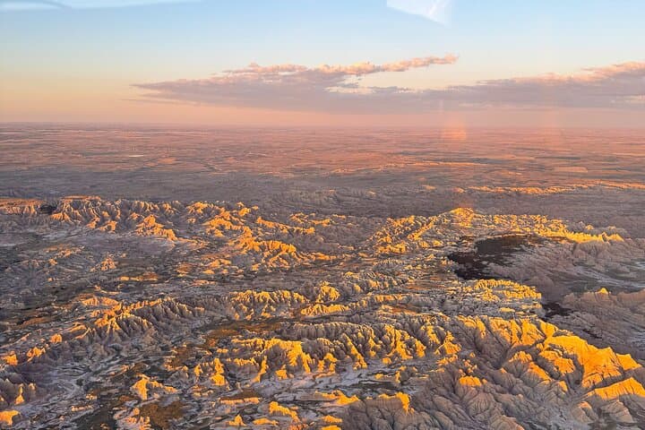
You climb into a light aircraft at a windswept strip near Wall, South Dakota, and within minutes the prairie drops away. The engine hum becomes a steady companion as the Badlands unfurl below—jagged spires, fossil-rich buttes, and wide, serrated valleys carved by ancient rivers and wind.
Verified experiences and guided adventures in the surrounding area.
Operated by Fly Badlands · Wall, South Dakota
You climb into a light aircraft at a windswept strip near Wall, South Dakota, and within minutes the prairie drops away. The engine hum becomes a steady companion as the Badlands unfurl below—jagged spires, fossil-rich buttes, and wide, serrated valleys carved by ancient rivers and wind.
From the air the region reads like a cross-section of deep time: layered sedimentary bands that record changing seas and climates, punctuated by the blunt mesas and steep badlands carved over millions of years. The flight traces the boundary between Buffalo Gap National Grassland’s grass sea and the raw, eroded cliffs of Badlands National Park, skimming past Saddle Pass, Toadstool Rock, and Sheep Mountain Table while your pilot narrates stories of ranching, paleontology, and Lakota presence on these plains.
Culturally, Wall remains the practical gateway—Wall Drug’s neon and small-town services—and flights launch here to give you maximum park exposure without hours of driving on rutted roads. Wildlife below—bison, pronghorn, and prairie dogs—assert themselves in moving patterns; from above they look like elements in a living map.
Practical guidance: flights run about 70 minutes and favor morning or late afternoon light for photography. Expect wind to sway the plane; motion-sickness precautions help. Bring a camera with a short telephoto, warm layers (temps change quickly over the prairie), and plan for a brief ground briefing at the airstrip. Flights are private and narrated, and operators often include noise-dampening headsets and a small souvenir photo. For photographers and anyone wanting scale and context, this aerial tour turns the Badlands into a readable landscape.
easy.
1–1.5 hours.
No special fitness required; able to climb into a small aircraft and sit for the flight is sufficient.
The tour runs about 70 minutes from briefing to landing, with roughly an hour over the Badlands themselves.
Yes—operators provide noise-dampening headsets and allow photography; bring a fast lens and avoid flash.
The flight is suitable for most ages, but not recommended for people with serious heart conditions; check medical limitations with the operator.
Flights are canceled or rescheduled for poor visibility or high winds; operators typically refund full price if canceled 24+ hours in advance.
The Badlands record millions of years of sedimentation and are rich in fossils; this region was also traversed and used seasonally by Lakota communities and later ranchers.
Aerial visits reduce wear on fragile trails and habitats by concentrating viewing in the air, but operators are encouraged to follow low-impact flight corridors and avoid disturbing sensitive wildlife areas.
Fly Badlands operates guided outdoor trips and adventures with an emphasis on safety, stewardship, and memorable experiences.
You climb into a light aircraft at a windswept strip near Wall, South Dakota, and within minutes the prairie drops away. The engine hum becomes a steady companion as the Badlands unfurl below—jagged spires, fossil-rich buttes, and wide, serrated valleys carved by ancient rivers and wind.
You climb into a light aircraft at a windswept strip near Wall, South Dakota, and within minutes the prairie drops away. The engine hum becomes a steady companion as the Badlands unfurl below—jagged spires, fossil-rich buttes, and wide, serrated valleys carved by ancient rivers and wind.
From the air the region reads like a cross-section of deep time: layered sedimentary bands that record changing seas and climates, punctuated by the blunt mesas and steep badlands carved over millions of years. The flight traces the boundary between Buffalo Gap National Grassland’s grass sea and the raw, eroded cliffs of Badlands National Park, skimming past Saddle Pass, Toadstool Rock, and Sheep Mountain Table while your pilot narrates stories of ranching, paleontology, and Lakota presence on these plains.
Culturally, Wall remains the practical gateway—Wall Drug’s neon and small-town services—and flights launch here to give you maximum park exposure without hours of driving on rutted roads. Wildlife below—bison, pronghorn, and prairie dogs—assert themselves in moving patterns; from above they look like elements in a living map.
Practical guidance: flights run about 70 minutes and favor morning or late afternoon light for photography. Expect wind to sway the plane; motion-sickness precautions help. Bring a camera with a short telephoto, warm layers (temps change quickly over the prairie), and plan for a brief ground briefing at the airstrip. Flights are private and narrated, and operators often include noise-dampening headsets and a small souvenir photo. For photographers and anyone wanting scale and context, this aerial tour turns the Badlands into a readable landscape.