THE ADVENTURE COLLECTIVE® · Independent discovery and booking for outdoor travel

A compact, guided two-day ascent of Jbel Toubkal from Marrakech: sleep in a mountain refuge, rise pre-dawn for summit views at 4,167m, and descend back the same day. This itinerary mixes high-altitude hiking with local Amazigh culture and exposed alpine terrain.
A compact, guided two-day ascent of Jbel Toubkal from Marrakech: sleep in a mountain refuge, rise pre-dawn for summit views at 4,167m, and descend back the same day. This itinerary mixes high-altitude hiking with local Amazigh culture and exposed alpine terrain.
Morning light slices the High Atlas as you leave the olive terraces of Imlil and switchback into stone gullies that climb toward sky. On this two-day push, the mountain changes mood—oasis-like valleys give way to scree slopes and wind-scoured ridgelines—and the refuge at 3,200m becomes both waypoint and shelter before an alpine dawn summit.
Verified experiences and guided adventures in the surrounding area.
Operated by Marrakech Travel Experience · Imlil, Marrakech-Safi
Morning light slices the High Atlas as you leave the olive terraces of Imlil and switchback into stone gullies that climb toward sky. On this two-day push, the mountain changes mood—oasis-like valleys give way to scree slopes and wind-scoured ridgelines—and the refuge at 3,200m becomes both waypoint and shelter before an alpine dawn summit.
Jbel Toubkal (4,167m) sits at the edge of the Sahara-influenced Atlas range and is shaped by folded sedimentary rock and Pleistocene glacial scouring; its ridges are steep, often loose, and exposed above 3,000m. The area is home to Amazigh (Berber) villages whose running water channels and stone terraced fields speak to generations of mountain life—look for the Shrine of Sidi Chamharouch, a cultural waypoint where locals stop and leave stones.
Practically: expect roughly 8–12 km the first day with ~1,200–1,500 m of gain to the refuge, then a summit ascent of ~950–1,000 m on day two with a long descent back to Imlil or Marrakech the same day. Terrain ranges from packed trail to steep scree; snow and ice can appear outside summer, so hire guides if unfamiliar with high-altitude route-finding.
Travel light but prepared: layered clothing, sturdy boots, headlamp and water system matter. Start very early on summit day to avoid afternoon winds, acclimatize in Imlil when possible, and move deliberately—altitude, loose rock and weather are the real challenges here. The guide and refuge system make the objective achievable for fit hikers ready for sustained climbs.
challenging.
2 days.
Good cardiovascular fitness and experience with sustained uphill hiking; comfortable with multiple hours of ascent at altitude.
You should be able to hike 6–8 hours with sustained uphill sections; prior multi-hour uphill experience and aerobic fitness are important.
No technical rock-climbing skills are needed on the normal route, but crampons and an ice axe can be necessary in winter; guides will advise seasonally.
Most groups start from Imlil (-valley village) after hotel pickup in Marrakech, and typically return to Imlil or Marrakech after the summit day.
Yes—trekking poles, sleeping bags, crampons and ice axes are commonly available for rent in Imlil or via the operator.
The Toubkal area is long-inhabited by Amazigh (Berber) farming communities; summer pasturing and stone terraces reflect centuries of adaptation to high-altitude life.
Stick to marked trails, avoid open fires, and use refuge facilities to reduce camp impact; local guides are invested in sustainable trekking that supports villages.
Marrakech Travel Experience operates guided outdoor trips and adventures with an emphasis on safety, stewardship, and memorable experiences.
Morning light slices the High Atlas as you leave the olive terraces of Imlil and switchback into stone gullies that climb toward sky. On this two-day push, the mountain changes mood—oasis-like valleys give way to scree slopes and wind-scoured ridgelines—and the refuge at 3,200m becomes both waypoint and shelter before an alpine dawn summit.
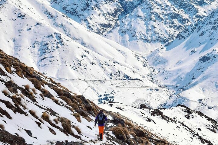
Morning light slices the High Atlas as you leave the olive terraces of Imlil and switchback into stone gullies that climb toward sky. On this two-day push, the mountain changes mood—oasis-like valleys give way to scree slopes and wind-scoured ridgelines—and the refuge at 3,200m becomes both waypoint and shelter before an alpine dawn summit.
Jbel Toubkal (4,167m) sits at the edge of the Sahara-influenced Atlas range and is shaped by folded sedimentary rock and Pleistocene glacial scouring; its ridges are steep, often loose, and exposed above 3,000m. The area is home to Amazigh (Berber) villages whose running water channels and stone terraced fields speak to generations of mountain life—look for the Shrine of Sidi Chamharouch, a cultural waypoint where locals stop and leave stones.
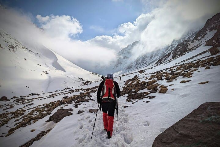
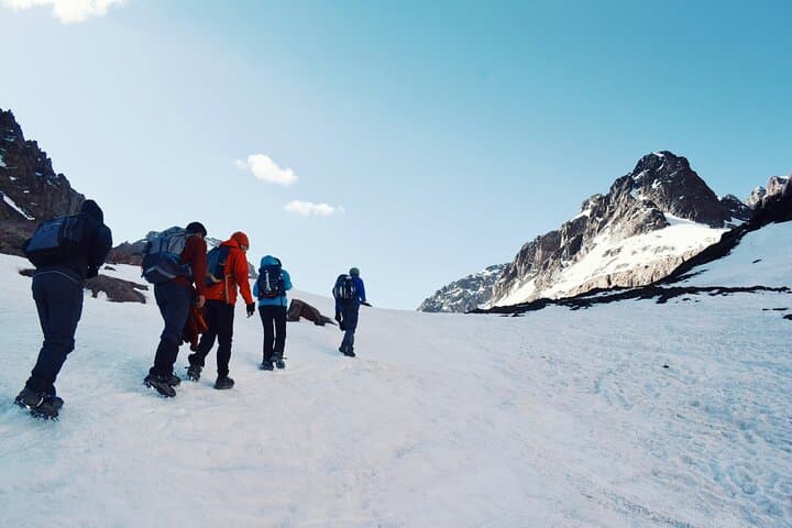
Practically: expect roughly 8–12 km the first day with ~1,200–1,500 m of gain to the refuge, then a summit ascent of ~950–1,000 m on day two with a long descent back to Imlil or Marrakech the same day. Terrain ranges from packed trail to steep scree; snow and ice can appear outside summer, so hire guides if unfamiliar with high-altitude route-finding.
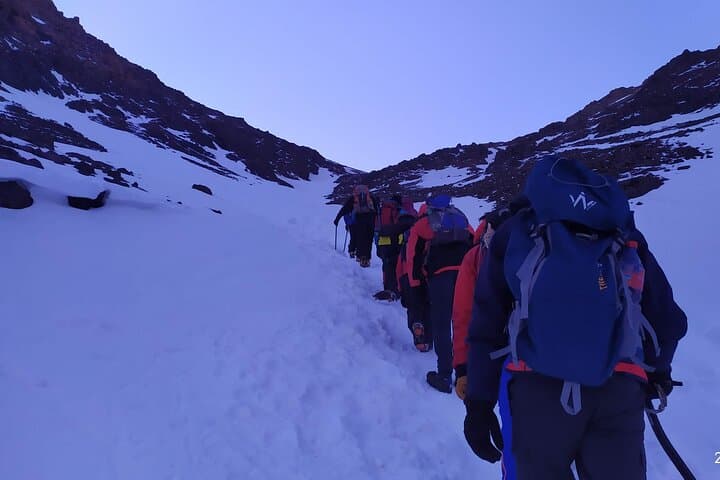
Travel light but prepared: layered clothing, sturdy boots, headlamp and water system matter. Start very early on summit day to avoid afternoon winds, acclimatize in Imlil when possible, and move deliberately—altitude, loose rock and weather are the real challenges here. The guide and refuge system make the objective achievable for fit hikers ready for sustained climbs.