THE ADVENTURE COLLECTIVE® · Independent discovery and booking for outdoor travel

A classic two-day ascent from Imlil to Jbel Toubkal’s 4,167 m summit. This guide covers the route, terrain, local culture and practical tips to help you plan a safe and successful climb.
A classic two-day ascent from Imlil to Jbel Toubkal’s 4,167 m summit. This guide covers the route, terrain, local culture and practical tips to help you plan a safe and successful climb.
The road out of Marrakech gives way to lower slopes of the High Atlas, then green terraces and the stone roofs of Imlil appear—your gateway at 1,740 m. From that village the trail rises steadily, a mule track threading through Berber farms and scrub as the mountain gathers itself above you.
Verified experiences and guided adventures in the surrounding area.
Operated by Ouirgane Atlas Activity · Imlil, Marrakech-Safi
The road out of Marrakech gives way to lower slopes of the High Atlas, then green terraces and the stone roofs of Imlil appear—your gateway at 1,740 m. From that village the trail rises steadily, a mule track threading through Berber farms and scrub as the mountain gathers itself above you.
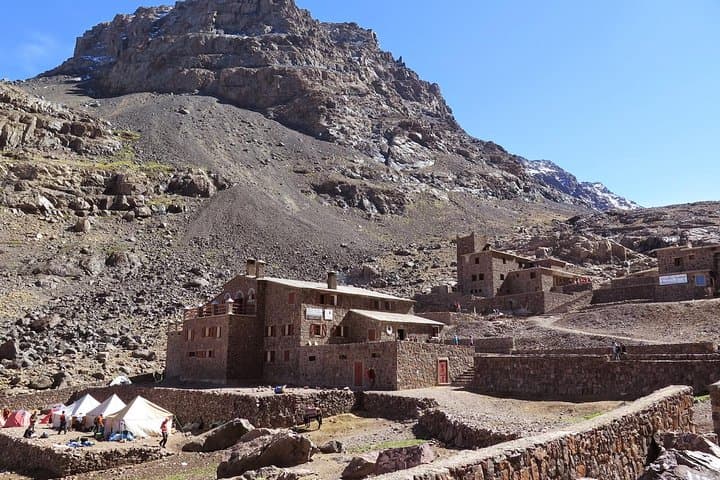
This two-day itinerary traces the classic route: Imlil to Sidi Chamharouch shrine (≈2,500 m) for lunch, onward to the mountain refuge at about 3,200 m on day one, then an early start for the summit push to Jbel Toubkal (4,167 m) on day two. The massif is part of the Atlas range, uplifted by plate collision and scoured by winter snow and summer storms, resulting in steep gullies, rocky ridgelines and long scree slopes that demand steady footing.
Local culture is visible at every turn—Berber villages, mules and shepherds who have guided travelers here for generations. The refuge experience is simple and communal: shared meals, hot tea and core-rest before the summit attempt.
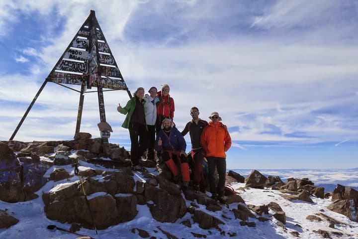
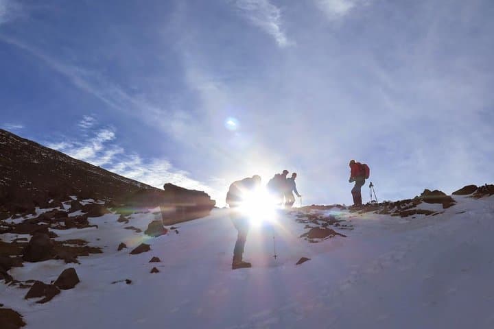
Practicalities: expect 5–6 hours of walking on day one (roughly 8–10 km with ≈1,450 m gain) and a 3–4 hour ascent from the refuge to the summit (steep, 900–1,000 m elevation gain), with similar descent times. Trails are mostly rocky and well-worn, but can be snowy or icy in shoulder seasons; crampons and gaiters may be required in winter. Hydrate, layer for alpine winds, and give yourself time to move deliberately—altitude, not distance, is the main challenge. With a good guide, basic trekking fitness, and the right kit, the summit view across the High Atlas is a clear, uncompromising reward.
challenging.
2 days (5–6 hours per day hiking; summit day 3–7 hours total).
Good aerobic fitness and prior day-hiking experience recommended; ability to walk on rocky, steep terrain for several hours.
You should be comfortable hiking 5–7 hours over uneven ground with sustained elevation gain; prior multi-day trekking experience is a plus.
Yes—symptoms can occur above 3,000 m; ascend slowly, stay hydrated, and inform guides if you feel unwell; descent is the primary treatment.
Night one is in a simple mountain refuge with shared bunk rooms, hot meals and basic facilities; expect communal sleeping and early dining times.
Late spring through early fall offers the most thawed trails; winter ascents require mountaineering gear and experience due to snow and ice.
The High Atlas has long been inhabited by Berber communities; routes to Toubkal were used historically for trade and seasonal grazing and later for European climbers in the 20th century.
The area faces pressure from increasing visitor numbers; stick to marked trails, minimize waste, and use local guides and accommodations to support community-based tourism.
Ouirgane Atlas Activity operates guided outdoor trips and adventures with an emphasis on safety, stewardship, and memorable experiences.

The road out of Marrakech gives way to lower slopes of the High Atlas, then green terraces and the stone roofs of Imlil appear—your gateway at 1,740 m. From that village the trail rises steadily, a mule track threading through Berber farms and scrub as the mountain gathers itself above you.
The road out of Marrakech gives way to lower slopes of the High Atlas, then green terraces and the stone roofs of Imlil appear—your gateway at 1,740 m. From that village the trail rises steadily, a mule track threading through Berber farms and scrub as the mountain gathers itself above you.
This two-day itinerary traces the classic route: Imlil to Sidi Chamharouch shrine (≈2,500 m) for lunch, onward to the mountain refuge at about 3,200 m on day one, then an early start for the summit push to Jbel Toubkal (4,167 m) on day two. The massif is part of the Atlas range, uplifted by plate collision and scoured by winter snow and summer storms, resulting in steep gullies, rocky ridgelines and long scree slopes that demand steady footing.
Local culture is visible at every turn—Berber villages, mules and shepherds who have guided travelers here for generations. The refuge experience is simple and communal: shared meals, hot tea and core-rest before the summit attempt.
Practicalities: expect 5–6 hours of walking on day one (roughly 8–10 km with ≈1,450 m gain) and a 3–4 hour ascent from the refuge to the summit (steep, 900–1,000 m elevation gain), with similar descent times. Trails are mostly rocky and well-worn, but can be snowy or icy in shoulder seasons; crampons and gaiters may be required in winter. Hydrate, layer for alpine winds, and give yourself time to move deliberately—altitude, not distance, is the main challenge. With a good guide, basic trekking fitness, and the right kit, the summit view across the High Atlas is a clear, uncompromising reward.