THE ADVENTURE COLLECTIVE® · Independent discovery and booking for outdoor travel

Two days from Marrakech to the roof of North Africa: a cultured approach through Berber villages, an overnight at Toubkal Refuge, and a challenging summit of Jebel Toubkal (4,167 m). Learn what to expect—distances, elevation, terrain—and how to prepare for high-altitude hiking in the High Atlas.
Two days from Marrakech to the roof of North Africa: a cultured approach through Berber villages, an overnight at Toubkal Refuge, and a challenging summit of Jebel Toubkal (4,167 m). Learn what to expect—distances, elevation, terrain—and how to prepare for high-altitude hiking in the High Atlas.
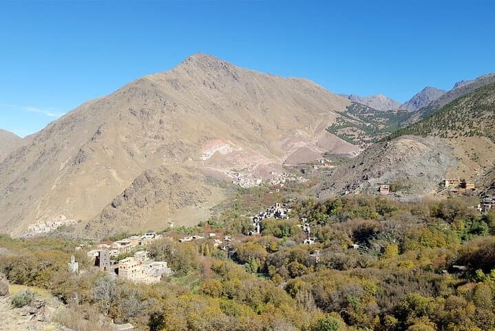
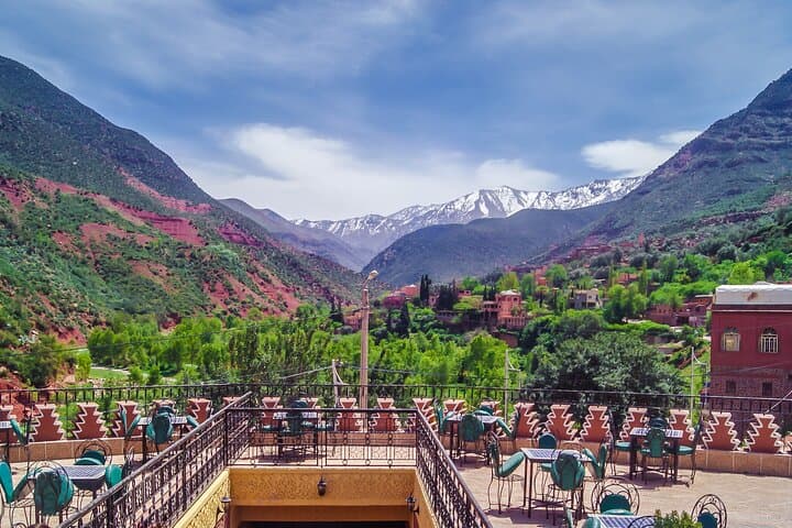
Dawn slices the High Atlas into cool bands of blue and ochre as you leave Marrakech behind and drop into the river-carved valley toward Imlil. The trail rises quickly—stone switchbacks, terraced fields, and villages that watch the sky—until the human world thins and the mountains begin to pull you forward. By mid-afternoon the route reaches Chamharouch, a simple outpost where shepherds and merchants exchange news as clouds push across the ridgelines.
Verified experiences and guided adventures in the surrounding area.
Operated by Morocco trekking discovery · Imlil, Marrakech-Safi
Dawn slices the High Atlas into cool bands of blue and ochre as you leave Marrakech behind and drop into the river-carved valley toward Imlil. The trail rises quickly—stone switchbacks, terraced fields, and villages that watch the sky—until the human world thins and the mountains begin to pull you forward. By mid-afternoon the route reaches Chamharouch, a simple outpost where shepherds and merchants exchange news as clouds push across the ridgelines.
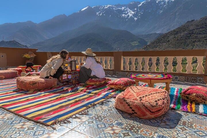
Geology here is granite hewn by millennia of freeze-and-thaw; peaks wear hard edges where glacial action once gripped. Berber culture is immediate: mule tracks braid the hills, flat-roofed houses sit low to the wind, and hospitality centers around mint tea and slow-cooked tagine. The Toubkal Refuge (≈3,200 m) perches below the summit like a foothold—practical, warm, and designed for mountaineers to rest and rehydrate.
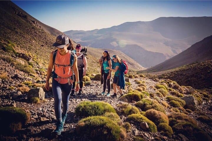
Expect numbers: from Imlil (~1,740 m) to the refuge is roughly 8–10 km with ~1,400–1,500 m of elevation gain, 4–6 hours of steady uphill. The summit push adds about 960 m and can take 6–10 hours round trip from the valley depending on pace and weather. Terrain alternates packed dirt, loose scree, and steeper stone steps; snow and ice are common in shoulder seasons and winter.
Practical beat: start pre-dawn for the summit, layer for extremes, and drink often to blunt altitude effects. Guides handle logistics—permits, mules for gear, and local insight—so your focus stays on breathing, steady footing, and the expanding view that waits at 4,167 m.
challenging.
2 days.
Good aerobic fitness and experience with sustained uphill hiking; ability to hike 6–10 hours in a day at altitude.
Physically it's challenging due to sustained elevation gain and altitude; technical climbing is not required in summer, but expect steep, loose terrain and long days.
Late spring through early autumn offers the most stable conditions; winter brings snow and requires mountaineering equipment and experience.
Some visitors feel mild symptoms; proper acclimatization, hydration, slow pace, and communicating with your guide reduce risk—serious cases are uncommon but possible.
Most two-day trips include private transport from Marrakech, guide, refuge accommodation, and meals listed; confirm your specific pickup point when booking.
The High Atlas has been inhabited by Amazigh (Berber) communities for millennia; trails here were long trade and pastoral routes linking valleys to Marrakech.
Trails are fragile—stick to established paths, avoid littering, and respect water sources; local guides and refuges work to manage visitor impact and support village economies.
Morocco trekking discovery operates guided outdoor trips and adventures with an emphasis on safety, stewardship, and memorable experiences.
Dawn slices the High Atlas into cool bands of blue and ochre as you leave Marrakech behind and drop into the river-carved valley toward Imlil. The trail rises quickly—stone switchbacks, terraced fields, and villages that watch the sky—until the human world thins and the mountains begin to pull you forward. By mid-afternoon the route reaches Chamharouch, a simple outpost where shepherds and merchants exchange news as clouds push across the ridgelines.
Dawn slices the High Atlas into cool bands of blue and ochre as you leave Marrakech behind and drop into the river-carved valley toward Imlil. The trail rises quickly—stone switchbacks, terraced fields, and villages that watch the sky—until the human world thins and the mountains begin to pull you forward. By mid-afternoon the route reaches Chamharouch, a simple outpost where shepherds and merchants exchange news as clouds push across the ridgelines.
Geology here is granite hewn by millennia of freeze-and-thaw; peaks wear hard edges where glacial action once gripped. Berber culture is immediate: mule tracks braid the hills, flat-roofed houses sit low to the wind, and hospitality centers around mint tea and slow-cooked tagine. The Toubkal Refuge (≈3,200 m) perches below the summit like a foothold—practical, warm, and designed for mountaineers to rest and rehydrate.
Expect numbers: from Imlil (~1,740 m) to the refuge is roughly 8–10 km with ~1,400–1,500 m of elevation gain, 4–6 hours of steady uphill. The summit push adds about 960 m and can take 6–10 hours round trip from the valley depending on pace and weather. Terrain alternates packed dirt, loose scree, and steeper stone steps; snow and ice are common in shoulder seasons and winter.
Practical beat: start pre-dawn for the summit, layer for extremes, and drink often to blunt altitude effects. Guides handle logistics—permits, mules for gear, and local insight—so your focus stays on breathing, steady footing, and the expanding view that waits at 4,167 m.