THE ADVENTURE COLLECTIVE® · Independent discovery and booking for outdoor travel

A concentrated, two-day ascent from Imlil to the summit of Mount Toubkal (4,167 m). This trip pairs steep high-Atlas ridgelines with a night at the mountain refuge and a pre-dawn summit push.
A concentrated, two-day ascent from Imlil to the summit of Mount Toubkal (4,167 m). This trip pairs steep high-Atlas ridgelines with a night at the mountain refuge and a pre-dawn summit push.
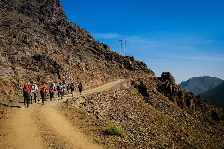
On the first morning the slip of Marrakech gives way to narrow mule tracks and terraced fields; the road to Imlil climbs into granite shoulders that smell of dry thyme and sheep wool.
Verified experiences and guided adventures in the surrounding area.
Operated by Traces Berbres Voyages · Imlil, Marrakech-Safi
On the first morning the slip of Marrakech gives way to narrow mule tracks and terraced fields; the road to Imlil climbs into granite shoulders that smell of dry thyme and sheep wool.
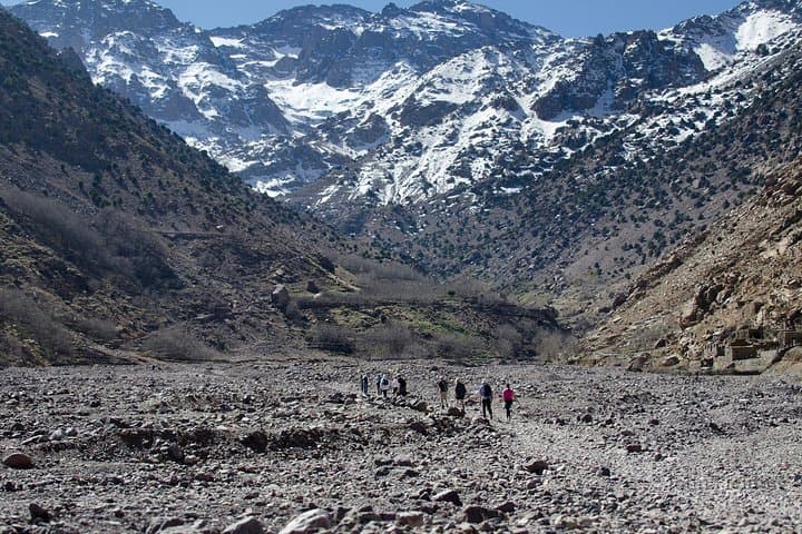
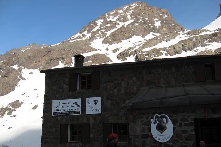
Walkers meet a local mountain guide in Imlil, then hike through a mosaic of berber villages before steepening into boulder fields and scree. By late afternoon the Toubkal Refuge appears like a plain-stone shelter clinging to the slope — a final base before the summit push.
Toubkal (4,167 m) is the highest point in the High Atlas and has long been part of the life of Amazigh (Berber) communities: seasonal grazing routes, mule tracks and small shrines mark the approach. Geologically the massif is composed of hard metamorphic and igneous rock; ridgelines and cols channel wind and snow, creating sharp, exposed sections above 3,000 m.
Day two begins before dawn. Expect loose rock, steep switchbacks and sections where the trail narrows into a ridge that demands attention. On a clear morning the summit view stretches to the Anti-Atlas and, on rare views, the Atlantic.
Practical guidance: travel light, use a durable sleeping bag for the refuge, and carry at least 2–3 liters of water plus high-calorie snacks. Acclimatize in Imlil or Marrakech the day before if possible, and plan summit attempts for early morning to avoid afternoon weather. The trek is non-technical in summer but can require crampons and winter experience when snow lingers. Respect local customs, hire a licensed guide, and pack out all waste — the mountains recover slowly.
challenging.
2 days (approx. 8–10 hours active per day).
Good aerobic fitness and experience with long uphill days; comfortable carrying a 6–12 kg daypack.
You should have experience with full days of uphill hiking and be able to sustain 6–10 hours of mixed terrain; prior trekking above 2,500 m helps with acclimatization.
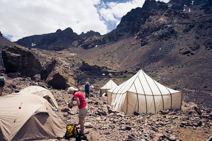
The refuge supplies basic full-board meals and bunk accommodations; bring a sleeping bag and small toiletries, and expect shared facilities.
In summer the route is non-technical and follows marked trails; in winter or after heavy snow, crampons and ice axe skills may be required.
Yes—boots, sleeping bags and trekking poles can be rented in Imlil or Marrakech, but fit and quality vary so arrange in advance if possible.
The High Atlas has been inhabited by Amazigh (Berber) communities for centuries; mule tracks and seasonal pastures shaped the routes climbers now use.
Trail erosion and waste are local concerns; visitors should stick to established paths, use local guides and pack out waste to minimize impact.
Traces Berbres Voyages operates guided outdoor trips and adventures with an emphasis on safety, stewardship, and memorable experiences.
On the first morning the slip of Marrakech gives way to narrow mule tracks and terraced fields; the road to Imlil climbs into granite shoulders that smell of dry thyme and sheep wool.
On the first morning the slip of Marrakech gives way to narrow mule tracks and terraced fields; the road to Imlil climbs into granite shoulders that smell of dry thyme and sheep wool.
Walkers meet a local mountain guide in Imlil, then hike through a mosaic of berber villages before steepening into boulder fields and scree. By late afternoon the Toubkal Refuge appears like a plain-stone shelter clinging to the slope — a final base before the summit push.
Toubkal (4,167 m) is the highest point in the High Atlas and has long been part of the life of Amazigh (Berber) communities: seasonal grazing routes, mule tracks and small shrines mark the approach. Geologically the massif is composed of hard metamorphic and igneous rock; ridgelines and cols channel wind and snow, creating sharp, exposed sections above 3,000 m.
Day two begins before dawn. Expect loose rock, steep switchbacks and sections where the trail narrows into a ridge that demands attention. On a clear morning the summit view stretches to the Anti-Atlas and, on rare views, the Atlantic.
Practical guidance: travel light, use a durable sleeping bag for the refuge, and carry at least 2–3 liters of water plus high-calorie snacks. Acclimatize in Imlil or Marrakech the day before if possible, and plan summit attempts for early morning to avoid afternoon weather. The trek is non-technical in summer but can require crampons and winter experience when snow lingers. Respect local customs, hire a licensed guide, and pack out all waste — the mountains recover slowly.