THE ADVENTURE COLLECTIVE® · Independent discovery and booking for outdoor travel

Summit Jebel Toubkal in a compact 2-day guided itinerary from Marrakech: a night at the Neltner refuge followed by an early-morning push to North Africa's highest peak. This practical guide covers what to expect—terrain, timing, and key gear to bring.
Summit Jebel Toubkal in a compact 2-day guided itinerary from Marrakech: a night at the Neltner refuge followed by an early-morning push to North Africa's highest peak. This practical guide covers what to expect—terrain, timing, and key gear to bring.
A pre-dawn van leaves Marrakech and the road narrows into the terraced valleys of the High Atlas; villages appear as stacked stone, mules clip-clop on switchbacks, and the air thins with each kilometer. By midday the trail climbs out of citrus groves and into boulder fields, ending the first day at the Neltner refuge (≈3,210 m) where the mountain's scale becomes real under a star-filled sky.
Verified experiences and guided adventures in the surrounding area.
Operated by Morocco Destination Experts · Imlil, Marrakech-Safi
A pre-dawn van leaves Marrakech and the road narrows into the terraced valleys of the High Atlas; villages appear as stacked stone, mules clip-clop on switchbacks, and the air thins with each kilometer. By midday the trail climbs out of citrus groves and into boulder fields, ending the first day at the Neltner refuge (≈3,210 m) where the mountain's scale becomes real under a star-filled sky.
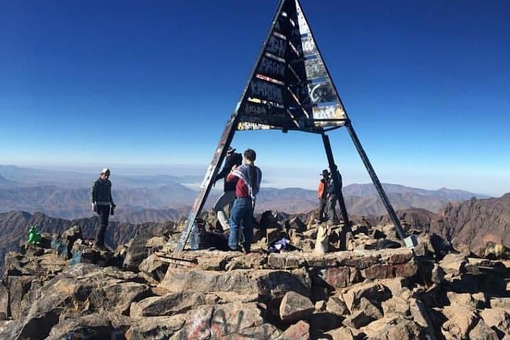
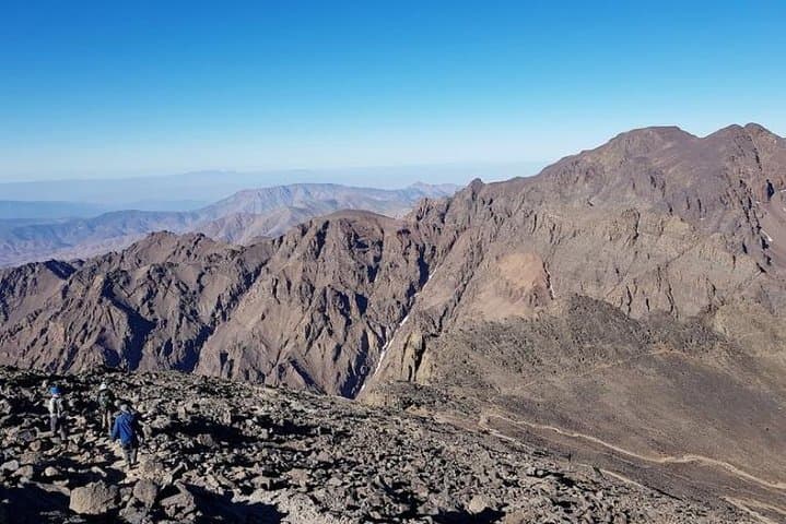
Jebel Toubkal (4,167 m) is the highest point in the Atlas and all of North Africa. The massif is the product of tectonic uplift where African and Eurasian plates met, exposing metamorphic and igneous rock and sharp ridgelines carved by glacial and seasonal runoff. The route passes Aremd and Sidi Chamarouch—small Berber hamlets where muleteers, local guides, and the communal use of the high trails reflect centuries of mountain life.
Practical guide: expect ~2 days of trekking with total elevation gain from Imlil near 1,900–2,400 m depending on start point. Day 1 climbs steadily to the refuge in 3–6 hours; Day 2 requires an early start, 3–5 hours to the summit from the hut, then descent back to Imlil. Terrain is rocky and sometimes icy above the hut—snow can persist into late spring and returns in autumn/winter. Shoes with firm ankle support, a warm insulated layer, and a steady pace matter more than technical rope skills on the standard south route.
Timing and logistics are straightforward with local guides, mule support, and refuge accommodation included on shared 2-day programs—plan for altitude, keep hydrated, and allow an extra day in Marrakech if you want a buffer for bad weather or fatigue.
challenging.
2 days (approx. 9–11 hours walking total).
Good cardiovascular fitness and prior day-hiking experience; be comfortable with sustained uphill walking and carrying a daypack.
You should be comfortable hiking 4–7 hours in a day with sustained uphill sections; trainers won’t do—sturdy boots and recent multi-hour hikes are recommended.
No technical climbing gear is needed on the normal southern route in summer; in winter you may need crampons and an ice axe and guide support for snow/ice conditions.
The Neltner refuge is a basic mountain hut with dormitory-style sleeping, simple hot meals, and communal spaces—bring a warm sleeping liner and expect spartan but functional facilities.
Yes—operators commonly cancel for unsafe weather or poor conditions; confirm cancellation and refund policies when booking and build flexibility into your travel plans.
Toubkal has long been a landmark for Berber communities in the High Atlas; the mountain became a popular mountaineering objective in the 20th century as access from Marrakech improved.
Trails are sensitive to erosion and seasonal overuse; stick to established paths, avoid camping above the refuge, and respect local grazing to reduce impact.
Morocco Destination Experts operates guided outdoor trips and adventures with an emphasis on safety, stewardship, and memorable experiences.
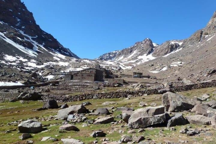
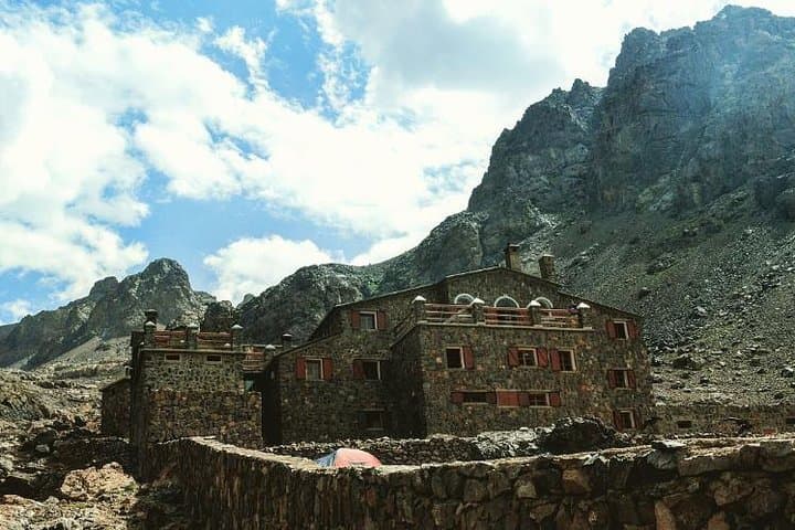
A pre-dawn van leaves Marrakech and the road narrows into the terraced valleys of the High Atlas; villages appear as stacked stone, mules clip-clop on switchbacks, and the air thins with each kilometer. By midday the trail climbs out of citrus groves and into boulder fields, ending the first day at the Neltner refuge (≈3,210 m) where the mountain's scale becomes real under a star-filled sky.
A pre-dawn van leaves Marrakech and the road narrows into the terraced valleys of the High Atlas; villages appear as stacked stone, mules clip-clop on switchbacks, and the air thins with each kilometer. By midday the trail climbs out of citrus groves and into boulder fields, ending the first day at the Neltner refuge (≈3,210 m) where the mountain's scale becomes real under a star-filled sky.
Jebel Toubkal (4,167 m) is the highest point in the Atlas and all of North Africa. The massif is the product of tectonic uplift where African and Eurasian plates met, exposing metamorphic and igneous rock and sharp ridgelines carved by glacial and seasonal runoff. The route passes Aremd and Sidi Chamarouch—small Berber hamlets where muleteers, local guides, and the communal use of the high trails reflect centuries of mountain life.
Practical guide: expect ~2 days of trekking with total elevation gain from Imlil near 1,900–2,400 m depending on start point. Day 1 climbs steadily to the refuge in 3–6 hours; Day 2 requires an early start, 3–5 hours to the summit from the hut, then descent back to Imlil. Terrain is rocky and sometimes icy above the hut—snow can persist into late spring and returns in autumn/winter. Shoes with firm ankle support, a warm insulated layer, and a steady pace matter more than technical rope skills on the standard south route.
Timing and logistics are straightforward with local guides, mule support, and refuge accommodation included on shared 2-day programs—plan for altitude, keep hydrated, and allow an extra day in Marrakech if you want a buffer for bad weather or fatigue.