THE ADVENTURE COLLECTIVE® · Independent discovery and booking for outdoor travel

A compact, two-day loop from Quito that pairs Cotopaxi’s high-altitude drama with Baños’ waterfalls and the eastern Amazon edge. Expect big altitude changes, varied ecosystems and active-volcano views.
A compact, two-day loop from Quito that pairs Cotopaxi’s high-altitude drama with Baños’ waterfalls and the eastern Amazon edge. Expect big altitude changes, varied ecosystems and active-volcano views.
Dawn on the Avenue of the Volcanoes feels like a promise: low clouds break over black-and-ochre ridgelines as the van climbs south from Quito. You reach Limpiopungo Lake with condors circling and wild horses grazing along the marshy shore, then press higher toward the José Rivas refuge—air thinning with each switchback and the volcano breathing quietly above.
Verified experiences and guided adventures in the surrounding area.
Operated by Ecuador Best Tours · Quito, Pichincha
Dawn on the Avenue of the Volcanoes feels like a promise: low clouds break over black-and-ochre ridgelines as the van climbs south from Quito. You reach Limpiopungo Lake with condors circling and wild horses grazing along the marshy shore, then press higher toward the José Rivas refuge—air thinning with each switchback and the volcano breathing quietly above.
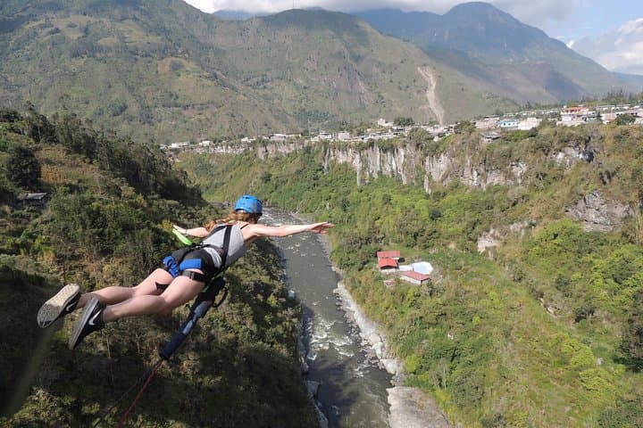
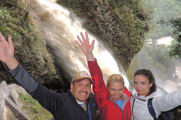
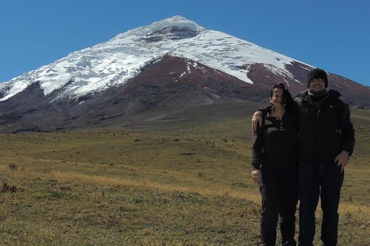
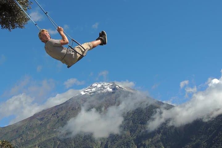
Cotopaxi (5,897 m / 19,347 ft) is a glaciated, frequently active stratovolcano whose cone and high-altitude páramo speak to the Andes’ volcanic and glacial past. The route threads colonial-era haciendas built atop Inca foundations, then drops dramatically to Baños de Agua Santa at the flanks of Tungurahua (an intermittently active volcano since 1999). On day two the landscape shifts again: cloud forest, the Pastaza River canyon bridged by a cable car, and the thunderous Pailón del Diablo waterfall before you descend into Amazonian foothills and the Yanacocha rescue center near Puyo.
Expect sharp altitude swings—3,800 m at Limpiopungo, 4,800 m near the refuge, then 1,800 m in Baños and ~800 m in Puyo—so pacing and hydration matter. Wear sturdy boots, layer for sun and wind, and carry cash and a camera for dramatic vistas and waterfalls. Guides manage logistics and one night’s lodging is included, making this a compact, accessible way to experience Ecuador’s ecological diversity: high Andean ice and páramo, active volcanic scenery, and the green edge of the Amazon.
moderate.
2 days (approximately 8–10 hours per day).
Moderate aerobic fitness; able to handle several hours of walking and short, steep sections at altitude.
You should have moderate fitness—short steep sections up to a few hundred meters of elevation gain are involved; the guide times the ascent to accommodate acclimatization.
The volcano is monitored; guides follow local safety advisories and adjust itineraries if authorities advise closures or hazards.
The tour includes certified English-speaking guide, private transport, one night’s accommodation, breakfast and lunch as listed—confirm specifics with the operator before booking.
Children can join but must be accompanied by an adult; the provider notes it’s not recommended for those with heart conditions or pregnancy due to altitude.
San Agustín del Callo is a colonial-era hacienda built over Inca structures, illustrating the region’s layered indigenous and colonial past.
Cotopaxi’s páramo is fragile—stay on trails and avoid collecting plants; wildlife rescue centers like Yanacocha focus on rehabilitation and education to reduce human-wildlife conflict.
Ecuador Best Tours operates guided outdoor trips and adventures with an emphasis on safety, stewardship, and memorable experiences.
Dawn on the Avenue of the Volcanoes feels like a promise: low clouds break over black-and-ochre ridgelines as the van climbs south from Quito. You reach Limpiopungo Lake with condors circling and wild horses grazing along the marshy shore, then press higher toward the José Rivas refuge—air thinning with each switchback and the volcano breathing quietly above.
Dawn on the Avenue of the Volcanoes feels like a promise: low clouds break over black-and-ochre ridgelines as the van climbs south from Quito. You reach Limpiopungo Lake with condors circling and wild horses grazing along the marshy shore, then press higher toward the José Rivas refuge—air thinning with each switchback and the volcano breathing quietly above.
Cotopaxi (5,897 m / 19,347 ft) is a glaciated, frequently active stratovolcano whose cone and high-altitude páramo speak to the Andes’ volcanic and glacial past. The route threads colonial-era haciendas built atop Inca foundations, then drops dramatically to Baños de Agua Santa at the flanks of Tungurahua (an intermittently active volcano since 1999). On day two the landscape shifts again: cloud forest, the Pastaza River canyon bridged by a cable car, and the thunderous Pailón del Diablo waterfall before you descend into Amazonian foothills and the Yanacocha rescue center near Puyo.
Expect sharp altitude swings—3,800 m at Limpiopungo, 4,800 m near the refuge, then 1,800 m in Baños and ~800 m in Puyo—so pacing and hydration matter. Wear sturdy boots, layer for sun and wind, and carry cash and a camera for dramatic vistas and waterfalls. Guides manage logistics and one night’s lodging is included, making this a compact, accessible way to experience Ecuador’s ecological diversity: high Andean ice and páramo, active volcanic scenery, and the green edge of the Amazon.