THE ADVENTURE COLLECTIVE® · Independent discovery and booking for outdoor travel

A two-day trek from Chakrata that links the shadowed Budher Caves with the sweeping Deoban Top and roadside Tigerfall. Expect long forest walks, meadow views and a glimpse into local highland life.
A two-day trek from Chakrata that links the shadowed Budher Caves with the sweeping Deoban Top and roadside Tigerfall. Expect long forest walks, meadow views and a glimpse into local highland life.
High pine forest opens and the trail exhales cold, resin-scented air as you climb toward Budher Caves. Thin shafts of light pick out lichen on rock; the cave mouth waits dark and cool, a handhold of myth in the hill.
Verified experiences and guided adventures in the surrounding area.
Operated by Kaushik's Cafe & Trek · Chakrata, Uttarakhand
High pine forest opens and the trail exhales cold, resin-scented air as you climb toward Budher Caves. Thin shafts of light pick out lichen on rock; the cave mouth waits dark and cool, a handhold of myth in the hill.
The route threads alpine meadows, pine stands and exposed ridgelines shaped by the Lower Himalaya’s folded limestone and shale. Local lore links Budher Caves to the Mahabharata—visitors come for the story as much as the view. Deoban Top, a long walk through carpeted meadows, rewards effort with broad panoramas of the greater Garhwal range; Tigerfall, one of the taller falls in the region, thunders below on the return leg.
Historically, Chakrata has been a hill outpost with colonial-era trails that now double as local shepherd routes. Geologically, the landscape is a mix of softer sedimentary rock and harder outcrops that create caves and small cliffs. Village life is simple: terrace fields, grazing goats and roadside tea stalls that fuel early starts.
Practical guidance: the trek is achievable for regular walkers who can handle 6–16 km days on uneven, sometimes muddy trails. Expect cool nights and sudden weather shifts—carry layered clothing, a reliable headlamp for cave visits, and water purification. Mobile signal is intermittent; plan logistics with the guide and keep to marked paths to respect fragile meadows. Time your trip for clear-weather windows (late spring or autumn) if you want snow-free ridgelines and best visibility.
moderate.
1–2 days.
Suitable for walkers who can manage 6–16 km days on uneven terrain and short steep sections
No formal trekking permit is generally required for these local trails, but check with your operator and local authorities for any recent restrictions.
Yes—walkers with basic fitness who can cover long days on uneven trails can complete this trek; guide support helps navigation.
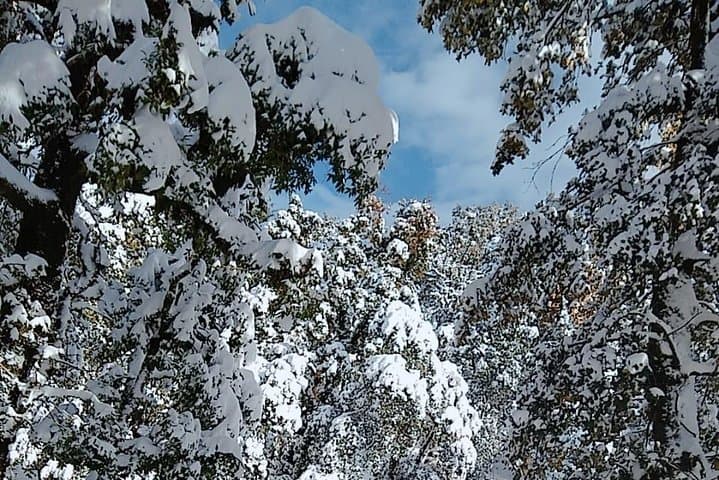
In winter, higher sections may hold snow and ice; crampons and trekking poles are recommended if conditions are snowy.
The itinerary notes no guide is required for Tigerfall since it’s accessible by road, but follow safety advice at the falls and parking area.
Budher Caves carry local Mahabharata-era legends and Chakrata’s trails were historically used as hill grazing and colonial-era patrol routes.
Alpine meadows are erosion-prone—practice pack-in, pack-out, avoid open-fire camping and follow local waste rules to protect fragile vegetation.
Kaushik's Cafe & Trek operates guided outdoor trips and adventures with an emphasis on safety, stewardship, and memorable experiences.
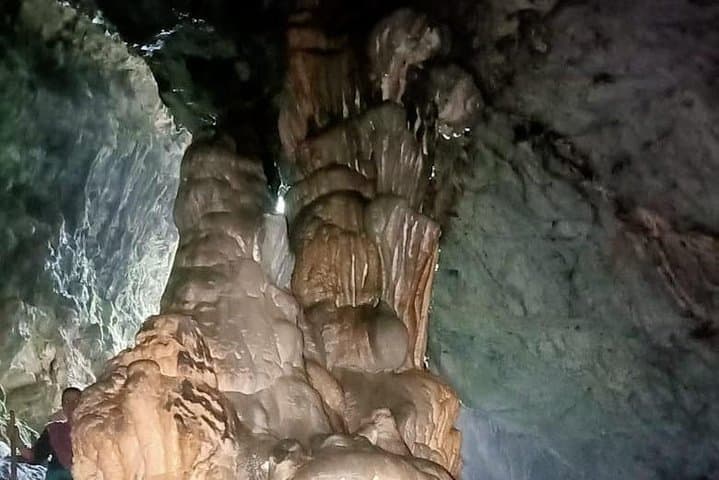
High pine forest opens and the trail exhales cold, resin-scented air as you climb toward Budher Caves. Thin shafts of light pick out lichen on rock; the cave mouth waits dark and cool, a handhold of myth in the hill.
High pine forest opens and the trail exhales cold, resin-scented air as you climb toward Budher Caves. Thin shafts of light pick out lichen on rock; the cave mouth waits dark and cool, a handhold of myth in the hill.
The route threads alpine meadows, pine stands and exposed ridgelines shaped by the Lower Himalaya’s folded limestone and shale. Local lore links Budher Caves to the Mahabharata—visitors come for the story as much as the view. Deoban Top, a long walk through carpeted meadows, rewards effort with broad panoramas of the greater Garhwal range; Tigerfall, one of the taller falls in the region, thunders below on the return leg.
Historically, Chakrata has been a hill outpost with colonial-era trails that now double as local shepherd routes. Geologically, the landscape is a mix of softer sedimentary rock and harder outcrops that create caves and small cliffs. Village life is simple: terrace fields, grazing goats and roadside tea stalls that fuel early starts.
Practical guidance: the trek is achievable for regular walkers who can handle 6–16 km days on uneven, sometimes muddy trails. Expect cool nights and sudden weather shifts—carry layered clothing, a reliable headlamp for cave visits, and water purification. Mobile signal is intermittent; plan logistics with the guide and keep to marked paths to respect fragile meadows. Time your trip for clear-weather windows (late spring or autumn) if you want snow-free ridgelines and best visibility.