THE ADVENTURE COLLECTIVE® · Independent discovery and booking for outdoor travel

Walk the cooled lava flows of Timanfaya with a native guide, learn the island’s volcanic story, and finish with a tasting of local Canarian products. This small-group trek is a 3–4 hour, moderate hike over stony, exposed terrain.
Walk the cooled lava flows of Timanfaya with a native guide, learn the island’s volcanic story, and finish with a tasting of local Canarian products. This small-group trek is a 3–4 hour, moderate hike over stony, exposed terrain.
You step off the main road at the roundabout by the Monumento del Campesino and the island opens in a way few landscapes can: black crusted lava fields, low scrub, and a horizon punctured by rust-colored cones. A local guide — born on Lanzarote — leads a small group across the cooled flows, explaining how fire reshaped this coast and how life returned to the ash.
Verified experiences and guided adventures in the surrounding area.
Operated by Lava Trekking · Yaiza, Canary Islands
You step off the main road at the roundabout by the Monumento del Campesino and the island opens in a way few landscapes can: black crusted lava fields, low scrub, and a horizon punctured by rust-colored cones. A local guide — born on Lanzarote — leads a small group across the cooled flows, explaining how fire reshaped this coast and how life returned to the ash.
The route threads through Montañas del Fuego, the result of the great 1730–36 eruptions that remade western Lanzarote. Geology is obvious here: pahoehoe and ʻaʻā-like flows, ash fields, and cinder cones that read like pages in a volcanic ledger. The guide ties geology to culture — how Canarian farmers adapted viticulture in nearby La Geria, how local foods use island salt and goat cheese — before finishing with a tasting of regional products and a glass of volcanic wine.
Expect 3–4 hours of walking on uneven, stony terrain with minimal shade. The pace is conversational: stops to inspect lava textures, to point out endemic plants and birdlife, and to let the views across arid slopes and Atlantic light settle in. Practicalities are straightforward: meet at the Monumento del Campesino roundabout, wear sturdy boots, carry at least 1–2 liters of water, and plan for strong sun exposure. Trails are exposed and wind can turn cool; layers are smart.
For travelers looking for a direct, interpretive way to read a volcanic landscape, this small-group trek pairs solid outdoor footing with local stories and a tasteful finish — geology you can taste.
moderate.
3–4 hours.
Moderate fitness for steady walking over uneven, rocky terrain; some short uphill sections.
The meeting point is the roundabout in front of the Monumento del Campesino by the Church of Masdache on the main road; exact pickup instructions are provided on booking.
Expect a moderately paced 3–4 hour walk over uneven volcanic terrain; a moderate level of fitness is recommended and the guide will adjust pace to the group.
The tour includes snacks, water and a tasting of Canarian products including local wine; inform the operator of dietary restrictions when booking.
Children can participate but must be supervised; the route is uneven and not suited for strollers or serious mobility limitations — the experience is adapted where possible to guests' physical state.
The landscape visible today was largely formed by eruptions between 1730–1736; Timanfaya later gained protected status as a national park to preserve its volcanic features.
The park limits off-trail travel to protect fragile soils and endemic plants; visitors should stick to paths, carry out waste, and avoid collecting rocks or plants.
Lava Trekking operates guided outdoor trips and adventures with an emphasis on safety, stewardship, and memorable experiences.
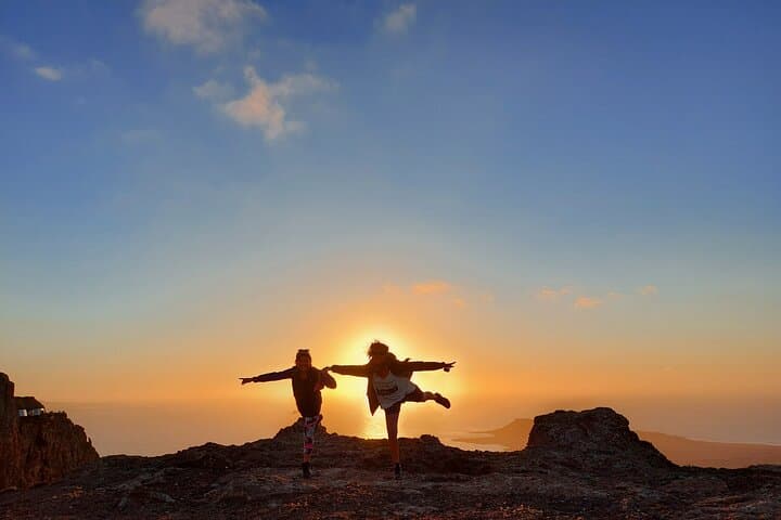
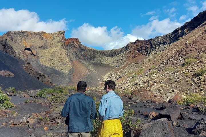
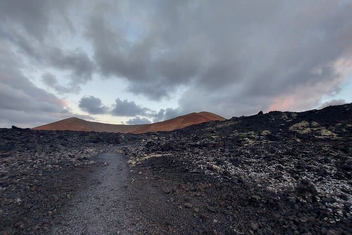
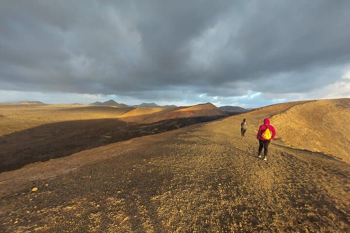
You step off the main road at the roundabout by the Monumento del Campesino and the island opens in a way few landscapes can: black crusted lava fields, low scrub, and a horizon punctured by rust-colored cones. A local guide — born on Lanzarote — leads a small group across the cooled flows, explaining how fire reshaped this coast and how life returned to the ash.
You step off the main road at the roundabout by the Monumento del Campesino and the island opens in a way few landscapes can: black crusted lava fields, low scrub, and a horizon punctured by rust-colored cones. A local guide — born on Lanzarote — leads a small group across the cooled flows, explaining how fire reshaped this coast and how life returned to the ash.
The route threads through Montañas del Fuego, the result of the great 1730–36 eruptions that remade western Lanzarote. Geology is obvious here: pahoehoe and ʻaʻā-like flows, ash fields, and cinder cones that read like pages in a volcanic ledger. The guide ties geology to culture — how Canarian farmers adapted viticulture in nearby La Geria, how local foods use island salt and goat cheese — before finishing with a tasting of regional products and a glass of volcanic wine.
Expect 3–4 hours of walking on uneven, stony terrain with minimal shade. The pace is conversational: stops to inspect lava textures, to point out endemic plants and birdlife, and to let the views across arid slopes and Atlantic light settle in. Practicalities are straightforward: meet at the Monumento del Campesino roundabout, wear sturdy boots, carry at least 1–2 liters of water, and plan for strong sun exposure. Trails are exposed and wind can turn cool; layers are smart.
For travelers looking for a direct, interpretive way to read a volcanic landscape, this small-group trek pairs solid outdoor footing with local stories and a tasteful finish — geology you can taste.