THE ADVENTURE COLLECTIVE® · Independent discovery and booking for outdoor travel

Walk to the rim of Mount Mihara on Izu Oshima and experience exposed lava flows, crater views, and the island’s recovering vegetation. This 3–4 hour trek combines paved approach trails with an unpaved crater loop—perfect for hikers wanting a compact volcanic experience.
Walk to the rim of Mount Mihara on Izu Oshima and experience exposed lava flows, crater views, and the island’s recovering vegetation. This 3–4 hour trek combines paved approach trails with an unpaved crater loop—perfect for hikers wanting a compact volcanic experience.
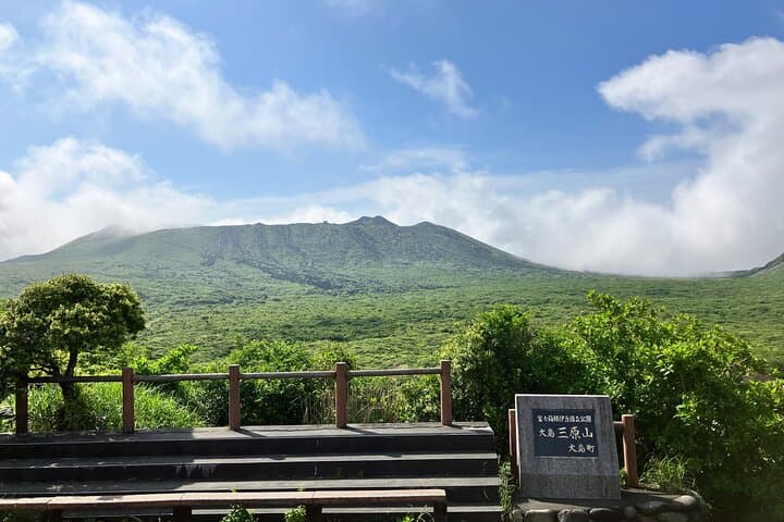
You arrive at the parking lot at Mt. Mihara as the island wind trims the horizon and the volcanic cone looms above—black lava ribs cut into green slopes, and the trail climbs toward a rim that smells faintly of mineral heat.
Verified experiences and guided adventures in the surrounding area.
Operated by ツアーガイド · Oshima, Tokyo
You arrive at the parking lot at Mt. Mihara as the island wind trims the horizon and the volcanic cone looms above—black lava ribs cut into green slopes, and the trail climbs toward a rim that smells faintly of mineral heat.
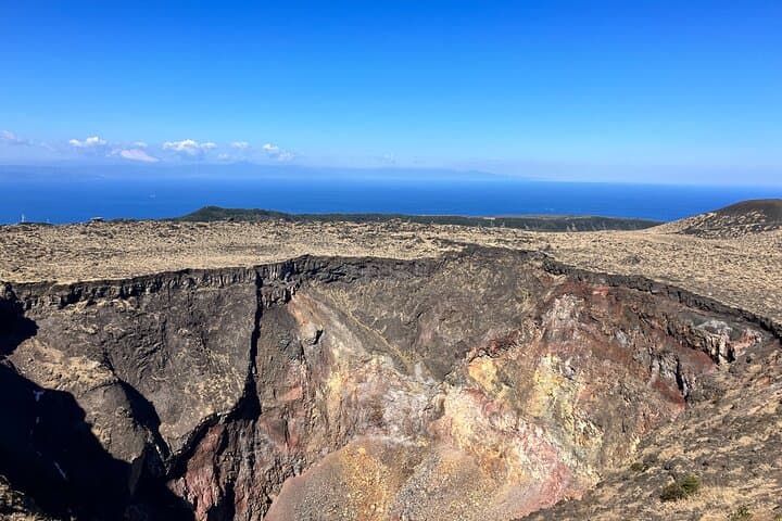
Mount Mihara is the dominant feature of Izu Oshima, an active stratovolcano about 120 km south of Tokyo. Eruptive episodes over the last century reshaped the island’s coastline and left visible lava flows and fresh-looking scars; the summit offers a close, raw view of that geology and a chance to walk around a well-defined crater.
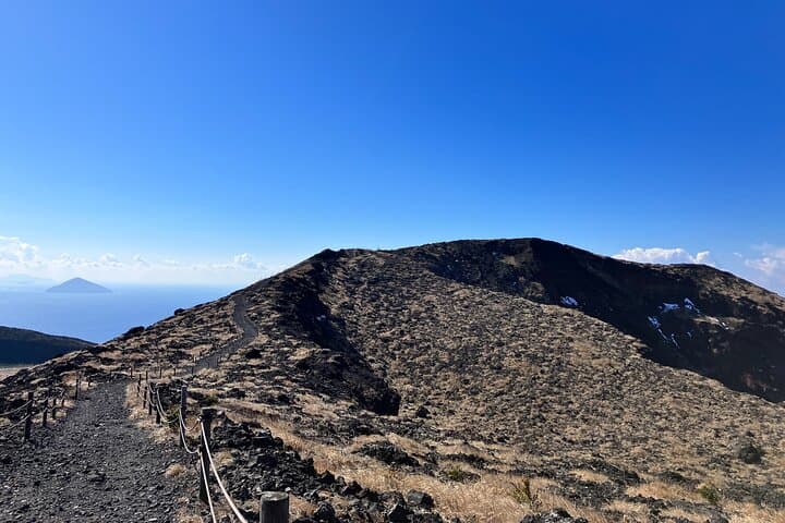
The route begins from a paved viewpoint and follows a maintained walkway to the summit; expect paved sections, then a shorter unpaved loop around the crater rim with looser volcanic scree and exposed rock. Vegetation shows the cycle of recovery—hardy shrubs and camellia-like growth advancing over older flows. Culturally, Izu Oshima is a fishing and flower-growing community; Motomachi harbor below feels quietly maritime and practical.
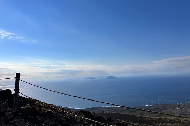
Practical guidance: plan 3–4 hours total, bring sturdy shoes for a mix of pavement and uneven trail, and carry 1–2 liters of water—the exposed rim gives little shade. Weather shifts quickly at elevation; wind and sudden rain are common. Respect closure signs near unstable crater edges and follow your guide’s instructions. If you’re aiming for photos, morning light highlights the crater’s textures and late afternoon softens the island’s contours. The hike is direct, geological, and elemental—an efficient way to feel an active volcanic landscape beneath your feet.
moderate.
3–4 hours.
Moderate fitness: able to walk uphill on paved paths and navigate uneven, unpaved crater rim for a few hours.
The guided route is about 3–4 hours round-trip including the paved approach and the unpaved crater loop; the operator lists roughly 210 minutes.
You can walk around the crater on an established loop, but closures may be in place for safety—always follow guide instructions and posted signs.
Regular ferries and faster hydrofoils run from Tokyo ports (Takeshiba/Kamome), with travel times ranging from about 50 minutes (high-speed) to several hours by conventional ferry; check schedules in advance.
Mount Mihara is about 758 m in elevation; most hikers do not experience altitude issues, but those with cardiovascular or serious mobility problems should consult a doctor and the operator’s restrictions.
Mount Mihara is an active volcanic cone whose eruptions over the past century have reshaped Izu Oshima’s landscape and settlement patterns.
Stay on trails to protect fragile volcanic soils and recovering vegetation; follow leave-no-trace principles and avoid disturbing regrowth or rock exposures.
ツアーガイド operates guided outdoor trips and adventures with an emphasis on safety, stewardship, and memorable experiences.
You arrive at the parking lot at Mt. Mihara as the island wind trims the horizon and the volcanic cone looms above—black lava ribs cut into green slopes, and the trail climbs toward a rim that smells faintly of mineral heat.
You arrive at the parking lot at Mt. Mihara as the island wind trims the horizon and the volcanic cone looms above—black lava ribs cut into green slopes, and the trail climbs toward a rim that smells faintly of mineral heat.
Mount Mihara is the dominant feature of Izu Oshima, an active stratovolcano about 120 km south of Tokyo. Eruptive episodes over the last century reshaped the island’s coastline and left visible lava flows and fresh-looking scars; the summit offers a close, raw view of that geology and a chance to walk around a well-defined crater.
The route begins from a paved viewpoint and follows a maintained walkway to the summit; expect paved sections, then a shorter unpaved loop around the crater rim with looser volcanic scree and exposed rock. Vegetation shows the cycle of recovery—hardy shrubs and camellia-like growth advancing over older flows. Culturally, Izu Oshima is a fishing and flower-growing community; Motomachi harbor below feels quietly maritime and practical.
Practical guidance: plan 3–4 hours total, bring sturdy shoes for a mix of pavement and uneven trail, and carry 1–2 liters of water—the exposed rim gives little shade. Weather shifts quickly at elevation; wind and sudden rain are common. Respect closure signs near unstable crater edges and follow your guide’s instructions. If you’re aiming for photos, morning light highlights the crater’s textures and late afternoon softens the island’s contours. The hike is direct, geological, and elemental—an efficient way to feel an active volcanic landscape beneath your feet.