THE ADVENTURE COLLECTIVE® · Independent discovery and booking for outdoor travel

Spend a full day trading Marrakech’s medina for cedar forests, Berber villages and panoramic ridgelines. This guided trek to Isk summit (≈2,500 m) combines cultural stops with an accessible mountain ascent.
Spend a full day trading Marrakech’s medina for cedar forests, Berber villages and panoramic ridgelines. This guided trek to Isk summit (≈2,500 m) combines cultural stops with an accessible mountain ascent.
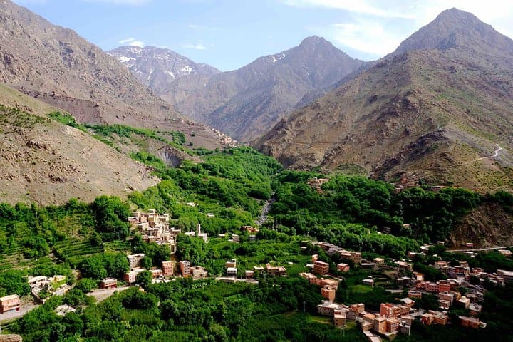
You leave the bustle of Marrakech behind as the minivan climbs a 64-kilometer ribbon of road into the High Atlas. By mid-morning the air thins and cedar-scented wind moves through terraces and stone houses; Imlil (1,740 m) appears below like a scattering of earthen tiles. Your guide checks boots and maps, and the trail pulls you up past the small waterfall that announces the valley’s waterline.
Verified experiences and guided adventures in the surrounding area.
Operated by Atlas Discovery Tours · Imlil, Marrakech-Safi
You leave the bustle of Marrakech behind as the minivan climbs a 64-kilometer ribbon of road into the High Atlas. By mid-morning the air thins and cedar-scented wind moves through terraces and stone houses; Imlil (1,740 m) appears below like a scattering of earthen tiles. Your guide checks boots and maps, and the trail pulls you up past the small waterfall that announces the valley’s waterline.
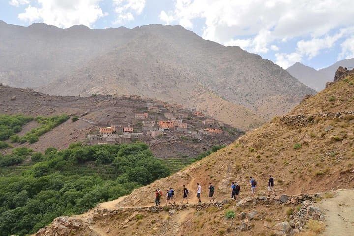
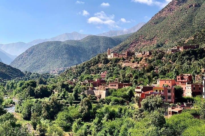
The route follows old mule tracks that linked Berber hamlets for centuries. Geologically, the High Atlas are young, uplifted ranges of metamorphic rock—crags and folded ridges cut by seasonal streams—so expect dusty talus, packed earth, and root-streaked slopes. Cultural markers appear in the form of flat-roofed houses, olive presses, and terraced plots worked by local families; English and French are common among guides, while Tamazight names mark the landscape.
From Armd (≈1,900 m) the trail enters a pine stand, the trees shading a steady ascent toward Isk (≈2,500 m). At the summit the Imnane Valley unfolds: stepped fields, more villages, and a horizon of serrated peaks. The return is gentler—lunch on the slope, then a measured descent back to Imlil and the drive to Marrakech.
Practical: this is a long day—plan 6–8 hours with roughly 700–800 m elevation gain. Wear sturdy footwear, carry 1.5–2 liters of water, and layer for sun and mountain chill. Start early to avoid midday heat and give yourself time to savor the view.
moderate.
6–8 hours.
Suitable for hikers with moderate fitness able to sustain steady uphill walking and manage 700–800 m of elevation gain.
Expect a steady uphill with roughly 700–800 m of elevation gain; it’s rated moderate and suitable for people comfortable with full-day hikes.
No technical experience is required, but good footwear and basic stamina for sustained climbs make the day more enjoyable.
Lunch is included; bring extra snacks and water to supplement what’s provided during the outing.
The transfer is about 64 kilometers and typically takes around 1.5 hours each way, depending on traffic and stops.
The High Atlas has long been home to Amazigh (Berber) communities whose terraces and stone villages reflect centuries of mountain agriculture and transhumance routes.
Stick to established trails and avoid disturbing pastures; the region relies on seasonal water and traditional grazing, so minimize litter and respect local land use.
Atlas Discovery Tours operates guided outdoor trips and adventures with an emphasis on safety, stewardship, and memorable experiences.
You leave the bustle of Marrakech behind as the minivan climbs a 64-kilometer ribbon of road into the High Atlas. By mid-morning the air thins and cedar-scented wind moves through terraces and stone houses; Imlil (1,740 m) appears below like a scattering of earthen tiles. Your guide checks boots and maps, and the trail pulls you up past the small waterfall that announces the valley’s waterline.
You leave the bustle of Marrakech behind as the minivan climbs a 64-kilometer ribbon of road into the High Atlas. By mid-morning the air thins and cedar-scented wind moves through terraces and stone houses; Imlil (1,740 m) appears below like a scattering of earthen tiles. Your guide checks boots and maps, and the trail pulls you up past the small waterfall that announces the valley’s waterline.
The route follows old mule tracks that linked Berber hamlets for centuries. Geologically, the High Atlas are young, uplifted ranges of metamorphic rock—crags and folded ridges cut by seasonal streams—so expect dusty talus, packed earth, and root-streaked slopes. Cultural markers appear in the form of flat-roofed houses, olive presses, and terraced plots worked by local families; English and French are common among guides, while Tamazight names mark the landscape.
From Armd (≈1,900 m) the trail enters a pine stand, the trees shading a steady ascent toward Isk (≈2,500 m). At the summit the Imnane Valley unfolds: stepped fields, more villages, and a horizon of serrated peaks. The return is gentler—lunch on the slope, then a measured descent back to Imlil and the drive to Marrakech.
Practical: this is a long day—plan 6–8 hours with roughly 700–800 m elevation gain. Wear sturdy footwear, carry 1.5–2 liters of water, and layer for sun and mountain chill. Start early to avoid midday heat and give yourself time to savor the view.