THE ADVENTURE COLLECTIVE® · Independent discovery and booking for outdoor travel

Short, scenic day hike from Cloud's End to Benog Tibba with a hilltop Jwala Devi temple. Expect forested paths, short steep sections and clear views of the lower Himalaya on good days.
Short, scenic day hike from Cloud's End to Benog Tibba with a hilltop Jwala Devi temple. Expect forested paths, short steep sections and clear views of the lower Himalaya on good days.
You push through a stand of rhododendron and the forest opens to a low ridge where prayer flags catch wind and the valley exhales below.
Verified experiences and guided adventures in the surrounding area.
Operated by Divine Uttarakhand || 91-6300256017 || · Mussoorie, Uttarakhand
You push through a stand of rhododendron and the forest opens to a low ridge where prayer flags catch wind and the valley exhales below.
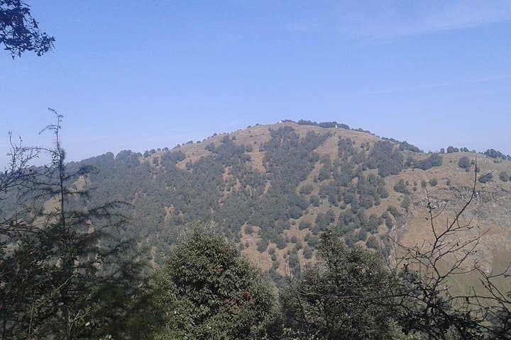
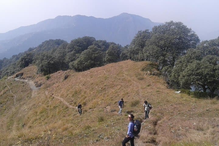
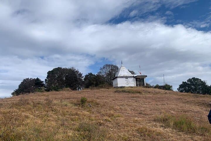
The trail from Cloud's End to Benog Tibba is a short, focused mountain walk that drops and climbs through mixed oak and pine before delivering you to the Jwala Devi temple at the summit. The hill sits on Mussoorie's western edge; on clear days the low foothills and distant Greater Himalaya peaks scribble the skyline.
Historically this ridge has been a local pilgrimage and grazing ground; the Jwala Devi shrine draws villagers and pilgrims who bring small offerings. Geologically the slopes are part of the lesser Himalaya—folded sedimentary beds and rocky outcrops that produce steep sections and loose scree in places. Culturally the route blends hill-station leisure with living village ritual: expect temple bells and the occasional herder.
Practical guidance: the direct out-and-back is roughly 3–4 km roundtrip with ~200–300 m cumulative ascent and usually takes about 2 hours at a steady pace. A longer circuit via Dhobi Ghat to Company Bagh extends to 8–10 km and four hours or more over uneven paths.
Trails are narrow, sometimes rooted or rocky; good footwear and steady footing matter. Start early to avoid crowds and monsoon downpours; carry water, a light rain layer, and cash for the temple. Respect shrine customs and pack out any trash—the ridge is small and recovers slowly from heavy foot traffic.
moderate.
2–4 hours.
Suitable for someone with regular walking or hiking fitness; short steep sections require leg strength and balance
The direct out-and-back from Cloud's End is about 3–4 km roundtrip and typically takes 2 hours; the extended route via Dhobi Ghat and Company Bagh is 8–10 km and around 4+ hours.
No; the marked trail from Cloud's End is walkable without a guide, but local guides can add cultural context and ensure safe routing on the longer circuit.
Yes, beginners with a basic level of fitness can complete the short route; the longer circuit requires good stamina and comfort on uneven terrain.
Facilities are limited—use amenities in Mussoorie before you go and carry water, as only small stalls may be available near the temple.
Benog Hill hosts the Jwala Devi temple, a regional pilgrimage site; Mussoorie's development as a British-era hill station shaped nearby access routes.
The ridge is ecologically sensitive; stick to established trails, avoid single-use plastics, and minimize noise around village and temple zones.
Divine Uttarakhand || 91-6300256017 || operates guided outdoor trips and adventures with an emphasis on safety, stewardship, and memorable experiences.
You push through a stand of rhododendron and the forest opens to a low ridge where prayer flags catch wind and the valley exhales below.
You push through a stand of rhododendron and the forest opens to a low ridge where prayer flags catch wind and the valley exhales below.
The trail from Cloud's End to Benog Tibba is a short, focused mountain walk that drops and climbs through mixed oak and pine before delivering you to the Jwala Devi temple at the summit. The hill sits on Mussoorie's western edge; on clear days the low foothills and distant Greater Himalaya peaks scribble the skyline.
Historically this ridge has been a local pilgrimage and grazing ground; the Jwala Devi shrine draws villagers and pilgrims who bring small offerings. Geologically the slopes are part of the lesser Himalaya—folded sedimentary beds and rocky outcrops that produce steep sections and loose scree in places. Culturally the route blends hill-station leisure with living village ritual: expect temple bells and the occasional herder.
Practical guidance: the direct out-and-back is roughly 3–4 km roundtrip with ~200–300 m cumulative ascent and usually takes about 2 hours at a steady pace. A longer circuit via Dhobi Ghat to Company Bagh extends to 8–10 km and four hours or more over uneven paths.
Trails are narrow, sometimes rooted or rocky; good footwear and steady footing matter. Start early to avoid crowds and monsoon downpours; carry water, a light rain layer, and cash for the temple. Respect shrine customs and pack out any trash—the ridge is small and recovers slowly from heavy foot traffic.