THE ADVENTURE COLLECTIVE® · Independent discovery and booking for outdoor travel

A steep, dramatic day-hike to Takachiho Peak in Kirishima offers close-up views of Mt. Shinmoedake's volcanic terrain, cultural waypoints, and a summit bento. Learn what to expect—terrain, timing, and safety—before you go.
A steep, dramatic day-hike to Takachiho Peak in Kirishima offers close-up views of Mt. Shinmoedake's volcanic terrain, cultural waypoints, and a summit bento. Learn what to expect—terrain, timing, and safety—before you go.
The trail opens under a cold, volcanic wind that seems to push you forward—steam whistles from distant vents and the ridge alternates between cedar forest and black pumice. On the climb toward Takachiho Peak the ground tightens into a steep, pumice-strewn path; on clear days Sakurajima and the dome of Shinmoedake cut the horizon like living geography.
Verified experiences and guided adventures in the surrounding area.
Operated by ファーストジャパン · Kirishima, Kagoshima Prefecture
The trail opens under a cold, volcanic wind that seems to push you forward—steam whistles from distant vents and the ridge alternates between cedar forest and black pumice. On the climb toward Takachiho Peak the ground tightens into a steep, pumice-strewn path; on clear days Sakurajima and the dome of Shinmoedake cut the horizon like living geography.
This route crosses Kirishima-Kinkowan National Park, a landscape shaped by repeated eruptions over millennia. The peaks here are young, volcanic cones and lava terraces; local shrines and volcanic place names reflect centuries of cultural respect and caution for eruptive power. Guides often point out Tengakuhoko, a jagged spire tied to regional mythology and modern pop culture references.
Expect roughly 600 meters of elevation gain from the 970 m trailhead to the 1,574 m summit over about 2.2 km—steep but well-worn. The ascent takes 2–2.5 hours, with a summit break for a bento lunch and panoramic views when conditions allow. Weather shifts quickly: clouds can hide fumaroles or reveal sudden vistas, and wind makes exposed sections feel sharper.
Practical guidance: travel with a local guide familiar with volcanic-alert procedures, carry 2–3 liters of water, and wear sturdy boots for loose pumice. Be prepared for route changes if the volcano is active—operators cancel for safety. Morning departures avoid afternoon wind and maximize visibility. This hike is technical-light but cardio-demanding; it rewards steady pacing and respect for the mountain’s moods.
challenging.
6–7 hours.
Good cardiovascular fitness and leg strength; accustomed to steep ascents and uneven volcanic terrain.
No special permit is required for the public trail, but access can be restricted by volcanic alerts or park rules—follow your guide's instructions.
The route gains about 600 m over 2.2 km—steep and physically demanding but not technical; basic scrambling may occur on loose sections.
You may observe fumarolic steam or minor ash emissions when activity is elevated; guided tours will cancel or reroute if eruptions are hazardous.
Public transport in rural Kyushu is limited; most operators provide private pickups from Kirishima stations, airports, or local ryokans included in the tour.
The Kirishima range has been a spiritual landscape in Japanese myth and Shinto practice for centuries; volcanic eruptions shaped settlement and ritual around these peaks.
Stick to marked trails to prevent erosion on fragile volcanic soils; follow pack-in/pack-out rules and respect seasonal closures to protect vegetation and cultural sites.
ファーストジャパン operates guided outdoor trips and adventures with an emphasis on safety, stewardship, and memorable experiences.
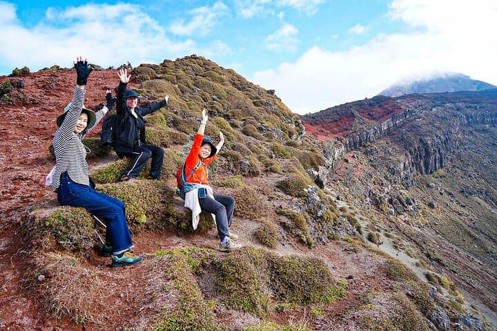

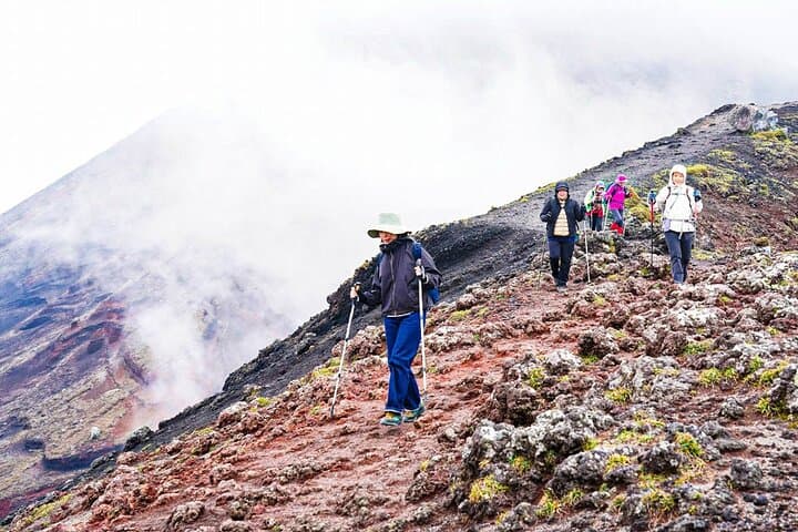
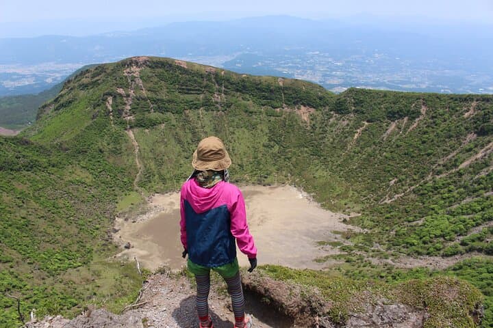
The trail opens under a cold, volcanic wind that seems to push you forward—steam whistles from distant vents and the ridge alternates between cedar forest and black pumice. On the climb toward Takachiho Peak the ground tightens into a steep, pumice-strewn path; on clear days Sakurajima and the dome of Shinmoedake cut the horizon like living geography.
The trail opens under a cold, volcanic wind that seems to push you forward—steam whistles from distant vents and the ridge alternates between cedar forest and black pumice. On the climb toward Takachiho Peak the ground tightens into a steep, pumice-strewn path; on clear days Sakurajima and the dome of Shinmoedake cut the horizon like living geography.
This route crosses Kirishima-Kinkowan National Park, a landscape shaped by repeated eruptions over millennia. The peaks here are young, volcanic cones and lava terraces; local shrines and volcanic place names reflect centuries of cultural respect and caution for eruptive power. Guides often point out Tengakuhoko, a jagged spire tied to regional mythology and modern pop culture references.
Expect roughly 600 meters of elevation gain from the 970 m trailhead to the 1,574 m summit over about 2.2 km—steep but well-worn. The ascent takes 2–2.5 hours, with a summit break for a bento lunch and panoramic views when conditions allow. Weather shifts quickly: clouds can hide fumaroles or reveal sudden vistas, and wind makes exposed sections feel sharper.
Practical guidance: travel with a local guide familiar with volcanic-alert procedures, carry 2–3 liters of water, and wear sturdy boots for loose pumice. Be prepared for route changes if the volcano is active—operators cancel for safety. Morning departures avoid afternoon wind and maximize visibility. This hike is technical-light but cardio-demanding; it rewards steady pacing and respect for the mountain’s moods.