THE ADVENTURE COLLECTIVE® · Independent discovery and booking for outdoor travel

A full-day guided trek from Mendoza to Cerro Cabras in Potrerillos climbs to 2,160 m with sustained uphill sections and rewarding views of the Cordón del Plata and Potrerillos dam. Practical for hikers with good fitness, the trip includes transfers, a box lunch, and bilingual guiding.
A full-day guided trek from Mendoza to Cerro Cabras in Potrerillos climbs to 2,160 m with sustained uphill sections and rewarding views of the Cordón del Plata and Potrerillos dam. Practical for hikers with good fitness, the trip includes transfers, a box lunch, and bilingual guiding.
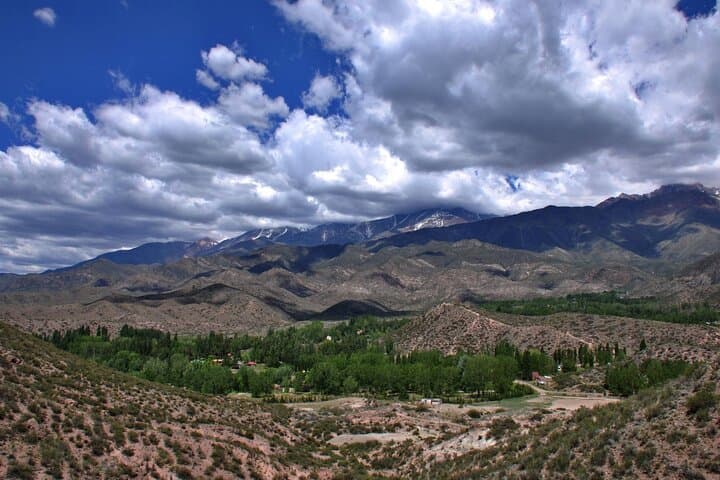
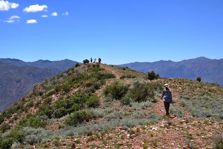
You leave Mendoza before dawn and the road toward Potrerillos unwraps through foothills; the reservoir glints and the Andes rise like a slowly sharpening promise. By the time the group assembles and the guide runs through a safety briefing, the valley air already carries the dry, mineral tang of high country. The trail climbs steadily toward Cerro Cabras, a single-day challenge that finishes at 2,160 meters above sea level.
Verified experiences and guided adventures in the surrounding area.
Operated by Gray Line Argentina · Potrerillos, Mendoza
You leave Mendoza before dawn and the road toward Potrerillos unwraps through foothills; the reservoir glints and the Andes rise like a slowly sharpening promise. By the time the group assembles and the guide runs through a safety briefing, the valley air already carries the dry, mineral tang of high country. The trail climbs steadily toward Cerro Cabras, a single-day challenge that finishes at 2,160 meters above sea level.
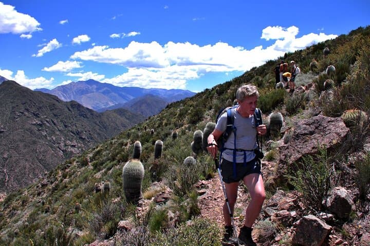
This ridge sits on the eastern flank of the Andes where young uplifted rock and alluvial fans meet engineered waters—Potrerillos dam channels meltwater from the Cordón del Plata range into the Mendoza River below. The region has long supported transhumant herding and small farming communities; today summer trails carry day-hikers and local mountaineers testing legs and lungs. Granite outcrops and scrub give way to looser scree higher up, and wind often takes charge, pushing hikers into tighter formations.
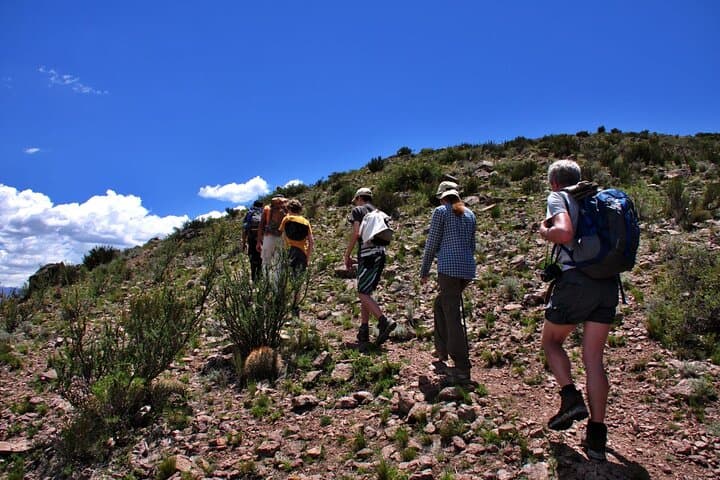
Practical guidance: the outing runs about five hours round-trip including breaks and transport; expect sustained uphill sections and rocky footing—good ankle support and steady cardio matter. Bring at least 1.5–2 liters of water, sun protection, and a light insulating layer for the summit wind. The included box lunch is a welcome pause halfway; plan for exposed sections where gaiters and trekking poles make a difference.
Timing matters—start early in shoulder seasons to avoid strong midday sun and unstable weather. Respect local grazing areas and pack out all trash: high-country drains recover slowly.
challenging.
5 hours.
Good cardiovascular fitness and previous uphill hiking experience recommended; comfortable with uneven, rocky terrain.
The tour is about five hours total including round-trip transfers from central Mendoza, a guided ascent, a boxed lunch, water and a bilingual professional guide.
Children under 12 are not permitted; hikers should have at least moderate fitness and prior uphill day-hike experience due to sustained climbs and uneven terrain.
Wear trekking boots or sturdy sport shoes, sun protection (hat, sunglasses, SPF), layered clothing for wind on the summit, and carry 1.5–2 liters of water and any personal medications.
Yes—trips may be canceled for bad weather; guides monitor mountain conditions and prioritize safety, so expect flexibility on departure during unstable seasons.
The Potrerillos valley has long been a corridor between Mendoza and Andean passes; irrigation and dam projects in the 20th century reshaped local water flow and recreation patterns.
Trails cross fragile alpine scrub; pack out waste, stick to established footpaths to prevent erosion, and avoid disturbing grazing areas and wildlife.
Gray Line Argentina operates guided outdoor trips and adventures with an emphasis on safety, stewardship, and memorable experiences.
You leave Mendoza before dawn and the road toward Potrerillos unwraps through foothills; the reservoir glints and the Andes rise like a slowly sharpening promise. By the time the group assembles and the guide runs through a safety briefing, the valley air already carries the dry, mineral tang of high country. The trail climbs steadily toward Cerro Cabras, a single-day challenge that finishes at 2,160 meters above sea level.
You leave Mendoza before dawn and the road toward Potrerillos unwraps through foothills; the reservoir glints and the Andes rise like a slowly sharpening promise. By the time the group assembles and the guide runs through a safety briefing, the valley air already carries the dry, mineral tang of high country. The trail climbs steadily toward Cerro Cabras, a single-day challenge that finishes at 2,160 meters above sea level.
This ridge sits on the eastern flank of the Andes where young uplifted rock and alluvial fans meet engineered waters—Potrerillos dam channels meltwater from the Cordón del Plata range into the Mendoza River below. The region has long supported transhumant herding and small farming communities; today summer trails carry day-hikers and local mountaineers testing legs and lungs. Granite outcrops and scrub give way to looser scree higher up, and wind often takes charge, pushing hikers into tighter formations.
Practical guidance: the outing runs about five hours round-trip including breaks and transport; expect sustained uphill sections and rocky footing—good ankle support and steady cardio matter. Bring at least 1.5–2 liters of water, sun protection, and a light insulating layer for the summit wind. The included box lunch is a welcome pause halfway; plan for exposed sections where gaiters and trekking poles make a difference.
Timing matters—start early in shoulder seasons to avoid strong midday sun and unstable weather. Respect local grazing areas and pack out all trash: high-country drains recover slowly.