THE ADVENTURE COLLECTIVE® · Independent discovery and booking for outdoor travel

Two days from Marrakech, this classic High Atlas trek takes you from Imlil to the summit of Jebel Toubkal (4,167 m). Expect long days, scree sections, and dramatic panoramic views with local guides, mules, and a night near the refuge.
Two days from Marrakech, this classic High Atlas trek takes you from Imlil to the summit of Jebel Toubkal (4,167 m). Expect long days, scree sections, and dramatic panoramic views with local guides, mules, and a night near the refuge.
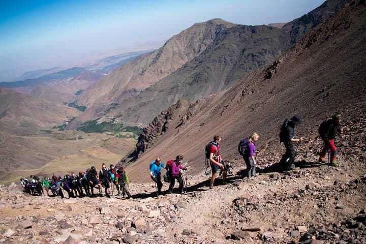
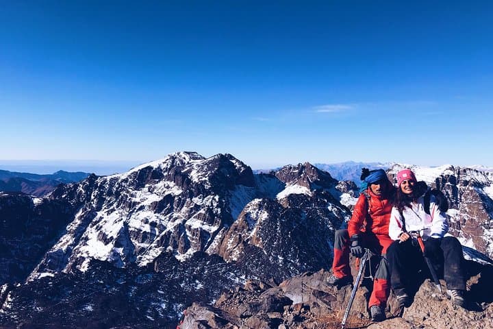
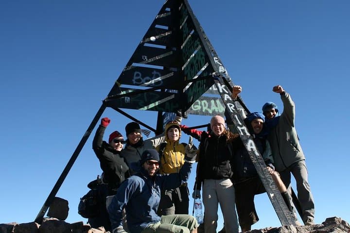
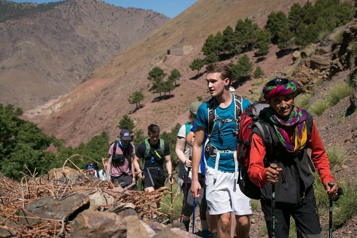
Morning light strips the valley bare as you step out of Imlil and follow mule tracks that climb into the High Atlas. Stones clack under boot soles, a thin wind pushes you higher, and the refuge at 3,206 m appears like a human pause against a raw skyline. On day two the summit pierces the sky at 4,167 m; the last slopes are loose scree that demand patience and steady footing.
Verified experiences and guided adventures in the surrounding area.
Operated by Toubkal Guide · Imlil, Marrakech-Safi
Morning light strips the valley bare as you step out of Imlil and follow mule tracks that climb into the High Atlas. Stones clack under boot soles, a thin wind pushes you higher, and the refuge at 3,206 m appears like a human pause against a raw skyline. On day two the summit pierces the sky at 4,167 m; the last slopes are loose scree that demand patience and steady footing.
The route follows centuries-old Berber paths that once carried salt and grain between mountain villages and Marrakech. Geologically the High Atlas is young and folded, composed of hard metamorphic rock and scree zones formed by repeated freeze–thaw—expect sharp ridgelines and wide, glacially-scoured cirques. Local culture remains visible in terraced fields, mule herds, and the Sidi Chamarouch shrine where pilgrims pause before the climb.
Practically, the trek is non-technical but strenuous: day one climbs steadily to the refuge (about 5–6 hours), and day two is a long summit push and descent (about 9–10 hours walking). Guides, a cook and mules are typically included, and camping near the refuge reduces pack weight. Hydrate early, pace upward to manage altitude, and use trekking poles on scree sections.
Expect large temperature swings—cold nights at the refuge and strong sun on exposed slopes. Leave no trace in this fragile alpine zone, and plan your return to Marrakech that evening to soak tired legs in the city’s rhythm.
challenging.
2 days (approx. 5–6 hours day 1; 9–10 hours day 2 of walking).
Good aerobic fitness and experience with long day hikes; prior high-elevation hiking recommended
No technical mountaineering skills are required for the normal south cirque route, but the trek is long and high—good fitness and prior hiking experience are important.
Altitude can affect anyone; symptoms are usually mild if you pace, hydrate, and sleep well at the refuge, but recognize warning signs and inform your guide immediately.
Typical itineraries include one night camping or a night in a local gite/guesthouse near the refuge; the operator here lists camping near the refuge and a gite on the first night.
Meals listed include two lunches, dinners and breakfasts; treated water may not be provided so bring purification or sufficient personal water capacity.
The High Atlas holds ancient transhumance routes used by Berber communities; Imlil grew as a mule-trading hub linking Marrakech to mountain valleys.
The alpine environment is fragile—stick to established trails, pack out waste, and respect grazing areas to limit erosion and habitat disturbance.
Toubkal Guide operates guided outdoor trips and adventures with an emphasis on safety, stewardship, and memorable experiences.
Morning light strips the valley bare as you step out of Imlil and follow mule tracks that climb into the High Atlas. Stones clack under boot soles, a thin wind pushes you higher, and the refuge at 3,206 m appears like a human pause against a raw skyline. On day two the summit pierces the sky at 4,167 m; the last slopes are loose scree that demand patience and steady footing.
Morning light strips the valley bare as you step out of Imlil and follow mule tracks that climb into the High Atlas. Stones clack under boot soles, a thin wind pushes you higher, and the refuge at 3,206 m appears like a human pause against a raw skyline. On day two the summit pierces the sky at 4,167 m; the last slopes are loose scree that demand patience and steady footing.
The route follows centuries-old Berber paths that once carried salt and grain between mountain villages and Marrakech. Geologically the High Atlas is young and folded, composed of hard metamorphic rock and scree zones formed by repeated freeze–thaw—expect sharp ridgelines and wide, glacially-scoured cirques. Local culture remains visible in terraced fields, mule herds, and the Sidi Chamarouch shrine where pilgrims pause before the climb.
Practically, the trek is non-technical but strenuous: day one climbs steadily to the refuge (about 5–6 hours), and day two is a long summit push and descent (about 9–10 hours walking). Guides, a cook and mules are typically included, and camping near the refuge reduces pack weight. Hydrate early, pace upward to manage altitude, and use trekking poles on scree sections.
Expect large temperature swings—cold nights at the refuge and strong sun on exposed slopes. Leave no trace in this fragile alpine zone, and plan your return to Marrakech that evening to soak tired legs in the city’s rhythm.