THE ADVENTURE COLLECTIVE® · Independent discovery and booking for outdoor travel

A brisk 15-minute helicopter loop that rises above downtown Toronto to circle the CN Tower and trace Lake Ontario’s shoreline. Perfect for first-time fliers who want a dramatic aerial snapshot of the city with every seat at a window.
A brisk 15-minute helicopter loop that rises above downtown Toronto to circle the CN Tower and trace Lake Ontario’s shoreline. Perfect for first-time fliers who want a dramatic aerial snapshot of the city with every seat at a window.
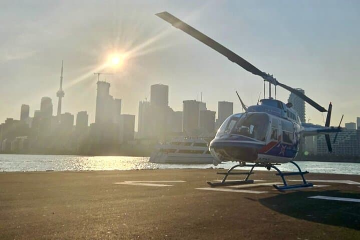
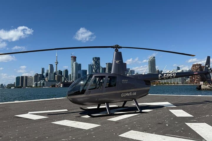
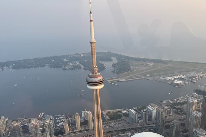
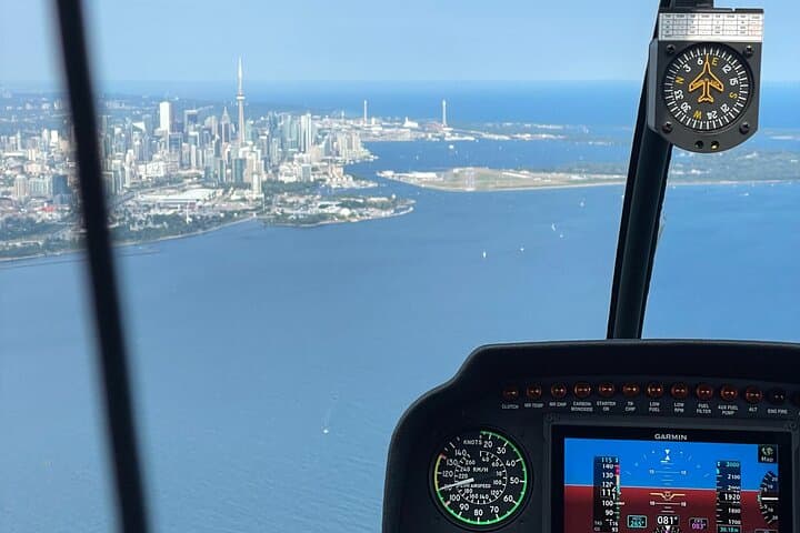
The rotors blur into a steady hum and the city unfolds beneath you — glass faces the sun, the CN Tower pierces the sky, and Lake Ontario dares you to map every shoreline curve. In fifteen minutes a downtown street grid becomes geometry and the waterfront stretches like a slow-moving canvas; the flight climbs above rooftop clutter to give a clean, vertical read of Toronto’s scale.
Verified experiences and guided adventures in the surrounding area.
Operated by Great Lakes Helicopter · Toronto, Ontario
The rotors blur into a steady hum and the city unfolds beneath you — glass faces the sun, the CN Tower pierces the sky, and Lake Ontario dares you to map every shoreline curve. In fifteen minutes a downtown street grid becomes geometry and the waterfront stretches like a slow-moving canvas; the flight climbs above rooftop clutter to give a clean, vertical read of Toronto’s scale.
Toronto’s skyline is recent history: the CN Tower rose in 1976 as a broadcast mast and visual claim to the skyline, while the waterfront traces a glacially carved basin where sediment and shale meet human engineering. From the air you’ll see the Rogers Centre dome swing open on game days, the pattern of islands, and hints of Indigenous and immigrant histories woven into the city’s neighborhoods.
This is a rapid, sensory tour — expect tight turns, quick climbs, and photo windows at every seat. Pilots brief safety and point out landmarks; bottled water is included and infants sit on laps. Flights cancel for poor weather, and operators follow Transport Canada rules to reduce noise over residential areas.
Practical edge: book golden-hour slots for the best contrast, travel light (no loose straps), carry government ID, and disclose weight or medical concerns when booking. If you want a longer aerial perspective, pair the tour with a harbor walk or ferry ride to compare the same shoreline at human pace. For photographers and first-time fliers alike, this loop is a high-altitude, low-commitment way to see Toronto from a new angle.
easy.
15 minutes.
No special fitness required beyond the ability to sit in a small helicopter cabin for the duration
The advertised flight is 15 minutes total—enough to loop the CN Tower and sweep over downtown and part of the waterfront.
Children can fly; infants are allowed but must sit on an adult’s lap per operator policy.
Flights are canceled for poor weather conditions; bookings are refundable if canceled at least 24 hours ahead or rescheduled when possible.
Yes—personal cameras and phones are allowed and every seat is a window seat for photos.
The CN Tower was completed in 1976 and held the record as the world’s tallest free-standing structure for decades; the downtown waterfront reflects both industrial shipping history and recent redevelopment.
Operators follow regulatory flight corridors to limit noise over residential neighborhoods and flights are subject to weather and emissions considerations; opt for reputable companies that report adherence to Transport Canada standards.
Great Lakes Helicopter operates guided outdoor trips and adventures with an emphasis on safety, stewardship, and memorable experiences.
The rotors blur into a steady hum and the city unfolds beneath you — glass faces the sun, the CN Tower pierces the sky, and Lake Ontario dares you to map every shoreline curve. In fifteen minutes a downtown street grid becomes geometry and the waterfront stretches like a slow-moving canvas; the flight climbs above rooftop clutter to give a clean, vertical read of Toronto’s scale.
The rotors blur into a steady hum and the city unfolds beneath you — glass faces the sun, the CN Tower pierces the sky, and Lake Ontario dares you to map every shoreline curve. In fifteen minutes a downtown street grid becomes geometry and the waterfront stretches like a slow-moving canvas; the flight climbs above rooftop clutter to give a clean, vertical read of Toronto’s scale.
Toronto’s skyline is recent history: the CN Tower rose in 1976 as a broadcast mast and visual claim to the skyline, while the waterfront traces a glacially carved basin where sediment and shale meet human engineering. From the air you’ll see the Rogers Centre dome swing open on game days, the pattern of islands, and hints of Indigenous and immigrant histories woven into the city’s neighborhoods.
This is a rapid, sensory tour — expect tight turns, quick climbs, and photo windows at every seat. Pilots brief safety and point out landmarks; bottled water is included and infants sit on laps. Flights cancel for poor weather, and operators follow Transport Canada rules to reduce noise over residential areas.
Practical edge: book golden-hour slots for the best contrast, travel light (no loose straps), carry government ID, and disclose weight or medical concerns when booking. If you want a longer aerial perspective, pair the tour with a harbor walk or ferry ride to compare the same shoreline at human pace. For photographers and first-time fliers alike, this loop is a high-altitude, low-commitment way to see Toronto from a new angle.