THE ADVENTURE COLLECTIVE® · Independent discovery and booking for outdoor travel

A demanding ridge walk in Tenerife’s Teno Mountains, the Roque de Tarucho loop delivers volcanic panoramas, a hands-on scramble, and solitary trails above Masca. This 8 km route climbs to 1,300 m and rewards effort with sweeping views of Teide, Chinyero, and the Atlantic.
A demanding ridge walk in Tenerife’s Teno Mountains, the Roque de Tarucho loop delivers volcanic panoramas, a hands-on scramble, and solitary trails above Masca. This 8 km route climbs to 1,300 m and rewards effort with sweeping views of Teide, Chinyero, and the Atlantic.
When the pair of worn boots first step off the track, the pines close behind like an audience lowering its breath. The path in the Teno Mountains climbs steadily, and with every switchback the Atlantic slides farther into the distance until it becomes a strip of light beneath the horizon. Hikers reach the ridge around 1,300 meters and, suddenly, Roque de Tarucho is not just a shape on the map but a jagged crown split by a raw crevice — a volcanic spine that dares you to keep moving.
Verified experiences and guided adventures in the surrounding area.
Operated by Sherpa · Masca, Tenerife
When the pair of worn boots first step off the track, the pines close behind like an audience lowering its breath. The path in the Teno Mountains climbs steadily, and with every switchback the Atlantic slides farther into the distance until it becomes a strip of light beneath the horizon. Hikers reach the ridge around 1,300 meters and, suddenly, Roque de Tarucho is not just a shape on the map but a jagged crown split by a raw crevice — a volcanic spine that dares you to keep moving.
This route threads through Tenerife’s geological story: ancient basalt flows, later tephra from Chinyero’s 1909 eruption, and the weathered scars of erosion that carved the Masca Gorge. Locals in the surrounding villages have long pointed to these peaks in stories about sea bandits and stone giants; the name “Teno” itself refers to the old aboriginal menceyato that ruled this remote corner before Spanish conquest. Today the ridge is quieter — goats, scrub, and the occasional shepherd marking old grazing lines.
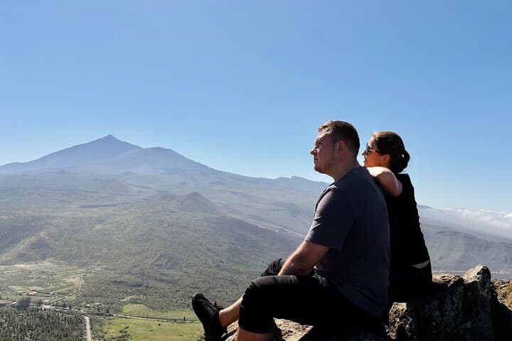
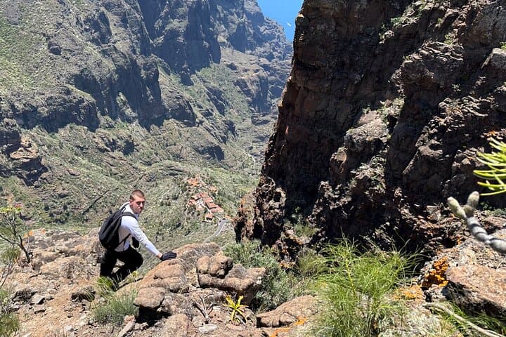
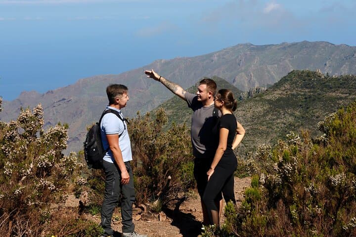
The hike opens in a cool pine stand, then exposes you to wild, volcanic panoramas of Mount Teide, the Chinyero slopes, the road descending to Masca, and the ocean beyond. The route published by the guide is an 8 km loop with roughly 450 meters of elevation gain and takes about 6–8 hours to complete when measured at a steady, confident pace. Much of the approach is steep and stony; one section requires scrambling on hands and feet where the trail squeezes across exposed rock.
Culturally, the west of Tenerife holds a different tempo from the tourist strip: villages like Masca and nearby Santiago del Teide preserve narrow lanes and whitewashed homes, while shepherding traditions still influence land use. Conservation here balances tourism and fragile vegetation; stay on trails and avoid trampling endemic plants.
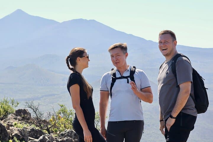
Practical guidance is straightforward. Start early to catch soft light and avoid the midday heat, and expect variable winds at the ridge. Bring 2–3 liters of water, sturdy hiking boots with tread for volcanic scree, gloves for the occasional scramble, and layered clothing — temperatures can drop sharply at altitude. Public buses reach Masca and Buenavista del Norte; the meeting point is often a restaurant or village square a short drive from the trailhead. The guide provides hiking poles and will lead a small group (max eight), so navigation is relaxed but the route still demands good fitness and no serious fear of heights.
At the summit, silence returns — only the goats’ curious hooves and the wind rearranging the clouds. It’s a landscape that insists on effort, then rewards it with a view that reads like the island’s geological autobiography.
challenging.
6–8 hours.
High — you should be comfortable with sustained climbs, uneven terrain, and short exposed scrambles.
The route is an 8 km circular with approximately 450 meters of elevation gain; plan for 6–8 hours including breaks and photo stops.
Public buses run to Masca and nearby towns; the meeting point is usually a restaurant or village square a short drive from the trailhead — transfers can be arranged with the guide if requested in advance.
This hike is not ideal for beginners due to steep sections and scrambling; participants should have a high fitness level and no serious fear of heights.
The operator cancels in poor weather for safety; check forecasts, and be prepared for sudden wind and cloud at higher elevations.
Yes, hiking poles are provided by the guide but personal poles are also welcome if you prefer your own.
Not recommended for those with heart or back problems, pregnant travelers, or anyone unable to handle steep, exposed terrain.
The Teno Mountains were part of a pre-conquest menceyato (native kingdom); the area’s isolated villages preserved traditional agriculture and pathways for centuries.
Teno is ecologically sensitive — stick to paths to protect endemic flora and support local efforts that balance hiking access with habitat protection.
Sherpa operates guided outdoor trips and adventures with an emphasis on safety, stewardship, and memorable experiences.
When the pair of worn boots first step off the track, the pines close behind like an audience lowering its breath. The path in the Teno Mountains climbs steadily, and with every switchback the Atlantic slides farther into the distance until it becomes a strip of light beneath the horizon. Hikers reach the ridge around 1,300 meters and, suddenly, Roque de Tarucho is not just a shape on the map but a jagged crown split by a raw crevice — a volcanic spine that dares you to keep moving.
When the pair of worn boots first step off the track, the pines close behind like an audience lowering its breath. The path in the Teno Mountains climbs steadily, and with every switchback the Atlantic slides farther into the distance until it becomes a strip of light beneath the horizon. Hikers reach the ridge around 1,300 meters and, suddenly, Roque de Tarucho is not just a shape on the map but a jagged crown split by a raw crevice — a volcanic spine that dares you to keep moving.
This route threads through Tenerife’s geological story: ancient basalt flows, later tephra from Chinyero’s 1909 eruption, and the weathered scars of erosion that carved the Masca Gorge. Locals in the surrounding villages have long pointed to these peaks in stories about sea bandits and stone giants; the name “Teno” itself refers to the old aboriginal menceyato that ruled this remote corner before Spanish conquest. Today the ridge is quieter — goats, scrub, and the occasional shepherd marking old grazing lines.
The hike opens in a cool pine stand, then exposes you to wild, volcanic panoramas of Mount Teide, the Chinyero slopes, the road descending to Masca, and the ocean beyond. The route published by the guide is an 8 km loop with roughly 450 meters of elevation gain and takes about 6–8 hours to complete when measured at a steady, confident pace. Much of the approach is steep and stony; one section requires scrambling on hands and feet where the trail squeezes across exposed rock.
Culturally, the west of Tenerife holds a different tempo from the tourist strip: villages like Masca and nearby Santiago del Teide preserve narrow lanes and whitewashed homes, while shepherding traditions still influence land use. Conservation here balances tourism and fragile vegetation; stay on trails and avoid trampling endemic plants.
Practical guidance is straightforward. Start early to catch soft light and avoid the midday heat, and expect variable winds at the ridge. Bring 2–3 liters of water, sturdy hiking boots with tread for volcanic scree, gloves for the occasional scramble, and layered clothing — temperatures can drop sharply at altitude. Public buses reach Masca and Buenavista del Norte; the meeting point is often a restaurant or village square a short drive from the trailhead. The guide provides hiking poles and will lead a small group (max eight), so navigation is relaxed but the route still demands good fitness and no serious fear of heights.
At the summit, silence returns — only the goats’ curious hooves and the wind rearranging the clouds. It’s a landscape that insists on effort, then rewards it with a view that reads like the island’s geological autobiography.