THE ADVENTURE COLLECTIVE® · Independent discovery and booking for outdoor travel

A high-altitude road climb from Puli to Wuling Pass: 53 km with roughly 2,800 m of ascent. This is a long, sustained effort over variable weather and exposed mountain roads—bring climbing legs and careful planning.
A high-altitude road climb from Puli to Wuling Pass: 53 km with roughly 2,800 m of ascent. This is a long, sustained effort over variable weather and exposed mountain roads—bring climbing legs and careful planning.
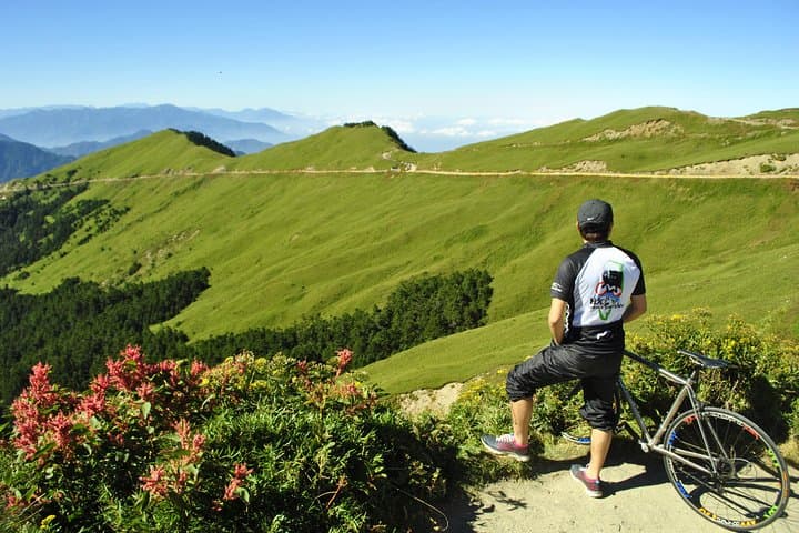
You start in Puli before dawn, tires whispering on cool pavement as the valley exhales behind you. The road climbs steadily, then insists—switchbacks carving into spruce and grass, the air thinning with every pedal stroke. By the time you reach Wuling, the sky feels closer and the road seems to test you personally.
Verified experiences and guided adventures in the surrounding area.
Operated by Bikefun Taiwan tour · Puli, Nantou County
You start in Puli before dawn, tires whispering on cool pavement as the valley exhales behind you. The road climbs steadily, then insists—switchbacks carving into spruce and grass, the air thinning with every pedal stroke. By the time you reach Wuling, the sky feels closer and the road seems to test you personally.
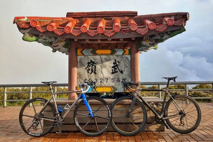
This route traces Central Taiwan’s spine along Provincial Highway 14, finishing at Wuling (3,275 m), one of Taiwan’s highest paved passes. Geologically you're riding over uplifted metamorphic bedrock—steep valleys and glacially smoothed ridgelines shaped by Taiwan’s active tectonics. Culturally the climb threads through agricultural terraces and farming hamlets where tea and highland vegetables are central to local life; cyclists cross both a sporting milestone and a living rural landscape.
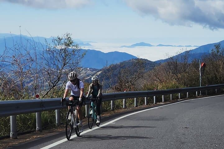
Expect 53 km of road with about 2,800 m of elevation gain—long sustained gradients, exposed high-altitude sections and a few narrow passes flanked by guardrails. The air cools sharply above 2,000 m; weather can flip from sun to fog in an hour, and the pass often hosts wind and residual frost outside summer.
Practical guidance: pace your effort—use lower gears early, eat small calories every 45–60 minutes, and hydrate for long climbs. Carry windproof layers, a powerful front light for pre-dawn starts, and check brakes and tires before you leave: descents are as technical as the ascent is relentless. Altitude is real here—if you’re not acclimatized, expect heavier breathing and plan a conservative pace. Arrive rested, respect local traffic rules, and let the road challenge you.
challenging.
6–9 hours.
Very high—riders should have sustained climbing endurance and experience with long ascents at altitude.
The route is about 53 km with roughly 2,800 m of elevation gain; plan 6–9 hours depending on pace and stops.
If you live near sea level, take it steady—symptoms like heavier breathing are common above 2,000 m; rest beforehand if possible.
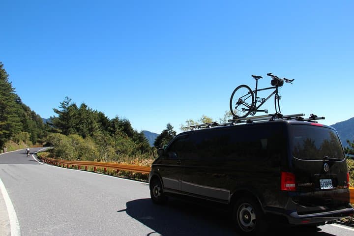
This tour lists air-conditioned transport for pickup/dropoff in inclusions; confirm details and emergency plans with the operator before booking.
Late spring through early fall offers the most reliable road access and milder temperatures; winter can bring ice and closures.
The road follows routes developed during Taiwan’s 20th-century road-building era to connect central highlands; Wuling is a celebrated target in Taiwan’s cycling culture.
Highland ecosystems are sensitive—stay on paved routes, pack out waste, and avoid disturbing fragile alpine vegetation.
Bikefun Taiwan tour operates guided outdoor trips and adventures with an emphasis on safety, stewardship, and memorable experiences.
You start in Puli before dawn, tires whispering on cool pavement as the valley exhales behind you. The road climbs steadily, then insists—switchbacks carving into spruce and grass, the air thinning with every pedal stroke. By the time you reach Wuling, the sky feels closer and the road seems to test you personally.
You start in Puli before dawn, tires whispering on cool pavement as the valley exhales behind you. The road climbs steadily, then insists—switchbacks carving into spruce and grass, the air thinning with every pedal stroke. By the time you reach Wuling, the sky feels closer and the road seems to test you personally.
This route traces Central Taiwan’s spine along Provincial Highway 14, finishing at Wuling (3,275 m), one of Taiwan’s highest paved passes. Geologically you're riding over uplifted metamorphic bedrock—steep valleys and glacially smoothed ridgelines shaped by Taiwan’s active tectonics. Culturally the climb threads through agricultural terraces and farming hamlets where tea and highland vegetables are central to local life; cyclists cross both a sporting milestone and a living rural landscape.
Expect 53 km of road with about 2,800 m of elevation gain—long sustained gradients, exposed high-altitude sections and a few narrow passes flanked by guardrails. The air cools sharply above 2,000 m; weather can flip from sun to fog in an hour, and the pass often hosts wind and residual frost outside summer.
Practical guidance: pace your effort—use lower gears early, eat small calories every 45–60 minutes, and hydrate for long climbs. Carry windproof layers, a powerful front light for pre-dawn starts, and check brakes and tires before you leave: descents are as technical as the ascent is relentless. Altitude is real here—if you’re not acclimatized, expect heavier breathing and plan a conservative pace. Arrive rested, respect local traffic rules, and let the road challenge you.